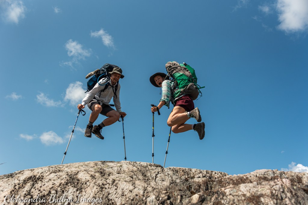
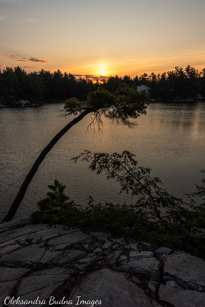
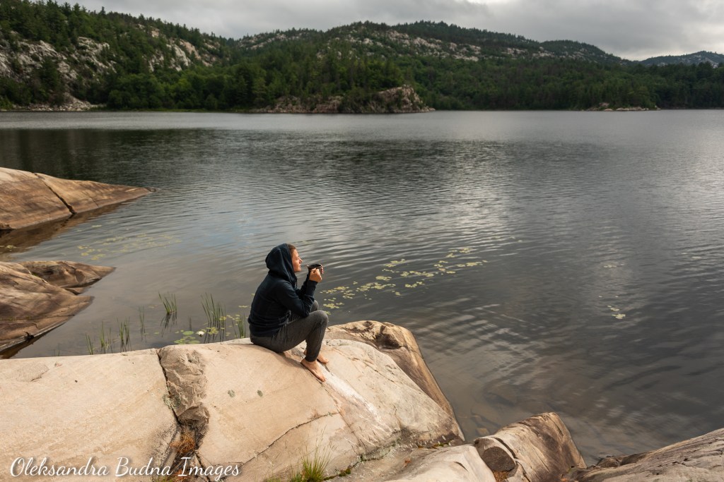
Eighteen years ago, during our first visit to Killarney, as I was chasing our eighteen-month-old son around the park, I stumbled upon the La Cloche Silhouette Trail sign. Looking at it, I wondered what it would take to walk 100 kilometres. What kind of gear do you need to bring? How much food? What about water? “Maybe one day…” was my last thought before my son pulled me in another direction.
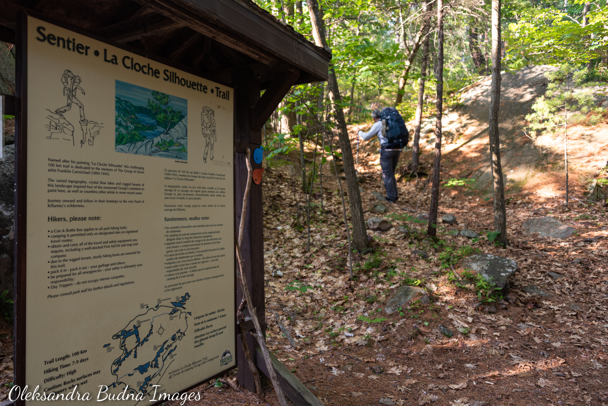
It all started many years ago when I came across this sign during our very first trip to Killarney.
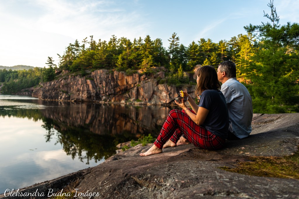
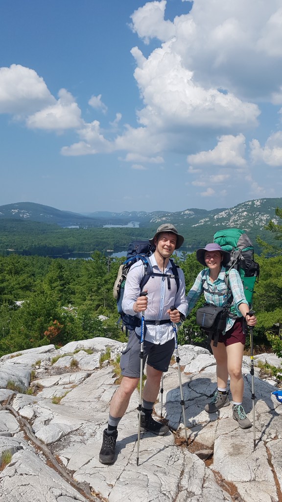
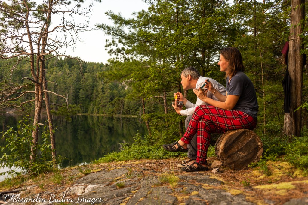
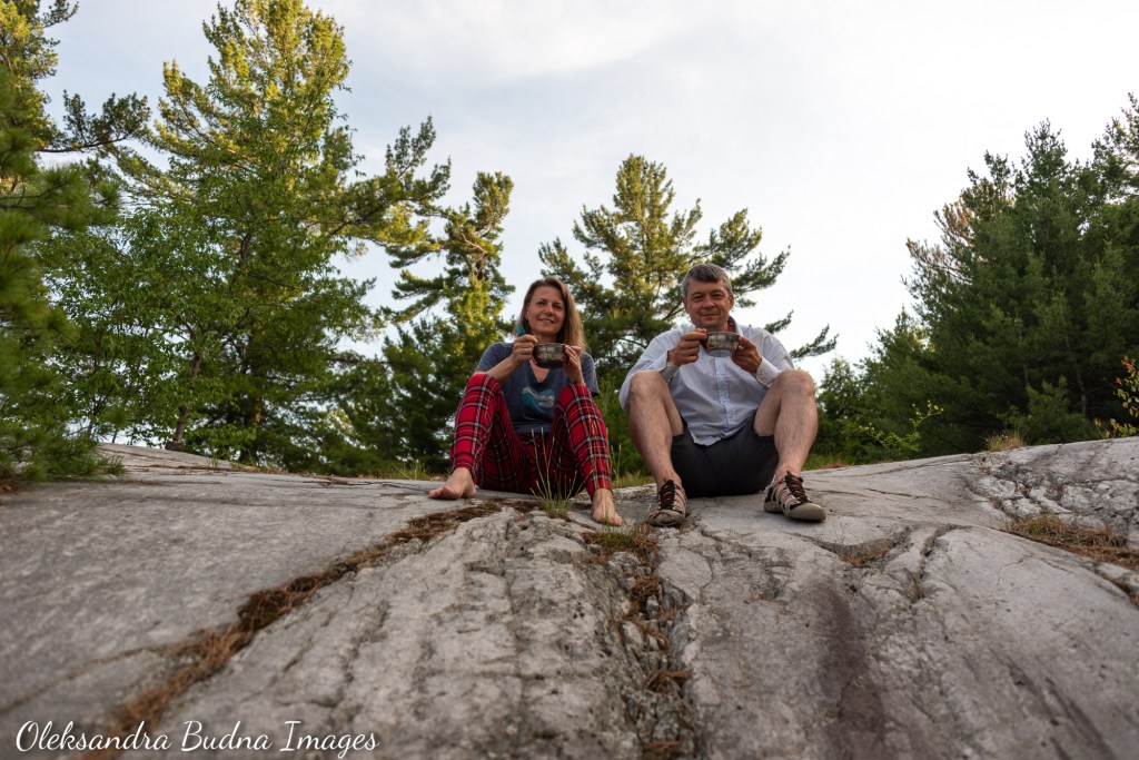
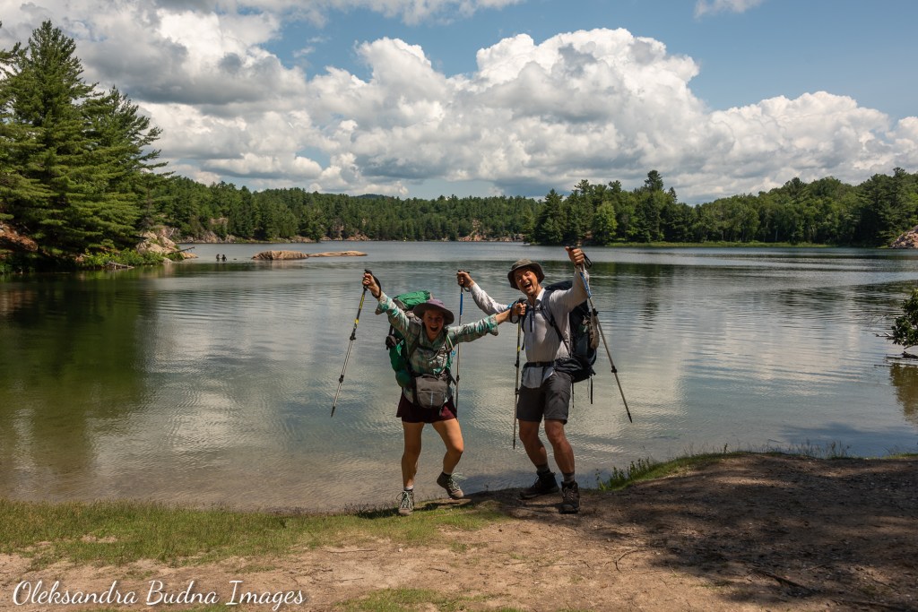
It took some time but that day finally arrived. Here we were – my husband and I – taking a selfie in front of that same sign a week after we’d taken one in front of an identical one at the other end of the trail. And while the signs looked the same, we certainly did not – a shade darker from all the sun, with an obvious stubble (my husband), greasy hair in a tight ponytail (me), noticeably smelly clothes (both of us). Our backpacks were lighter; our hearts filled to the brim with the incredible memories of the past week that included everything from extreme heat to an epic downpour, challenging climbs and descents, Killarney’s magnificent views, soul-nourishing tranquility of early mornings and seemingly endless evenings spent by the water with loons, sandhill cranes and beavers for company.
Here are some highlights from a backpacking trip that was years in the making.


Before and after: A week of backpacking, a lifetime of memories in between
The Mountains
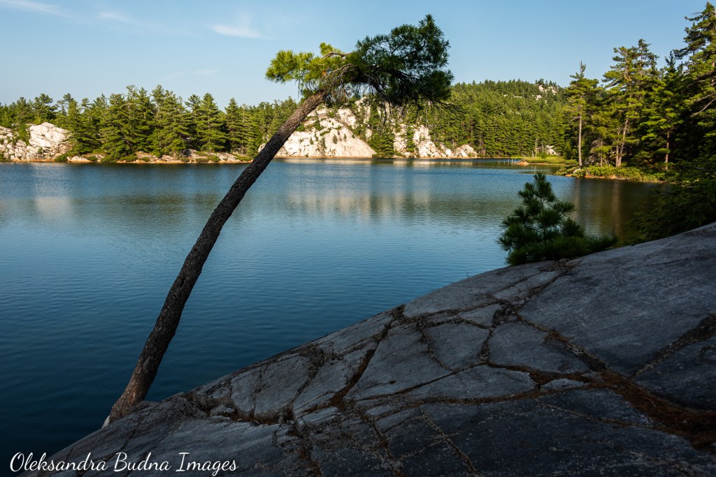
La Cloche Mountains, with their highest point Silver Peak at only 543 metres, are far from the world’s tallest. But whatever they lack in elevation, they more than make up for in history that goes back 2.5 billion years and the wow factor due to their sparkling white quartzite rocks framing crystalline lakes every shade of blue. Ojibwa/Nishnaabeg people of Wiigwaaskingaa, who have been living here for tens of thousands of years, named them Sinmedwe’ek, which means “bell rocks” or “sounding stones”, because of the ringing sound they produce when struck with a hard object. The meaning made it into their present day name – La Cloche means “bell” in French. That ringing sound became the background music for our hike – the rhythmic click-clacking of hiking poles against the rock accompanied us every step of the way.
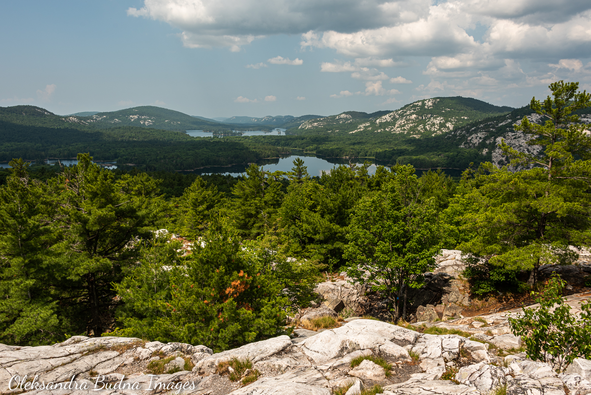
La Cloche Mountains may lack in height but they more than make up for it in billions years of history and striking vistas.
Ever since our first visit to Killarney, this park has spoken to me like no other place on this side of the ocean. For almost twenty years, we have been coming back over and over during different seasons, first staying at the campground, then slowly graduating to backcountry canoeing and exploring its many magnificent lakes. Now was our chance to feel this place with our feet.
As we ambled along the many ups and downs of La Cloche Silhouette Trail, the mountains transcended wiggly contours on the map and became the living tellers of stories and keepers of dreams. As we traced gentle slopes and boulder-strewn climbs with our feet and, on a rainy day, occasionally with our hands, studied cracks and scratches on their sparkling white quartzite surface, or pressed our backs against the sun-drenched smooth rock at the end of the day, we listened to their tales. Tales of pre-human history and Earth’s tumultuous past, its many underground shifts and retreating glaciers. Tales of former glory days when La Cloche Mountains rivaled present-day Rockies. Stories of the original keepers of this land who continue to live in and around the Sinmedwe’ek.


As we hiked La Cloche Silhouette Trail, the mountains transcended wiggly contours on the map and became tellers of stories and keepers of dreams.
The Trail
La Cloche Silhouette Trail got its name from the eponymous painting by Franklin Carmichael, one of the Group of Seven Artists who were instrumental in Killarney becoming a provincial park. It is a 78-kilometre loop that traces the main ridge of La Cloche Mountains. I know I said 100 kilometres at the beginning. Back in 1987 when the last section of the trail was completed, a Killarney Park Assistant Superintendent estimated its length at a hundred. Even though the trail has since been measured properly, the signs with the wrong distance at both ends stuck around. And so did the rumour. I can see why: “I hiked 100 kilometres” sounds more impressive than meager 78. Plus, if you add up all the offshoot trails to campsites and our off-trail wanderings, the total distance starts to inch closer to one hundred.
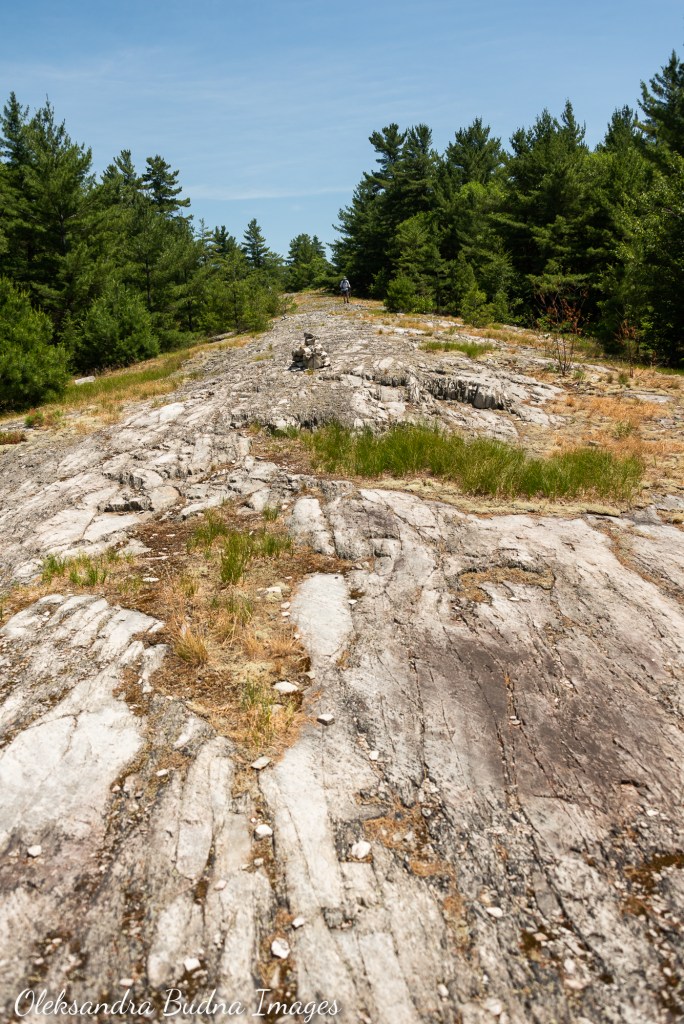
Speaking of off-trail wanderings, the trail is well marked with blue blazes and rock cairns. So the instances of getting lost and taking “the path less travelled” were rare but they did happen, mainly because we failed to notice the next marker. Those occurrences were more prevalent on a rainy day when the downpour and fog reduced visibility and our eyes were firmly locked on the ground looking for the least slippage prone areas to place our feet.


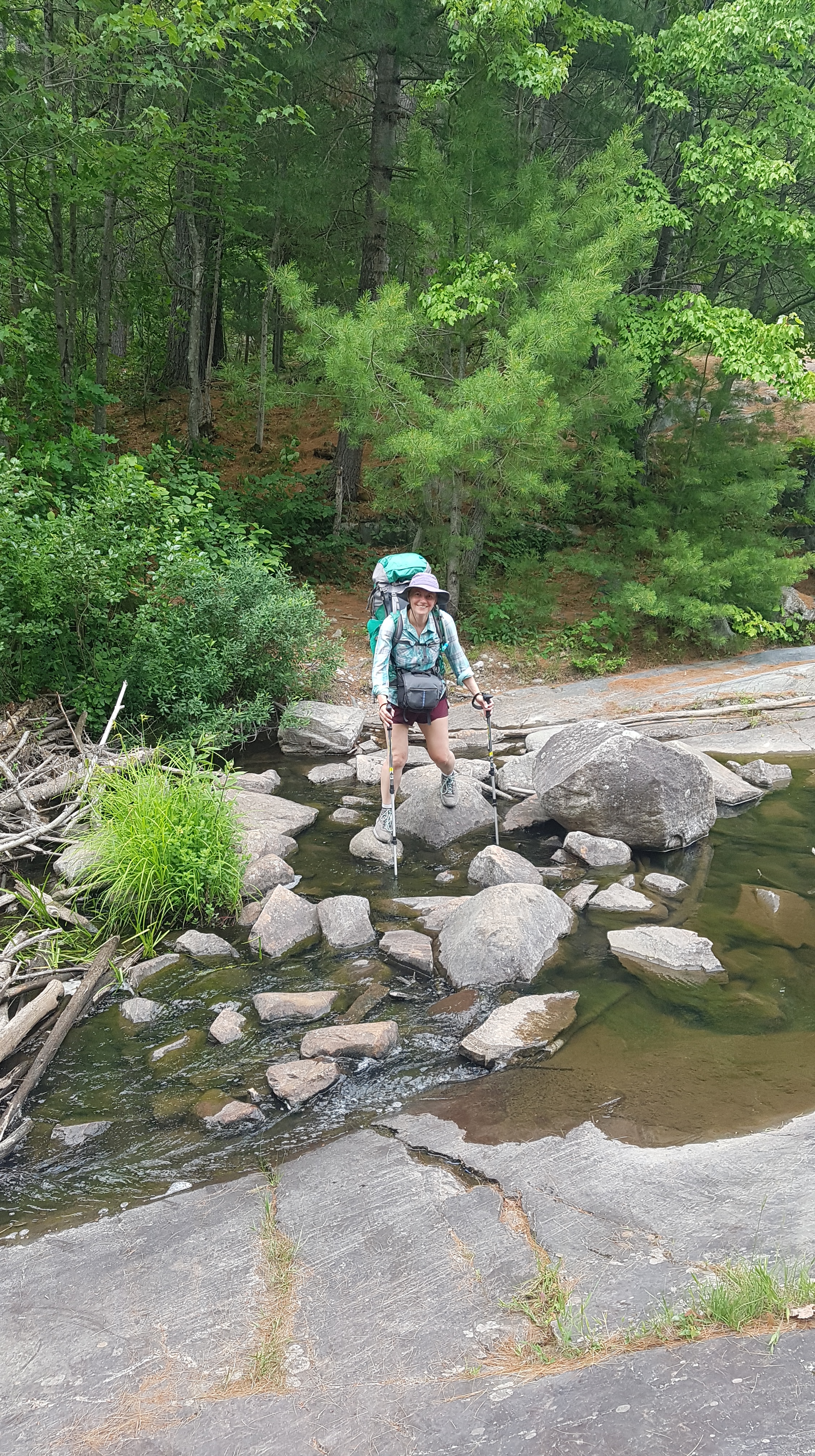
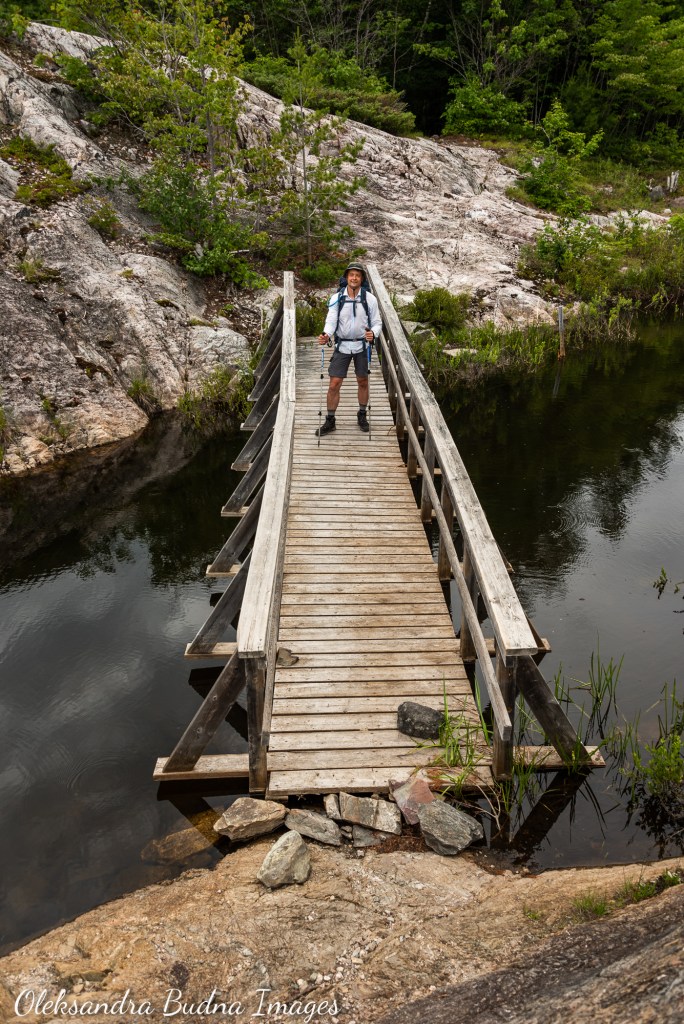
La Cloche Silhouette Trail is well marked with blue blazes and rock cairns; it also comes with lots of fun challenges: scrambling up rocks, climbing up hills, crossing streams and beaver dams, jumping over or crawling under fallen trees, and, my favourite, hiking through a waterfall, just to name a few.
Since La Cloche Silhouette Trail is a loop, it can be done in either direction. As I was preparing for our trip, I came across many discussions about hiking the trail clockwise or counter-clockwise. According to the proponents of the clockwise hike, you get to do the easiest sections first while the backpack is at its heaviest. It also allows some time to adjust and find your “trail legs.” The counter-clockwise group, on the other hand, believes you should cover the hardest parts at the beginning while you are still fresh.
As I was reading through these arguments, I couldn’t help but wonder how many hikers actually have a choice. We ended up hiking counter-clockwise, not because we wanted to cover the hardest parts first – we just had to go with whatever sites were available. I don’t think the direction impacts the experience that much. But if I was pressed to choose, I would have preferred to go clockwise for two reasons. The first few days of our trip were incredibly hot and humid so hiking through flatter and more wooded Baie Fine and Threenarrows sections would have been easier and provided more shade. Plus, these sections are less interesting than the rest of the trail so finishing with them felt a tiny bit anti-climactic.

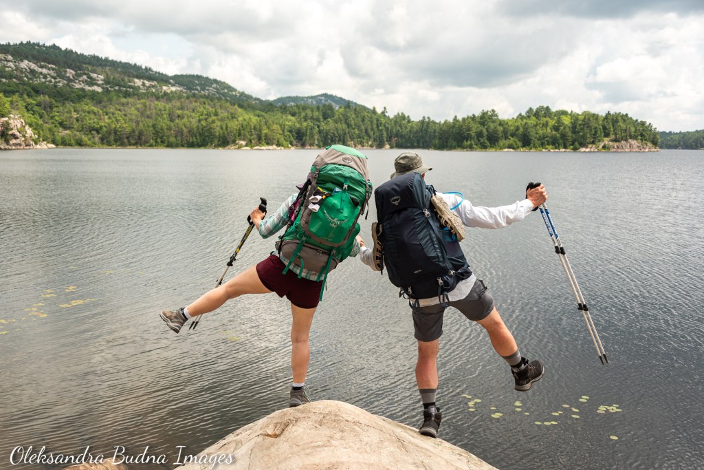


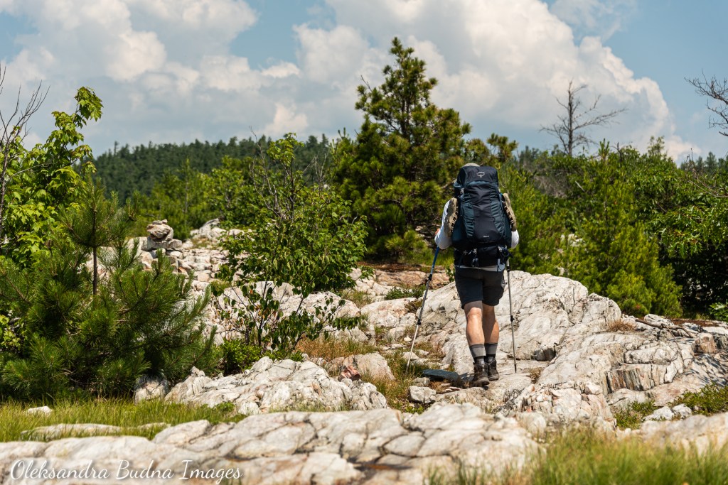
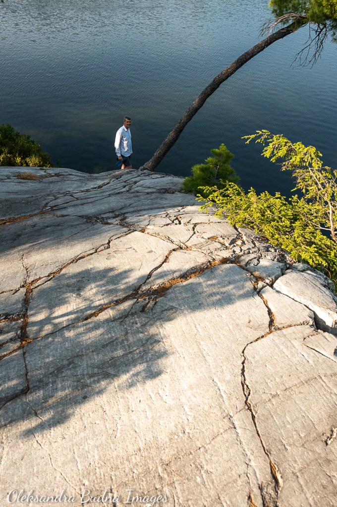
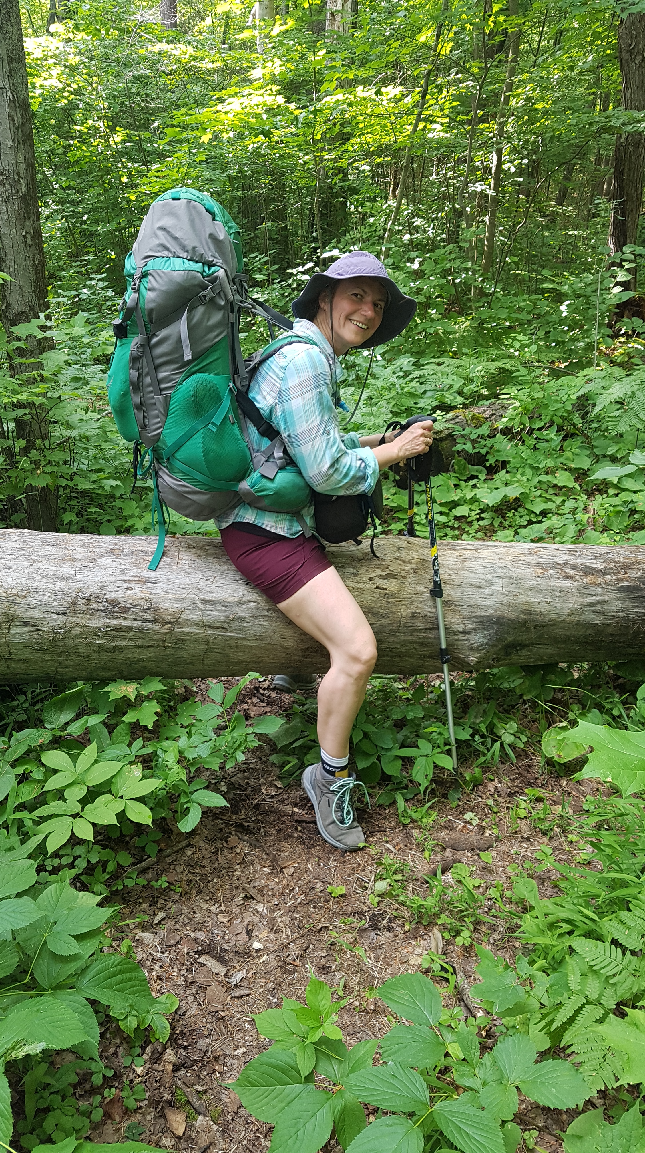
Sharing trail challenges, beautiful views and quiet moments with my husband made the trip extra special.
The itinerary
The whole trail took us nine days in total. The first and last days, however, were very short hikes plus a drive to and from the park. There were a couple more short days along the way because of campsite availability. If we wanted to, we could have probably combined some of those days and pushed through. Our backpacking goals, however, have never been about speed or endurance. Nothing but admiration for people who can cover the entire La Cloche Silhouette Trail in just a couple of days. We, however, prefer to take things slow, stop often to take photos and experience the place with all our senses. A chance to slow down and get to know the lands through which we travel is one of the reasons we go on backcountry trips. But more about it later. First, strap on your imaginary backpacks as I take you on a quick virtual tour.


Taking the time to notice small things
DAY 1: And so it begins… Almost
George Lake Campground to H53 on Little Sheguiandah Lake – 0.7 km, 20 minutes
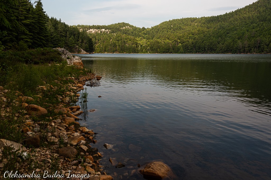
You could hardly count it as Day 1 even if you pad those meagre 700 meters with a walk from the parking lot to the trailhead. Initially, we planned to drive to Killarney and stay at the George Lake campground so we could start our trip bright and early. But because it was the Canada Day weekend, the campground was booked solid. So instead we added a site at Little Sheguiandah to our route. And great thing we did – that campsite is spectacular! Little Sheguiandah may indeed be little but it more than makes up for its size with its looks. Encased in red granite cliffs, cut into identical halves by water, with white domes of La Cloche Mountains rising in the distance, it offers stunning views from its only campsite.

The view from site H53 on Little Sheguiandah Lake is stunning.
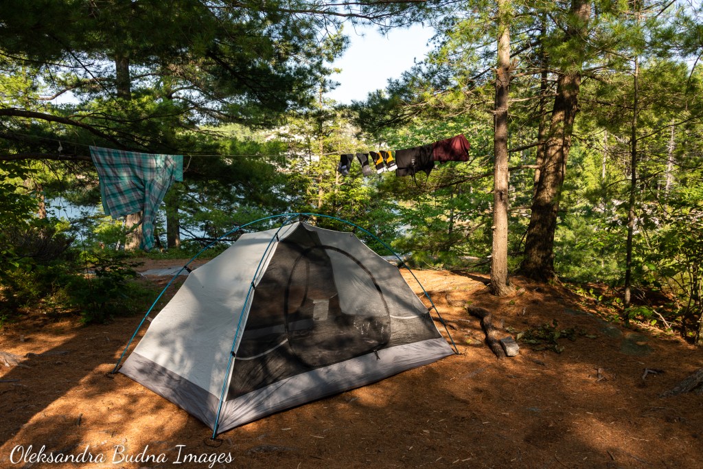
Once we finished set-up and had dinner, we spent the evening swimming, listening to bullfrogs’ calls bouncing between rocks and watching tadpoles at different stages of development: from round blobs with tails to almost fully formed frogs with tails still attached to everything in between. Our trip was off to a great start!

Site 53 is one of the best along the trail.
DAY 2: And so it begins… Kind of
H53 on Little Sheguiandah Lake to H50 on Sealey’s Lake – 4.6 km, 1 hour 40 minutes
Another short day with a mostly level trek through the woods. I wish we could book a site somewhere further along the trail but Sealey’s Lake was all we could get. I am not going to lie, I wasn’t very happy at first that we ended up here with half a day to spare. It’s an okay site with lots of flat space for tents, and expansive waterlily carpets do add to its charm.

Site 50 on Sealley’s Lake didn’t seem to offer much at first.
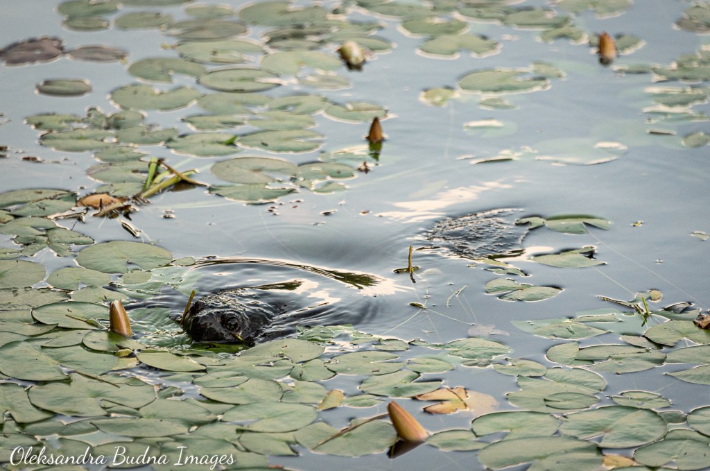
On the first inspection, however, the positives ended there. It didn’t help that we were all ready to jump into the lake after our sweaty hike, but leeches flexing their speckled bodies by water’s edge quickly curbed our enthusiasm. So instead we splashed ourselves with some water and went to look for ways to occupy ourselves. My husband decided it was a good time to catch up on sleep. I found a nice big boulder and spent the rest of the day reading and writing but mostly just watching this tiny lake teaming with life: beavers crisscrossing the water dotted with pyramid-shaped lodges, sandhill cranes ambling through grassy patches, a large snapping turtle poking her head through the waterlily carpet from time to time, her underwater movements betrayed by lily pads rearranging themselves in her wake. In the end, it was a perfect afternoon that helped realign our internal clocks with those of nature and prepare for the trek ahead.


Our stay on Sealey’s Lake ended up being one of the most relaxing and profound experiences of the trip.
DAY 3: WTF????
H50 on Sealey’s Lake to H46 on Bunnyrabbit Lake – 12.4 km, 8 hours
After two incredibly relaxing days, it was time to pick up the pace. The trail also upped its game. Somewhere along the way we crossed from Killarney Ridge to the Silver Peak section, a 16-kilometre stretch that runs under a watchful eye of Killarney’s highest point. Here elevation changes became larger and more frequent; one of the climbs inspired someone to write “WTF????” on a trail marker (I hear you, unknown fellow backpacker.) With more climbs and descents and temperatures in mid-thirties, this section was quite challenging.


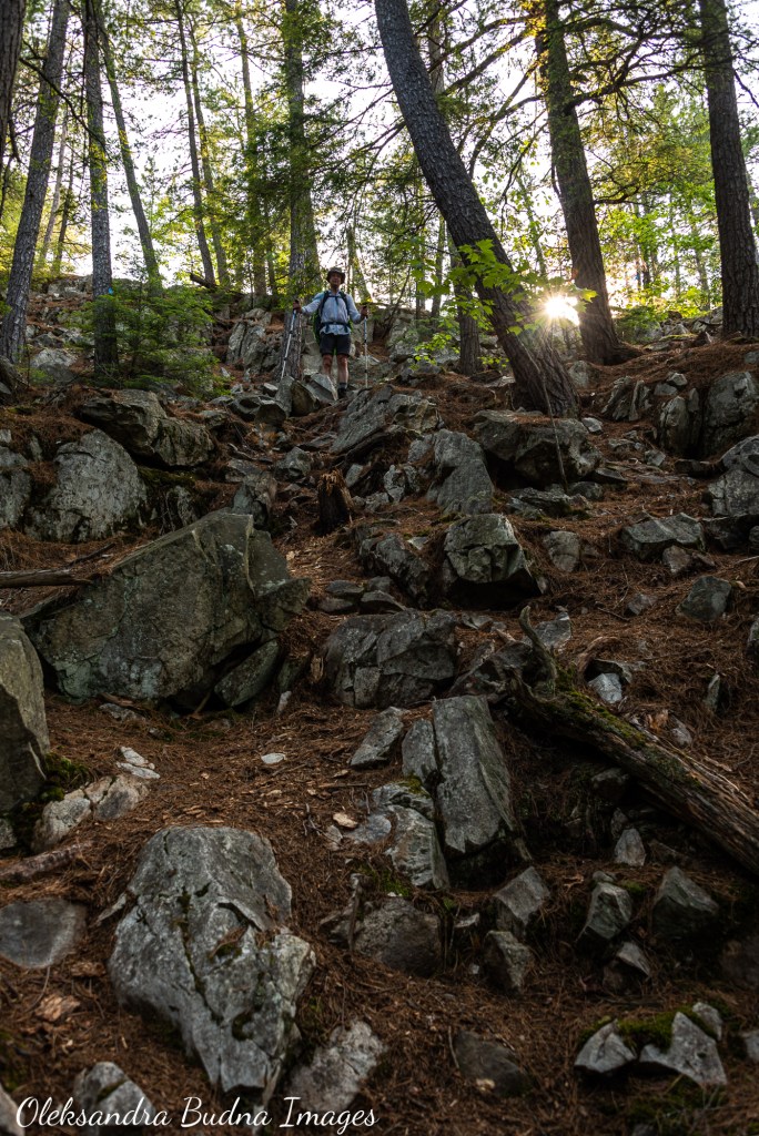

WTF?!?!?! Indeed
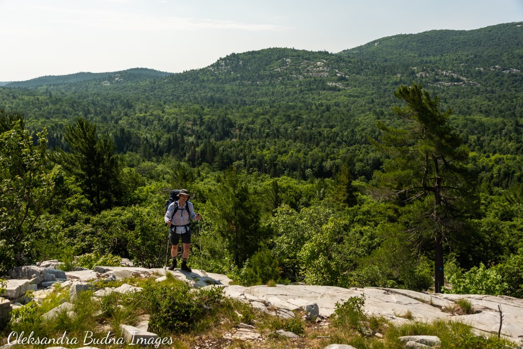
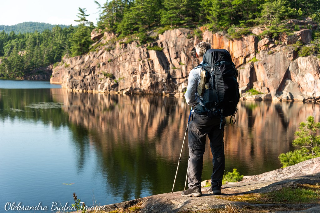
We made a few stops along the way too. First, there was The Crack, which we’d hiked numerous times before but never with 65-litre backpacks. Before we even started our ascent, we ran into a group of guys from Ukraine so we stopped to chat about things back home and beautiful places on both sides of the ocean. Once we got to the top, it took us another 30 minutes or so to take in the views, which always strike me in new and unexpected ways no matter how many times I see them. The Crack, of course, comes with crowds of day hikers who oohed and aahed over the size of our backpacks and the distance we were about to cover. One of the kids we met along the way was fascinated by the idea of sleeping in a tent and the fact that we had one in our backpack: “We are staying in a yurt and I am already tired. How are you going to sleep in the forest?!?” he exclaimed.

No matter how many times we hike to The Crack, the views are always captivating.
Once we left The Crack with its crowds behind, it was a little over an hour to Little Superior Lake. Killarney has no shortage of beautiful lakes boasting all shades of blue – from cerulean and azure to turquoise and teal. Little Superior, its outline reminiscent of a much larger cousin up north, still manages to stand out with its deep cobalt waters against striking white cliffs. Since we weren’t able to book a site here, we decided to at least stop for lunch and a swim.
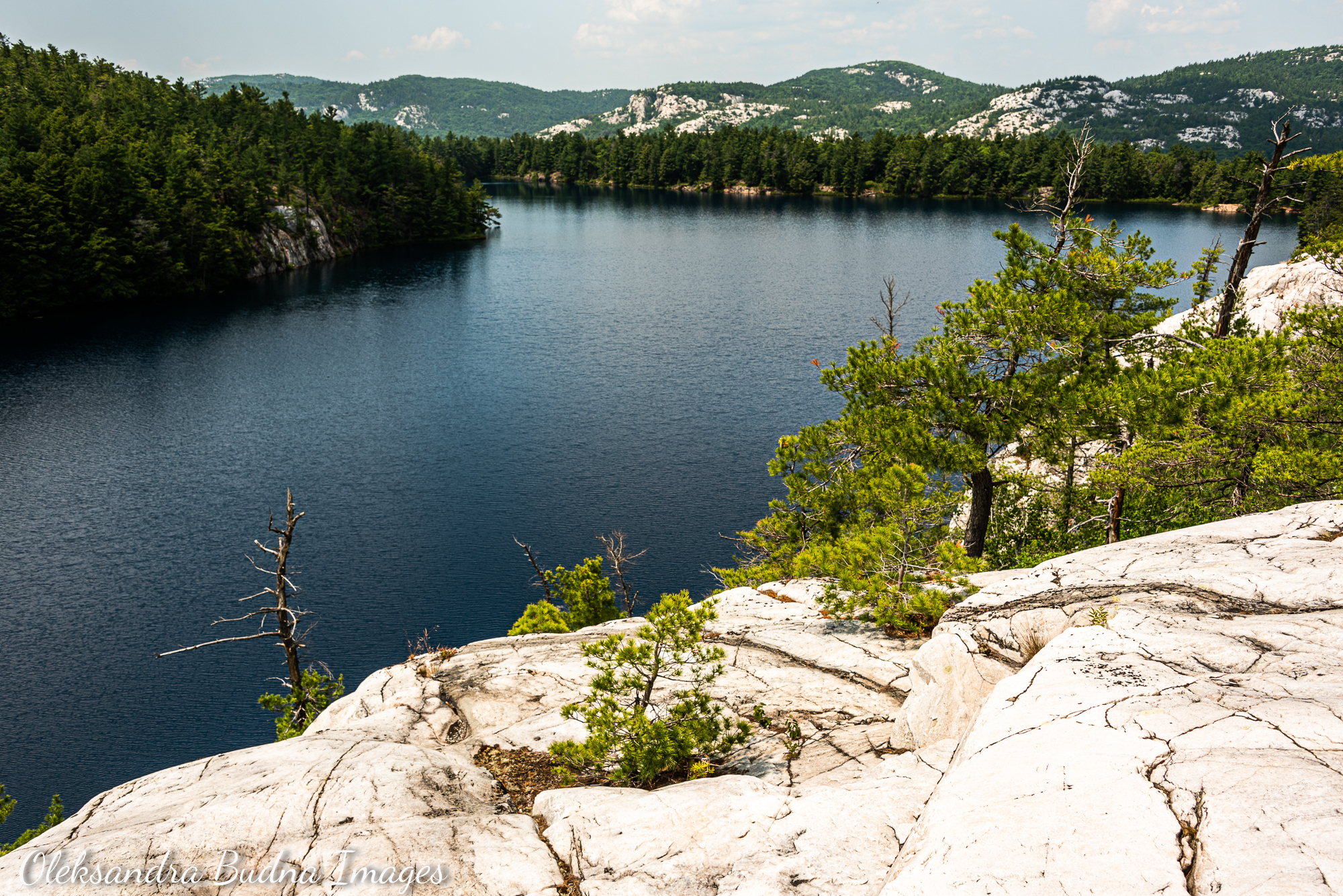
Little Superior is one of the most beautiful lakes in Killarney.
After Little Superior, it was more ups and downs, hikes along mountain ridges, treks through the woods, a stop at the Heaven Lake campsite – this time a quick one just to use their thunderbox. When we finally hit the split for the Bunnyrabbit Lake campsites, we couldn’t help but breathe a sigh of relief. As it turned out, it was a bit premature. We still had good 15 minutes to go before we finally reached our site.
Bunnyrabbit is another lake that got its name because of its shape. There are two campsites on the lake but they are far apart so we didn’t see or hear our neighrbours at all. We got the campsite further away (hence the long walk) and everything about it felt immense: lots of space between strapping pines and hardwoods, a long walk to the thunderbox (at least 60 metres so plan accordingly), massive logs around the campfire, a sloping rock leading to the water. So unlike Killarney’s signature quartzite, usually smooth and polished, this one felt rough and wrinkled, with fissures and cracks crisscrossing its surface. It offered a perfect spot for dinner, breakfast, tea, coffee, reading, writing, listening to beavers doing cannonballs in the water and a bullfrog talking to its echo, and, of course, watching the sun slide behind the hills at the end of the day.


Site H46 on Bunnyrabbit Lake requires some time to get to but it is worth the effort.
DAY 4: We will out-rock you!
H46 on Bunnyrabbit Lake to H38 on Silver Lake – 4.6 km, 2 hours 30 minutes
We were back to a shorter trek although this one was considerably more challenging than the sections at the beginning of our trip. Still, even with all the climbs, sweltering heat and taking things slow in the morning, we arrived at Silver Lake in the early afternoon, which meant a lot of time to relax.
We booked site 37 but ended up staying on 38 because the other one was already occupied. Unlike sites on Bunnyrabbit, these two were fairly close together (at least, on the water; there was a lengthy trek through the woods between them). We stopped at 38 for a quick break and could see two guys feeling all comfortable with their tent and hammock already set up on the other site. I don’t know if that was done on purpose or by mistake because the signage was confusing. I prefer to think it was the latter. My husband and I discussed going over to their our site to wave our permit and force them to leave but that would take time, which we’d much rather spend doing other more enjoyable things. So we decided to set camp on site 38. From where we were standing, there was only one advantage the other site could claim – easier access to water. We, however, had an upper hand – quite literally because site 38 sits on a rock overlooking 37. It afforded us more privacy but also meant that we had to practically resort to bouldering to get down to the lake. After a few trips down and up, once we figured out the best footholds, it all became part of the fun (admittedly, way less fun in the rain).
We booked site 37 on Silver Lake but it was already taken so we ended up staying on site 38.
Here is the thing. A lot goes into a good campsite: easy access to water, a level tent pad (preferably more than one if you are travelling with a group), a thunderbox in a decent condition at an acceptable distance from the site, good privacy from the main trail and other sites. For me, however, there is one thing that trumps all of the above – an open rock with a great view. And site 38 had the most spectacular rock: smooth, sleek, sloping all the way down to the water. As I stood there considering our options, I could hear it promising hours of lying with my back pressed against its warm surface after long leisurely swims in Silver Lake’s blue waters.

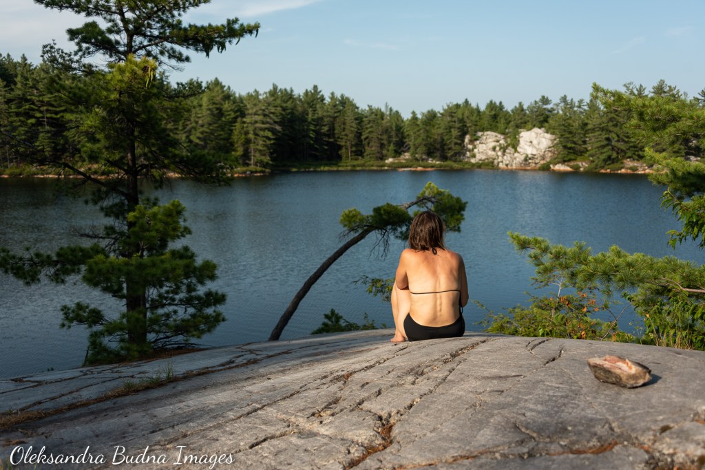
My favourite thing about site H38? An open, smooth, polished rock with a beautiful view of Silver Lake
DAY 5: Level paths are boring
H38 on Silver Lake to H33 on Little Mountain Lake – 11.4 km, 6 hours
The first part of our day could be called “everything that bites.” The trail ran through the woods and mosquitoes were relentless. Luckily, that section was also mostly flat so we practically ran through it to escape those bloodsuckers. Once we passed the turn-off to Silver Peak, the trail started going up and down at regular intervals because level paths are boring, I guess. The sparkling dome of Silver Peak looming and beckoning in the distance with its billion years of wisdom was a comforting and awe-inspiring sight. Since we’d hiked Silver Peak several times before, we decide to forgo a steep two-kilometre side trail to the top. But if you haven’t been there, the views – La Cloche Mountains like a wave frozen in time, smudges of blue amidst the white hills, a strip of Georgian Bay glistening in the distance – are definitely worth the extra effort required to get there.

We skipped a hike to Silver Peak since we’d hiked it several times before. For those who haven’t been to the top, the views are worth the extra effort to get there (photo taken during a canoe trips a few years ago)
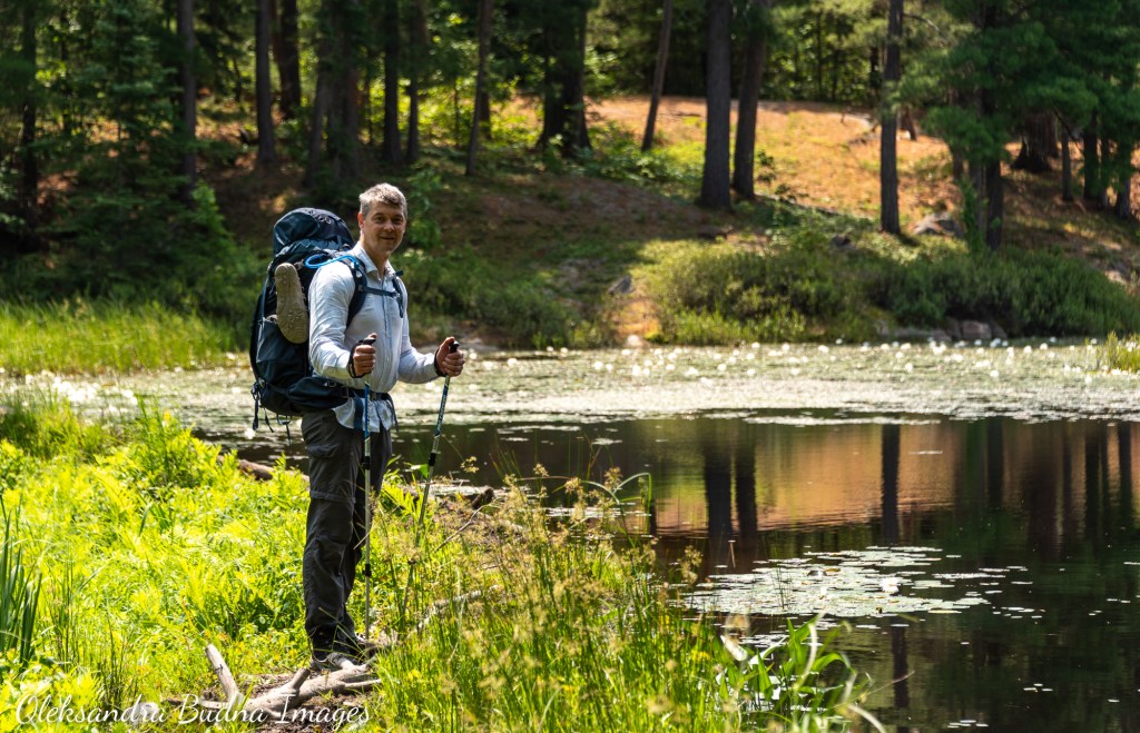
Our plan was to stop at Boundary Lake for lunch. Years ago, we stayed there during a canoe trip and could remember that the portage from David Lake to Boundary Lake intersected with La Cloche Silhouette and ended in a beautiful rocky outcrop – a perfect spot for an afternoon break. Somehow we managed to dash right past that intersection, probably distracted by mosquitoes. We didn’t realize our mistake until we reached the split-off for the Boundary Lake and David Lake campsites. Going back wasn’t an option. Going down to either Boundary or David meant extra effort to scramble back up to the main trail. But we needed to get more water (a quick swim wouldn’t hurt either) and there seemed to be no good water access coming up. After some deliberation we decided to go left, as in towards Boundary Lake.
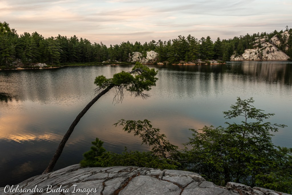
Even though our La Cloche Silhouette hike was an exploration of Killarney’s rock, water still ran the show. Every time we filled our pouches and bottles to quench thirst along the way, every time we jumped into a lake to cool down during our lunch break or after a long day of hiking, every morning coffee we enjoyed listening to the waves lapping against the shore, every night we spent by the lake watching it smooth out its wrinkles, all ready to reflect the sunset colours splashed across the skies – the power of water was undeniable.


While our La Cloche Silhouette hike was an exploration of Killarney’s rock, water still ran the show.
As we were approaching Little Mountain Lake, the water also started pulling over our heads – looked like that forecasted rain was going to happen after all. But that was a problem for the next morning. When we arrived at Little Mountain Lake, we still had lots of rain-free time to set up camp, go for a swim and have dinner on a rocky outcrop by the lake.
Little Mountain Lake shares its name, or at least part of it, with its bigger sibling – Great Mountain Lake – just a short portage away. A few years ago, we stayed on the Great one and then paddled across Little Mountain Lake to get to the next portage. What I remembered from that paddle was the turquoise waters against a white cliff, someone relaxing on the campsite and me thinking one day we could stay here too. That day was finally here. The cliff wasn’t visible from the site, the water was emerald green. The site itself was decent, although not as great as some of the other sites along the trail. Yet, surrounded by mountains on all sides, it offered a cozy, soothing feeling. That, in combination with changing weather and Benadryl that I took for my heat rash, sent me into the tent by seven and I was asleep soon after.


Site H33 on Little Mountain Lake felt soothing and cozy. Or maybe it was the Benadryl I had to take for my heat rash.
DAY 6: “This is almost better than sex.”
H33 on Little Mountain Lake to H21 on Three Narrows Lake – 10.8 km, 7 hours
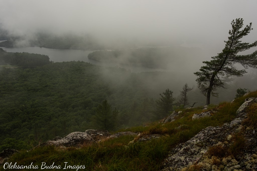
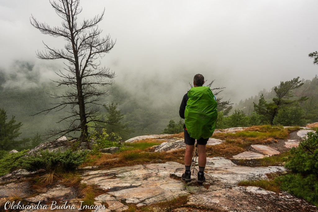
The next day we woke up to an overcast sky and mountain tops decked in wooly clouds. The rain held off long enough for us to have breakfast. As we started packing, the clouds started leaking and didn’t stop until after we reached our campsite on the other side. It didn’t help that we were hiking through the Hansen Township section. This section was completed last and is the most difficult part of the trail with steep climbs and descents, including hiking down through a waterfall (I’d like to emphasize the word “through”) and up a rockslide.


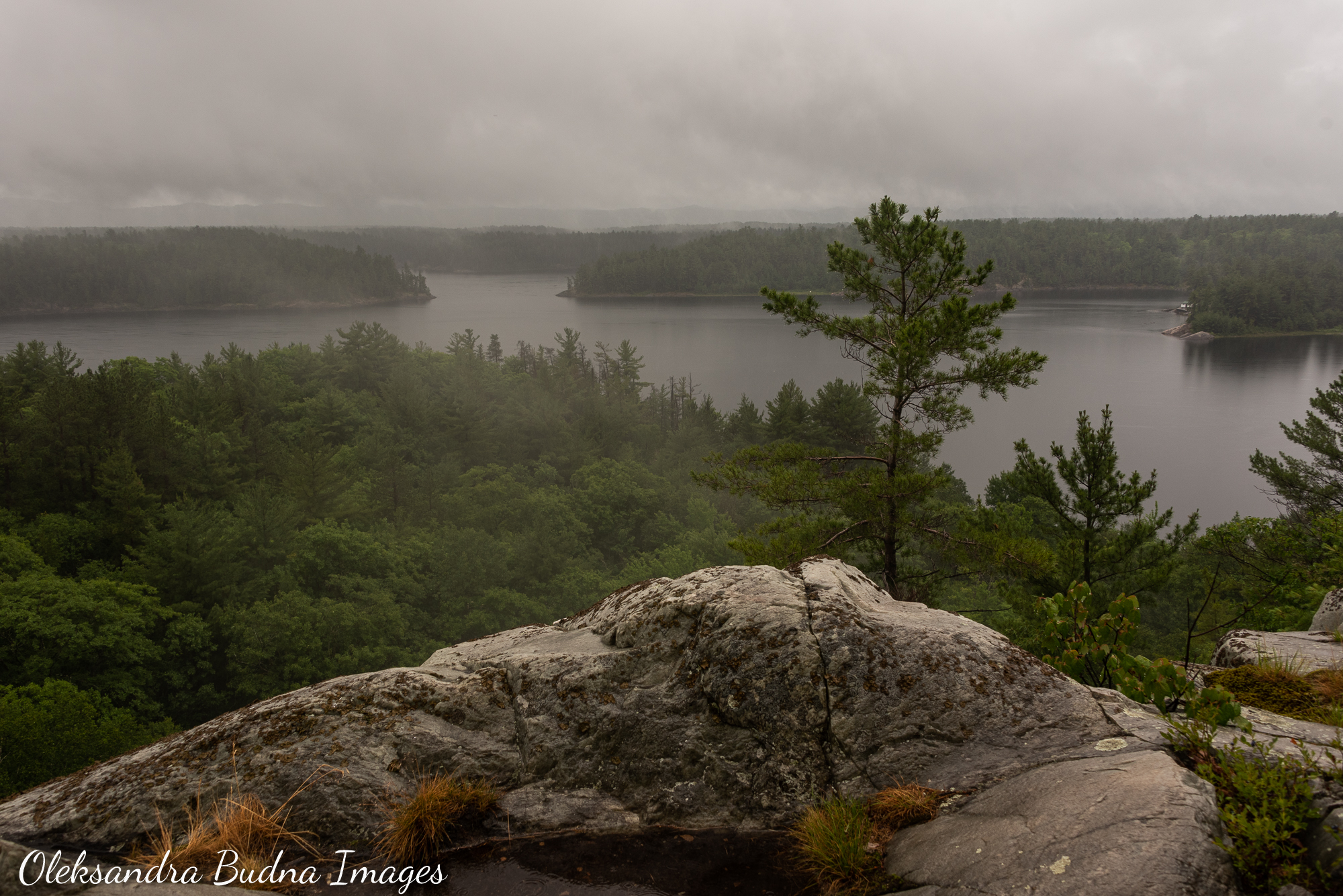


Hiking through the hardest section of the trail in the rain? It was quite a day. But look at the views!
Throughout the morning, as we made slow progress over slippery rock, we kept looking for signs that the rain would soon be over – a glimpse of a blue sky, a glimmer of the sun. There were a couple of short breaks that gave us false hope along with a chance to have a snack and pour water out of our hiking boots. By early afternoon, as the rain intensified from a drizzle to a steady downpour that occasionally bordered on deluge, it became clear there was no end in sight. By then, we also stopped caring about being wet. As we stood atop one of the lookout points watching the clouds drift in and out of view, revealing lakes and a snaking river down below, it felt as if we were dissolving and becoming rain.
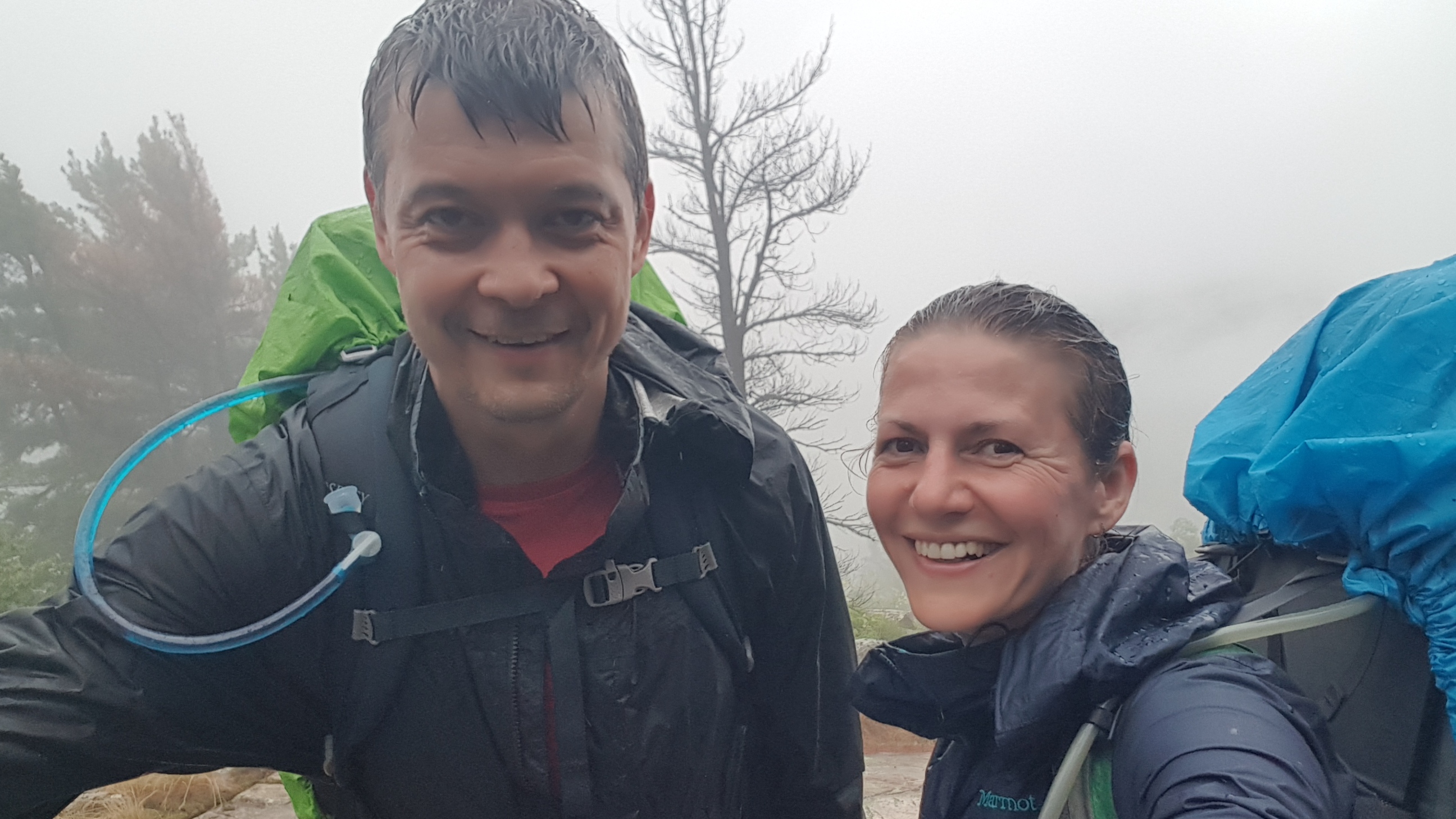
It was still pouring when we got to our site. Now that we stopped moving, the cold set in right away. So with trembling hands and pretty much every part of our body, we got to setting up the tarp and changing into dry clothes. “This is almost better than sex,” I exhaled as I slipped into my sweatpants, something my husband still teases me about. Speaking of clothes, this seems to be a good time to talk about our socks. After our blister-ridden Coastal Hiking Trail trip a few years ago, we decided to invest in better socks. At the Outdoor Adventure Show, we stumbled upon the CEP booth. Their socks seemed to promise everything we were looking for – compression to avoid aches, tight fit to avoid blisters – so we bought two pairs each. The socks didn’t disappoint! Even though our feet were wet half the time – either from sweat or, on this particular day, from rain – our feet remained blissfully blister-free. Since then, we have also tested them during our Grand Canyon hike and we stand by our initial assessment.
The moment we slipped into dry clothes, the rain stopped so we could finally take a good look around the site. Site 21 is beautiful, definitely the best one on Three Narrows: lots of space, open rock with gorgeous views of the lake and surrounding mountains, fantastic swimming. The only downside is a cottage that sits right next to it. We, of course, knew it when we booked the site – the cottage is right there on the map, but we were hoping it would be empty. No such luck: there were visitors and quite a few of them. Not that they were loud but it did feel jarring after days of solitude to have so many neighbours all at once. Another thing that was even more annoying than a bunch of half-expected neighbours were fire pits filled with garbage. There were a few of those (I guess people tried to find a more secluded spot on a windy day) and all of them were littered with food packages, cigarette butts, discarded band-aids and dental floss. Because Killarney was under a fire ban during our trip, we couldn’t just burn all this garbage so we had to pack it and bring it back with us. I wish people were more considerate of their fellow campers and, most importantly, respectful of the lands through which they travel.


Site 21 on Three Narrows was fantastic. The only downside was a cottage right next to it.
DAY 7: All that walking and we are still on Three Narrows
H21 to H16 on Three Narrows Lake – 11.4km, 5 hours
In the morning, the sky was a gray palette spotting every shade from muted light tones to threateningly purplish. As we ate breakfast and drank coffee by the lake, we studied the clouds in an effort to decipher their plans for the day. Our hiking boots were still wet, and we weren’t particularly excited about a prospect of another rainy day. Eventually the gray layers started to separate and fray at the edges allowing the blue of the sky and sunlight in.
The trail that day was significantly easier; with fewer ups and downs, it mostly ran through the woods following the outlines of Three Narrows Lake (yes, it is that big; the entire Threenarrows section, in fact, is 19 kilometres long). The challenges were different: mostly of the jump-over-streams and climb-over-logs kinds. The biggest challenge of them all was the endless buzzing of flies that circled our heads like rings of Saturn. We stopped for lunch at H18. Sitting on a cliff, it took the meaning of “steep access to water” to a whole new level. If the site at Silver Lake required bouldering, this one practically called for rappelling.
The trail started to get easier; the biggest challenges were crossing streams and climbing over logs.
Our campsite for the night, H16, also sat on top of a cliff but had a much easier way to get to the water. Down below stretched a secluded bay of Three Narrows Lake, so narrow that it looked almost like a river. Entertainment was provided by a group of fish that followed our every move the moment we got to the lake. Another highlight was two loons that drifted past our site a few times during our stay.


Site H16 overlooks a quiet bay on Three Narrows Lake.
Loons with their soulful calls are an indispensable part of any backcountry trip. This time, we didn’t see them until we hit Three Narrows, probably because our previous sites were on much smaller lakes. Unlike other birds whose bones are hollow, loons have many solid ones that make diving easier. It also means they are not the most graceful flyers and require a long runway to take off. So they rarely land on small lakes to avoid getting stranded. Three Narrows Lake, which used to be three (it’s right there in the name) separate lakes until a series of dams turned them into one body of water, offers endless space for loons to move around. Needless to say we were happy to see and hear them.
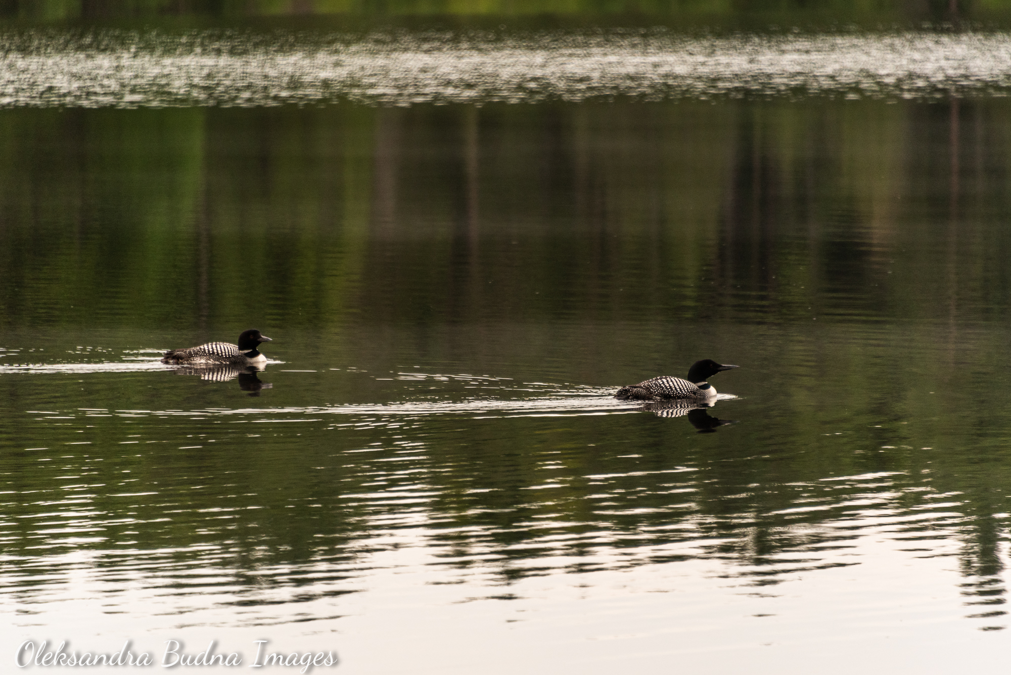
Loons with their soulful calls are an indispensable part of every backcountry trip.
DAY 8: A gem of a day
H16 on Three Narrows Lake to H2 on Lumsden Lake – 13.4 km, 6.5 hours
This was our longest day distance-wise. The trail, however, was mostly flat by that point. The most difficult part of that day was Killarney’s notorious The Pig portage. But without a canoe and after all the climbs we’d covered in the run-up to this part of the trail, even The Pig felt like a walk in the park.


The Pig portage (on the left) was the hardest part of the day, but without a canoe and after all the climbs we’d done is was child’s play.
Since we knew the hike wouldn’t take us long, we decided to stop at Topaz Lake for lunch. Topaz Lake, with its waters the colour of the eponymous gemstone and white cliffs rising on one side of it, is a famous spot in Killarney. Because of its relative proximity to the George Lake campground and Baie Fine access point, it attracts many campers and cottagers alike who come here for a day to cliff jump. And I guess backpackers who weren’t able to book its only site and are looking for a spot to take a break, wash off sweat and have some fun.
The day we stopped there was no different. The cliffs were crowded, mostly with cottagers who were easy to identify by their light packs, perfectly styled hair, squeaky clean clothes and actual swim suits (instead of underwear that could pass for a swimsuit, in our case, because why carry extra weight?). After eight days on the trail, to say we didn’t look very put together would be an understatement. Crowds aside, Topaz Lake is definitely worth a visit if you happen to be in the vicinity.

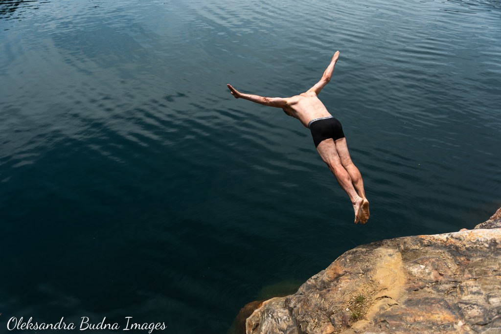


Topaz Lake is a popular cliff-jumping destination. We joined crowds of campers and cottagers to enjoy the beautiful waters and have lunch.
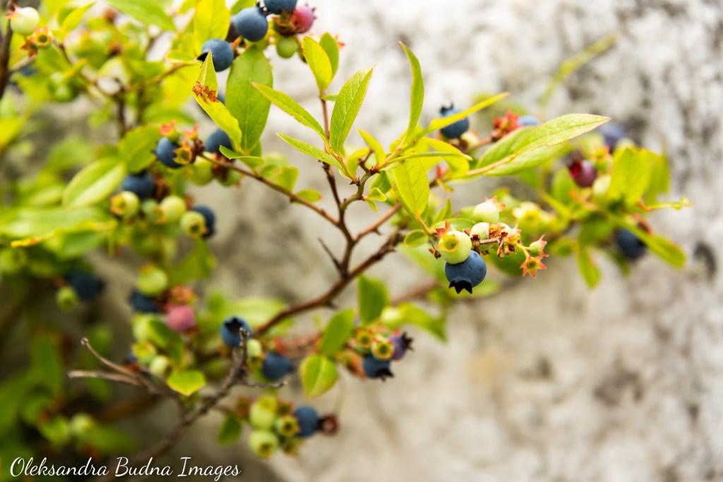
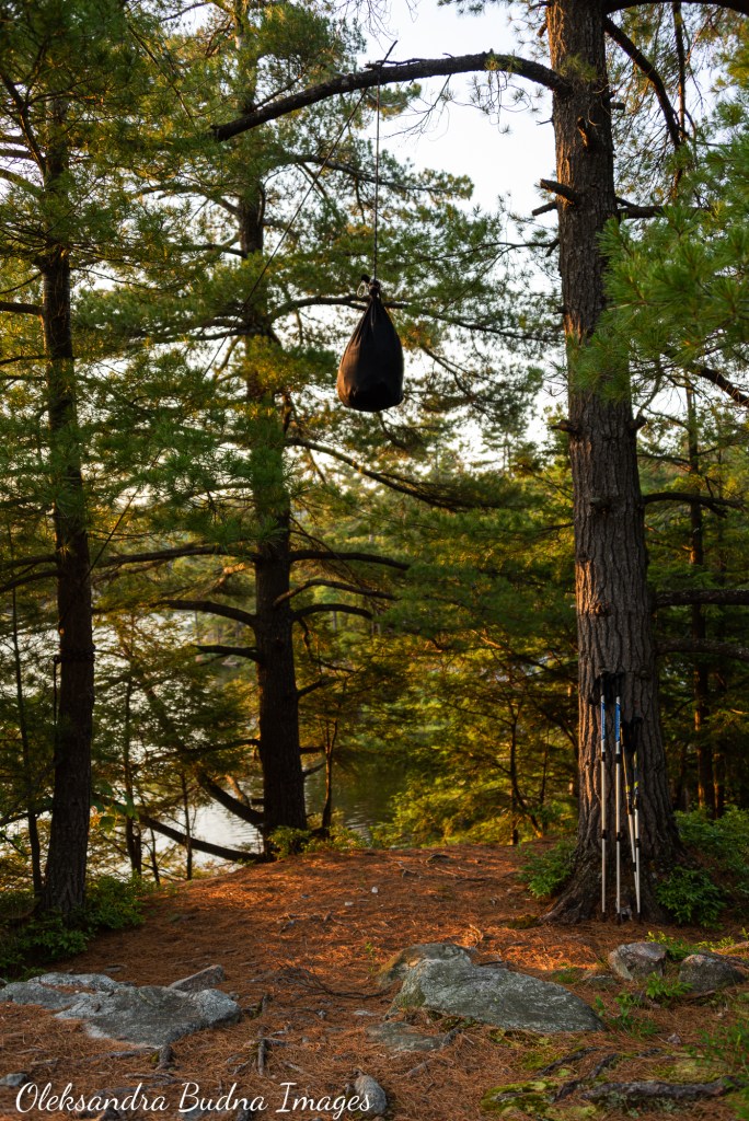
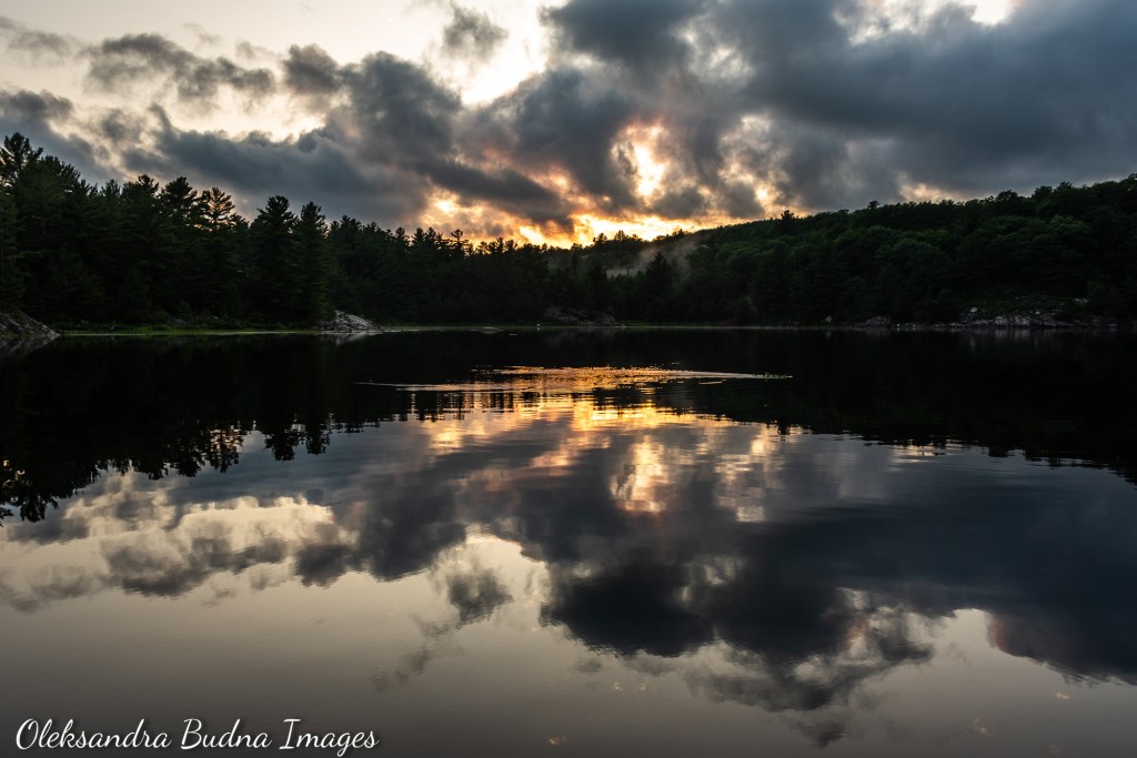
Our stop that night was Lumsden Lake. While not as striking as Topaz, it still offered a beautiful rock, a great view right from our tent and lots of blueberries around. An absence of crowds was definitely a plus. As was our routine by now, we jumped into the lake right after we arrived, which took our count of lakes we swam in during this trip to nine. After that we got to all the usual camping chores: tent, dinner, bear hang. Light rain drove us in early and we watched the night settle over the lake from the comfort of our tent.


Site H2 on Lumsden Lake – our last stop on the trail
DAY 9: “We actually did it!”
H2 on Lumsden Lake to George Lake Campground – 3.2 km, 50 minutes
We intentionally made this last day very short to have enough time to drive back to Toronto, but also to allow for a slow transition to a life off the trail. Unfortunately, people who were staying on the site after us arrived as we were packing so we had to leave earlier than planned. Once we got back to the parking lot at the George Lake Campground, we took a quick shower at the comfort station to look more presentable. We then headed to Killarney village for our traditional fish and chips celebratory lunch.
“We actually did it!” I turned to my husband as we got into the car to head back home, suddenly overwhelmed by magnificent experiences we’d shared over the past week and realization that the trip was now over.

And we are done! Celebratory fish and chips lunch at Herbert Fisheries in Killarney is a must.
The Why
And that brings me to the why. The reasons are as diverse and plentiful as the hikers who walk La Cloche Silhouette Trail every day. If asked, I could talk about the beauty of slowing down and travelling at human speed. About surrendering to the Earth’s rhythm. About experiencing the land with every fiber of my being and connecting to it on an intimate level.
I could talk about time transforming from deadlines, meetings and office hours into rocks holding billions years of stories and whispering pines with centuries of data encoded into their trunks. About days measured by waterlilies opening and closing their petals in accordance with the sun’s position in the sky, bracketed by an exultant bird song at dawn and a persistent buzz of mosquitoes at dusk.
I could talk about that slow afternoon on a rock by a swampy little lake, when the most significant occurrences were sandhill cranes announcing their arrivals and departures with joyful screeches and a snapping turtle poking her head through the waterlily carpet, and where the air smelled of sunshine and eternity. About feeling my boundaries expand and eventually dissolve. About becoming part of the landscape.
Instead, I will finish with my husband’s less poetic, but very accurate, insight on a very rainy day six of our trip. As we stood on a cliff above an unknown lake watching its contours peek through shifting clouds, rain dripping down our backs, water sloshing inside our hiking shoes, he delivered an utterance steeped in awe: “I look at all of this and for a moment I forget that my underwear is soaked through.”


Once you slow down and travel at human speed, you experience time differently, appreciate your body in a whole new way and, most importantly, connect to the land on a very intimate level.

A great achievement. Too much to read in one go but I will come back to it.
LikeLiked by 1 person
It was a long trip, hence the long post 😄 Thank you for reading!
LikeLike
Pingback: La Cloche Silhouette Trail - My First Time Backpacking - My Overdue Adventures