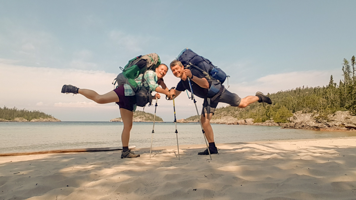
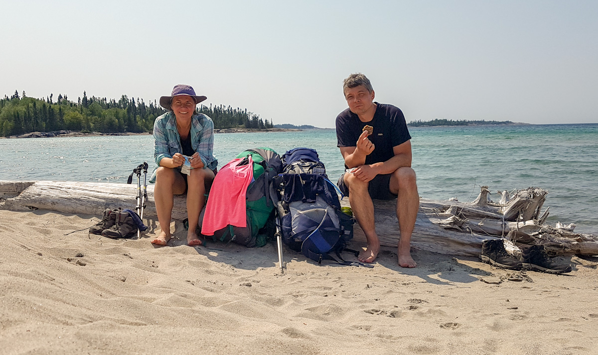
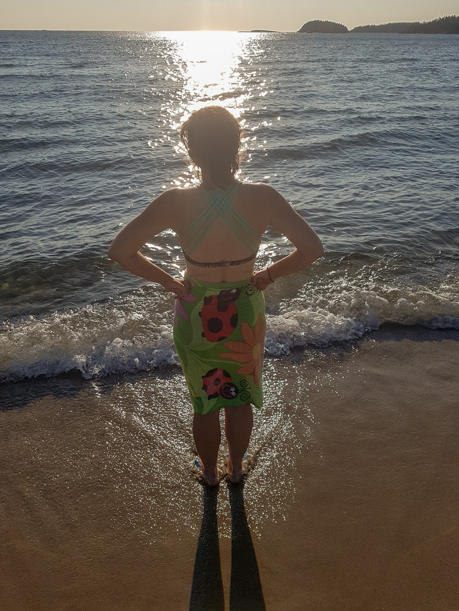
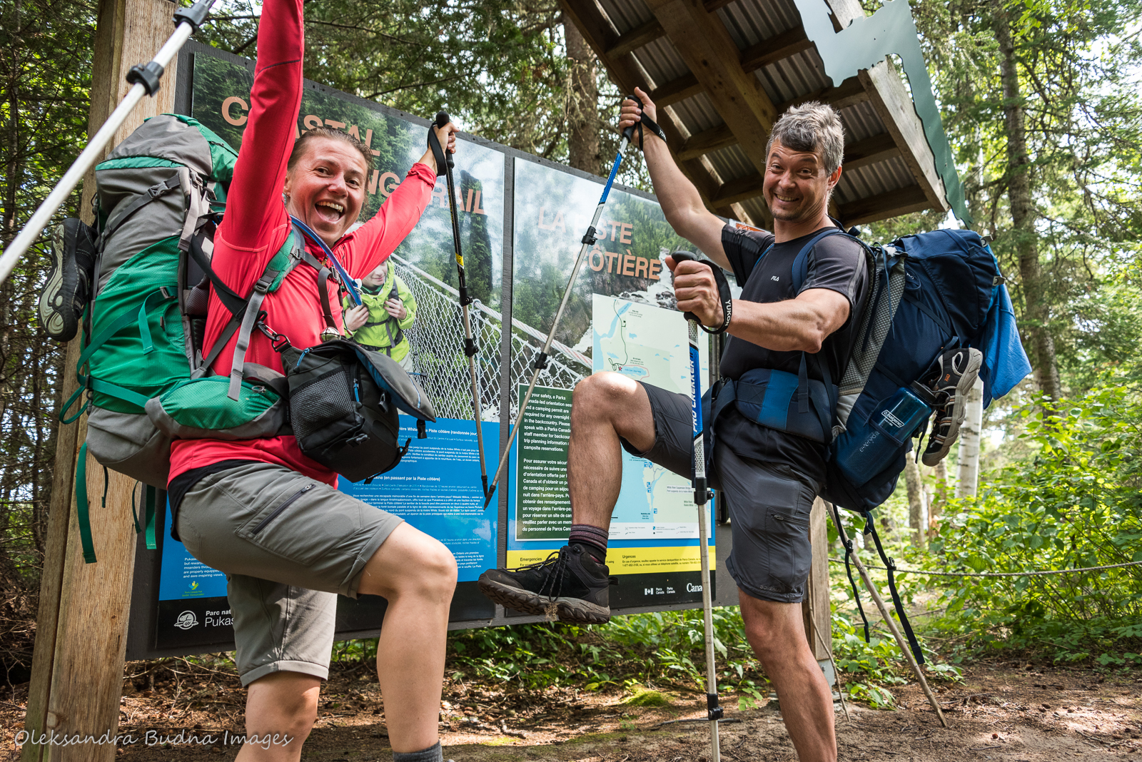
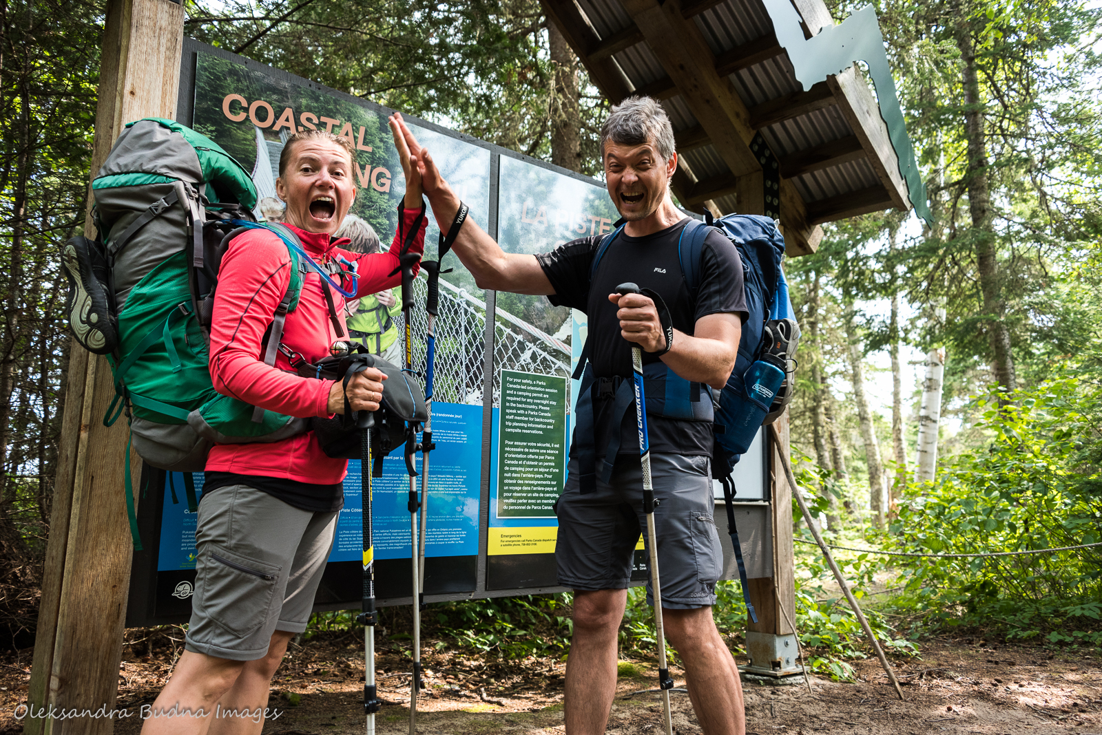
“This trail has been described as challenging,” says the park ranger flipping through her orientation binder. We stifle a nervous laugh, still trying to embrace the enormity of what we are about to undertake – backpacking the entire 60-kilometre Coastal Hiking Trail in Pukaskwa National Park on the north shore of Lake Superior. There and back, plus a detour to Picture Rock Harbour – totalling 130 kilometres over nine days. A significant distance even on the flattest of terrains, let alone what has been rated as one of the most challenging trails in Canada.

Part I: Poetry
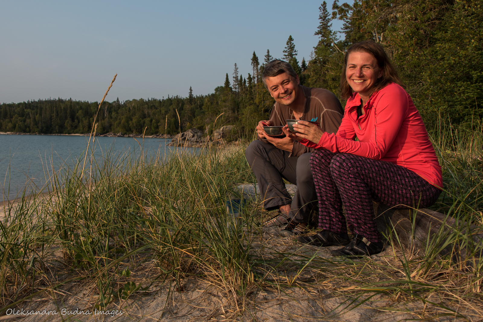
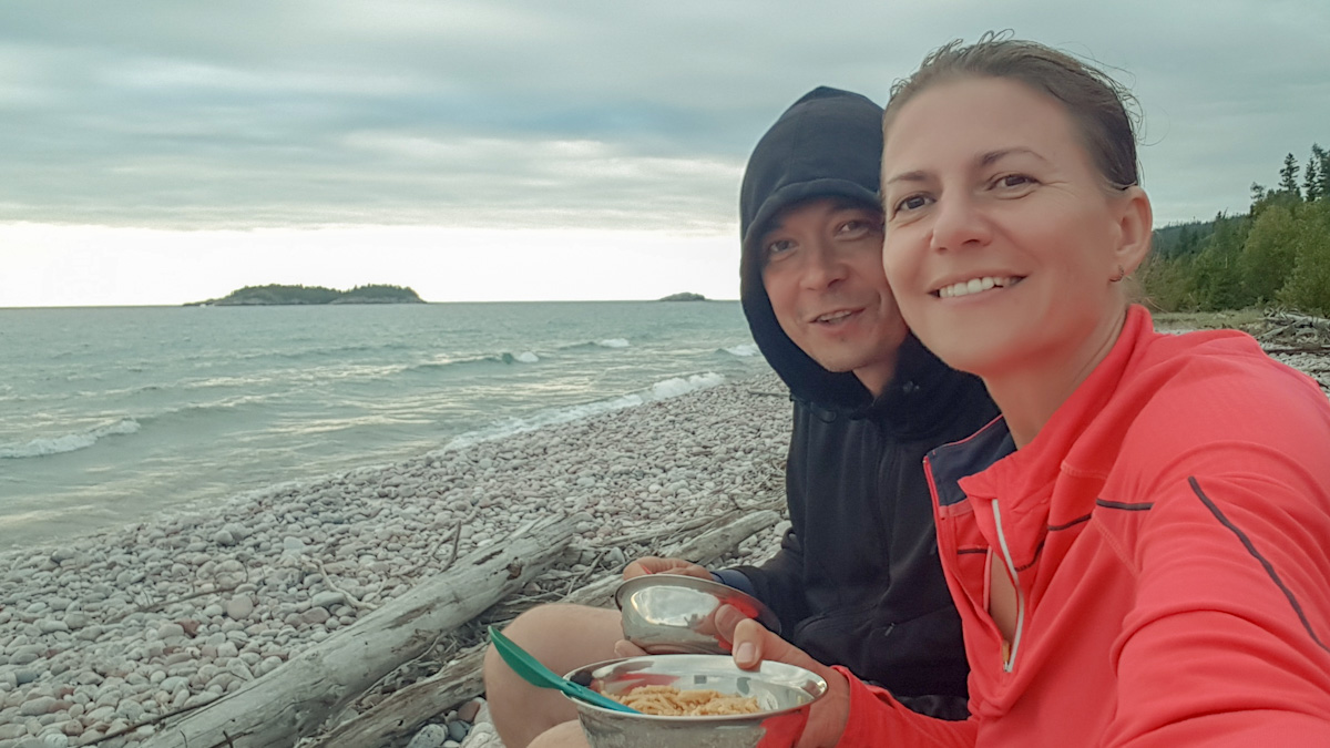
I should probably mention that we are more of a canoe people. For the most part, we prefer paddles to hiking shoes but we’ve done a few backpacking trips in the past. Last year, together with our kids, we hiked Mdaabii Miikna (‘go to the shore trail’ in Anishinaabemowin) here in the park, and that’s how the idea of backpacking the Coastal Hiking Trail was born. Although, according to my husband, the seed was planted much earlier. Apparently, I talked about it during our very first camping trip to Pukaskwa. Back then he thought dragging our stuff for 60 kilometres was a ludicrous idea. Yet here he is, ten years later, sitting on a rock next to me near the registration kiosk, nodding earnestly as the ranger goes through trail specifics, park rules, bear safety and other things that will help us get out of this adventure alive and unharmed.

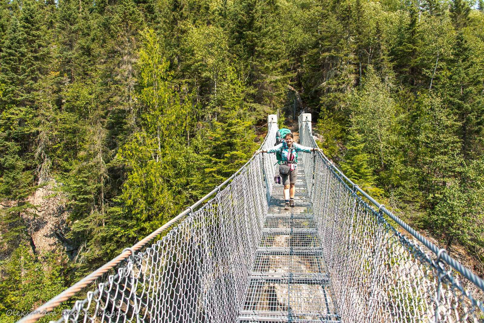
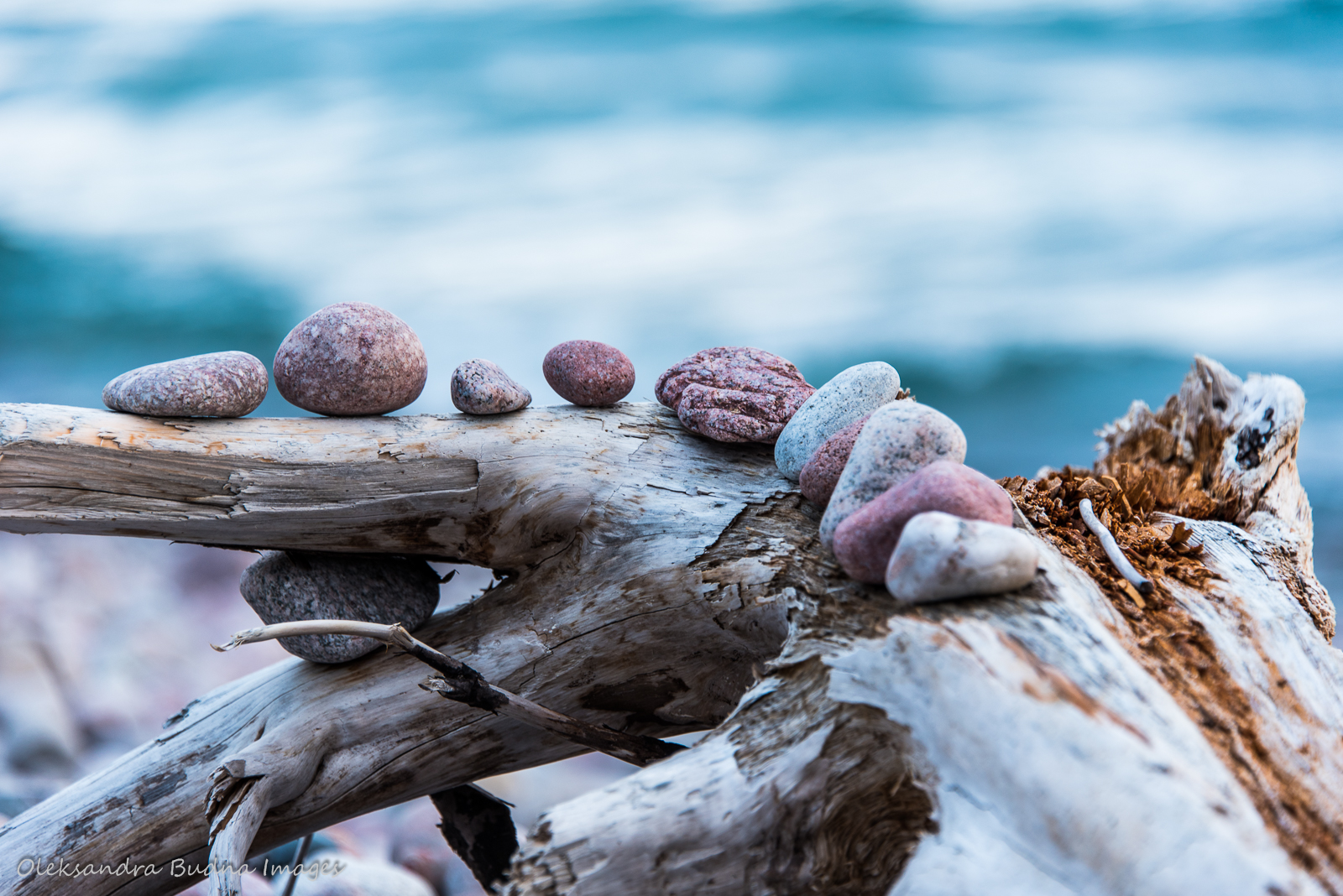
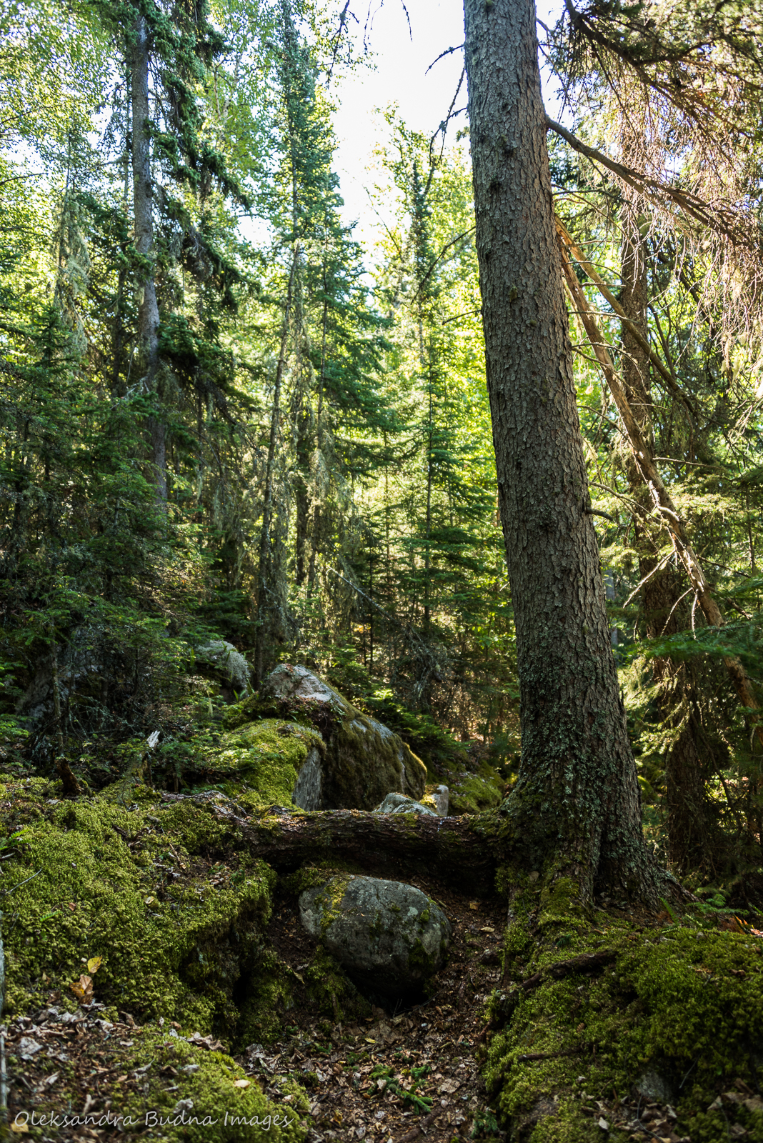
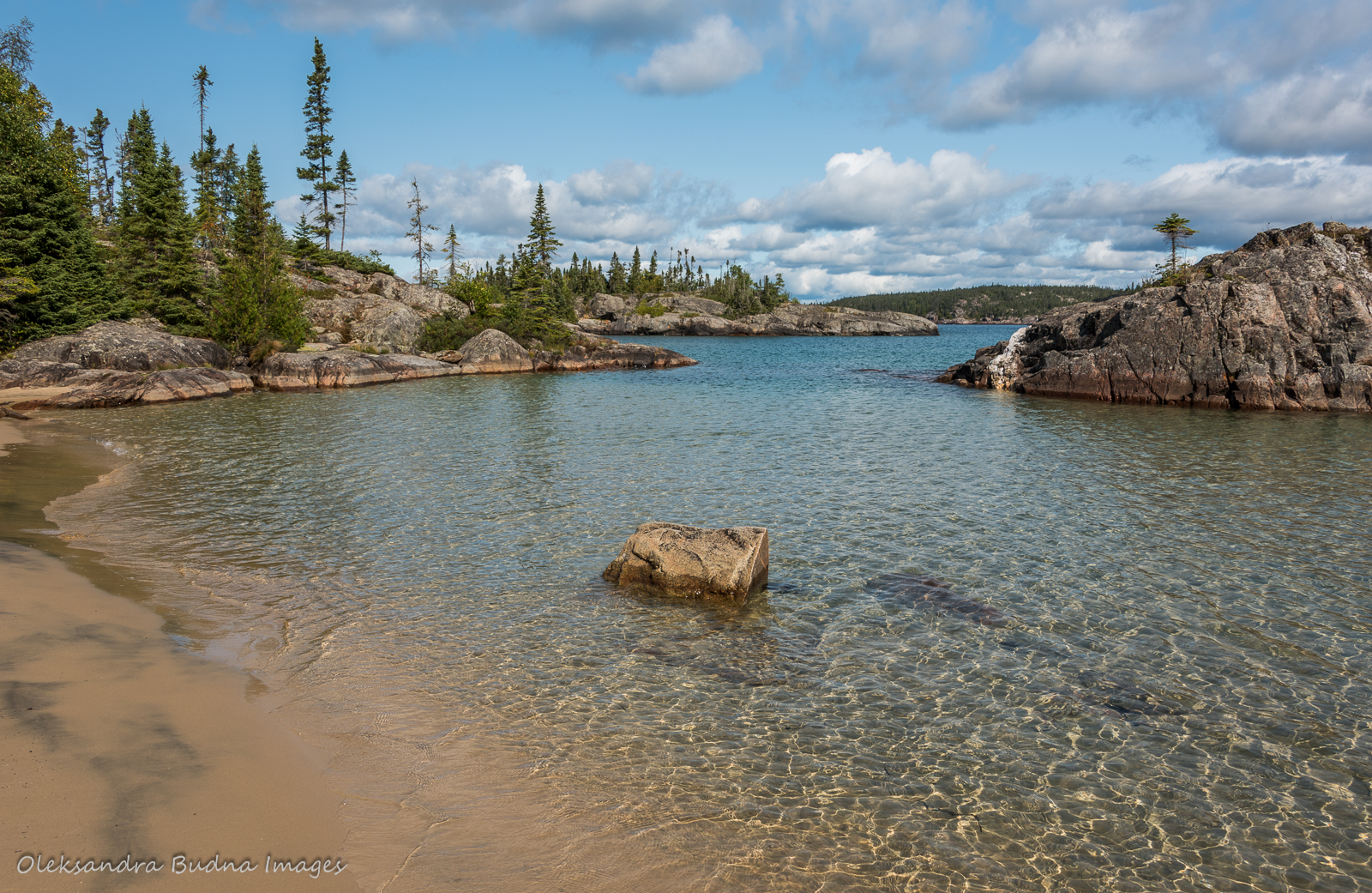
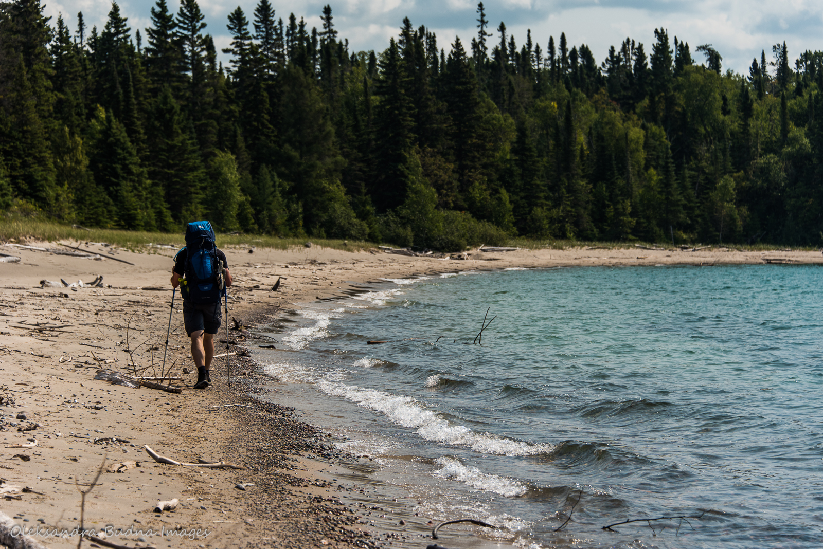
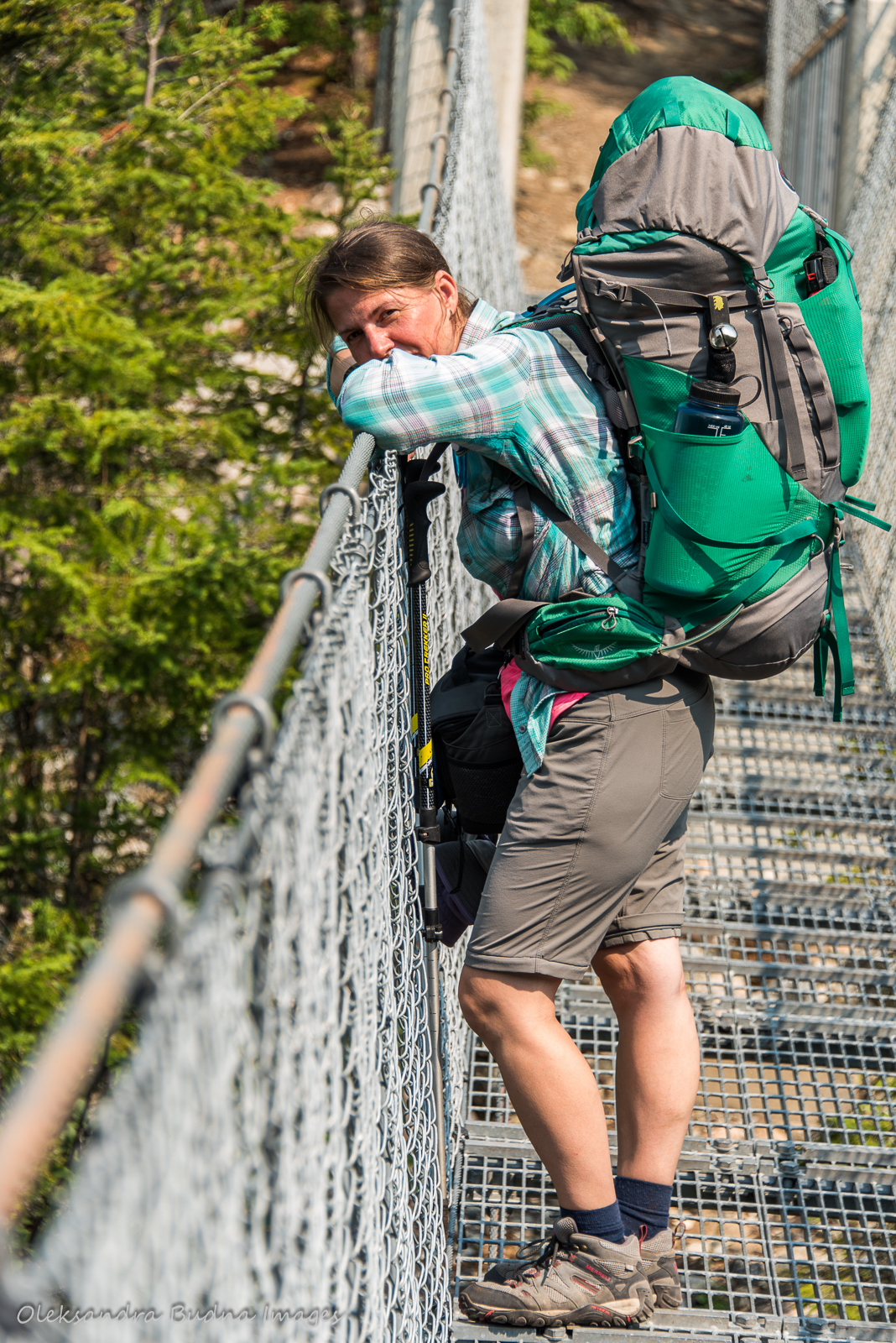
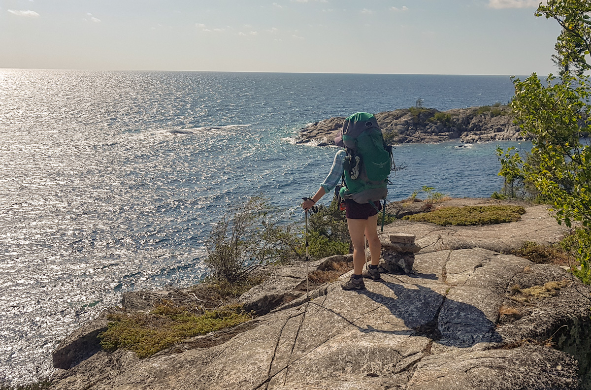
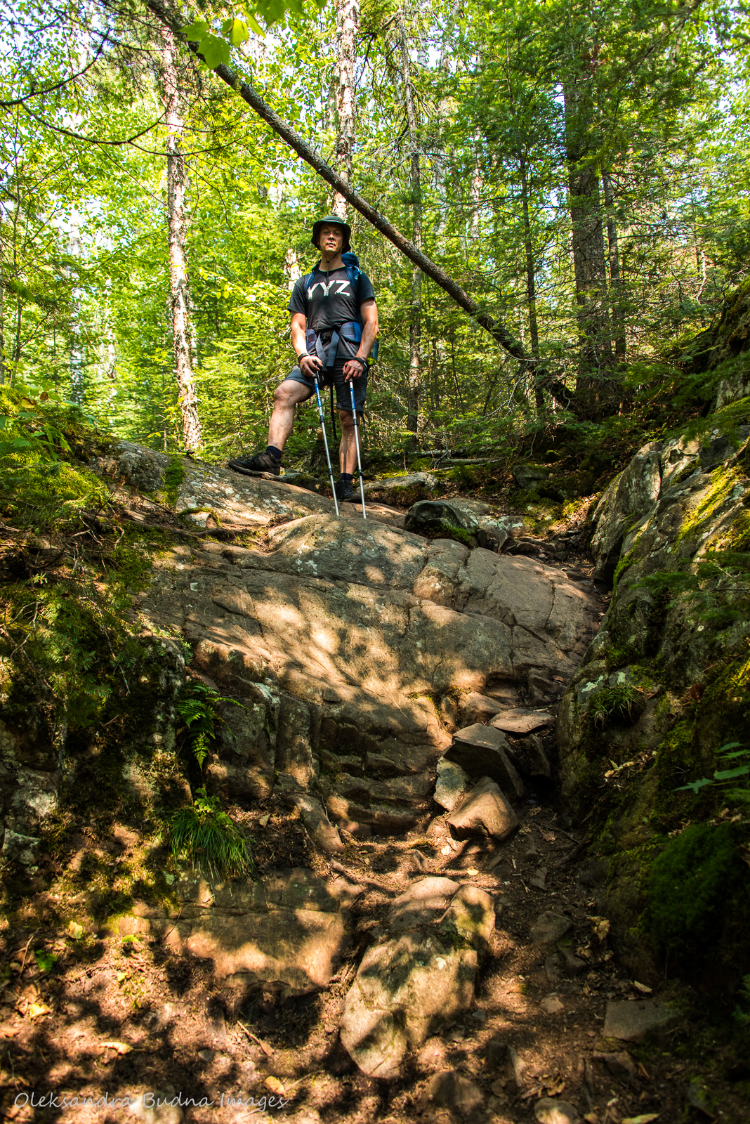
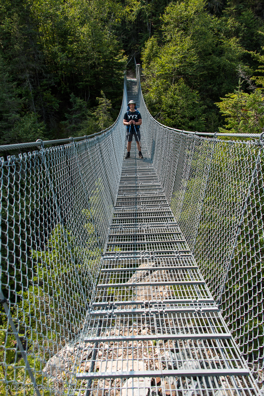
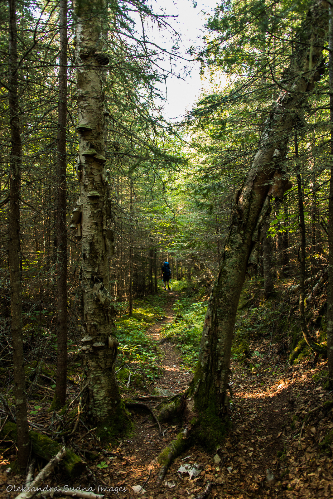
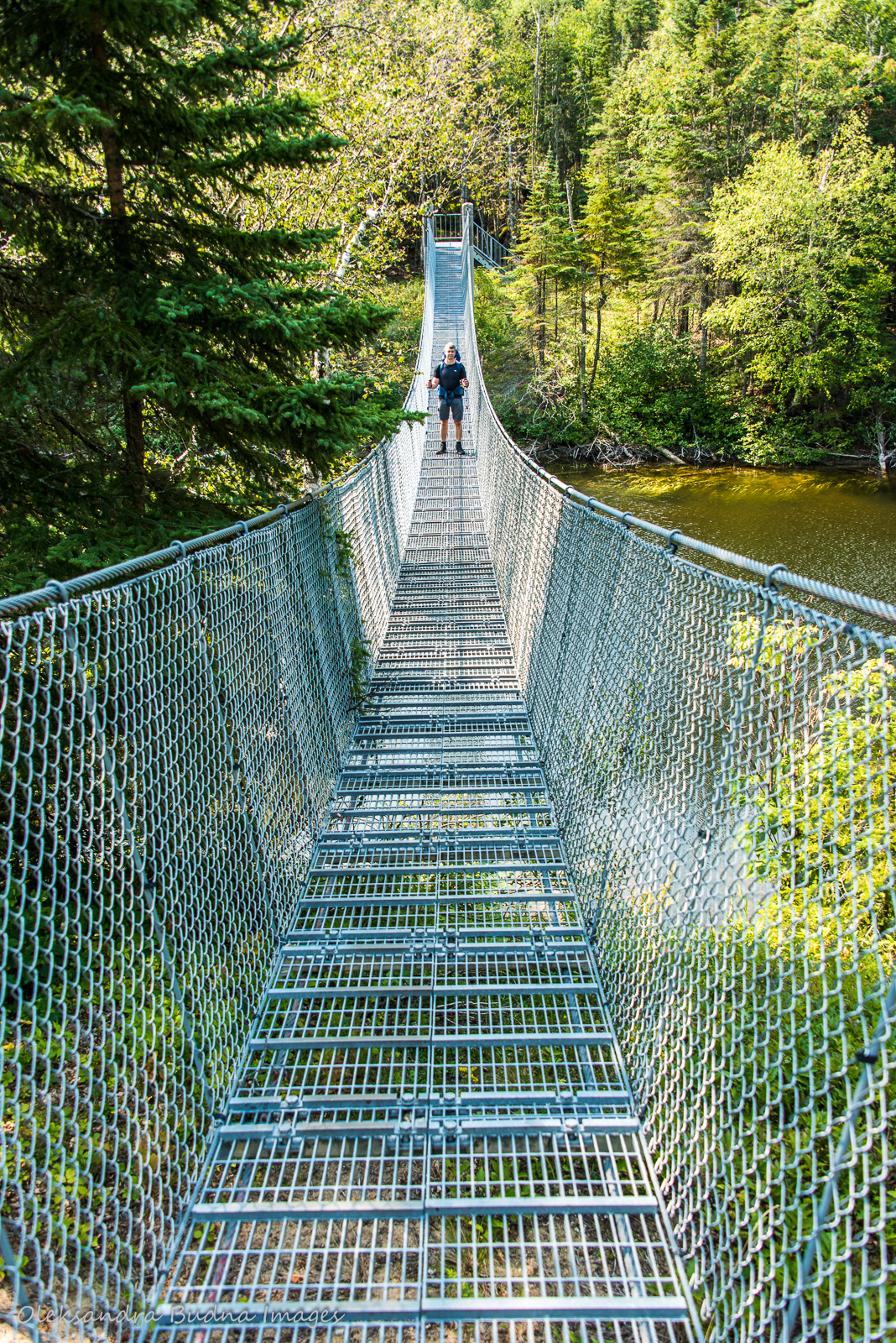
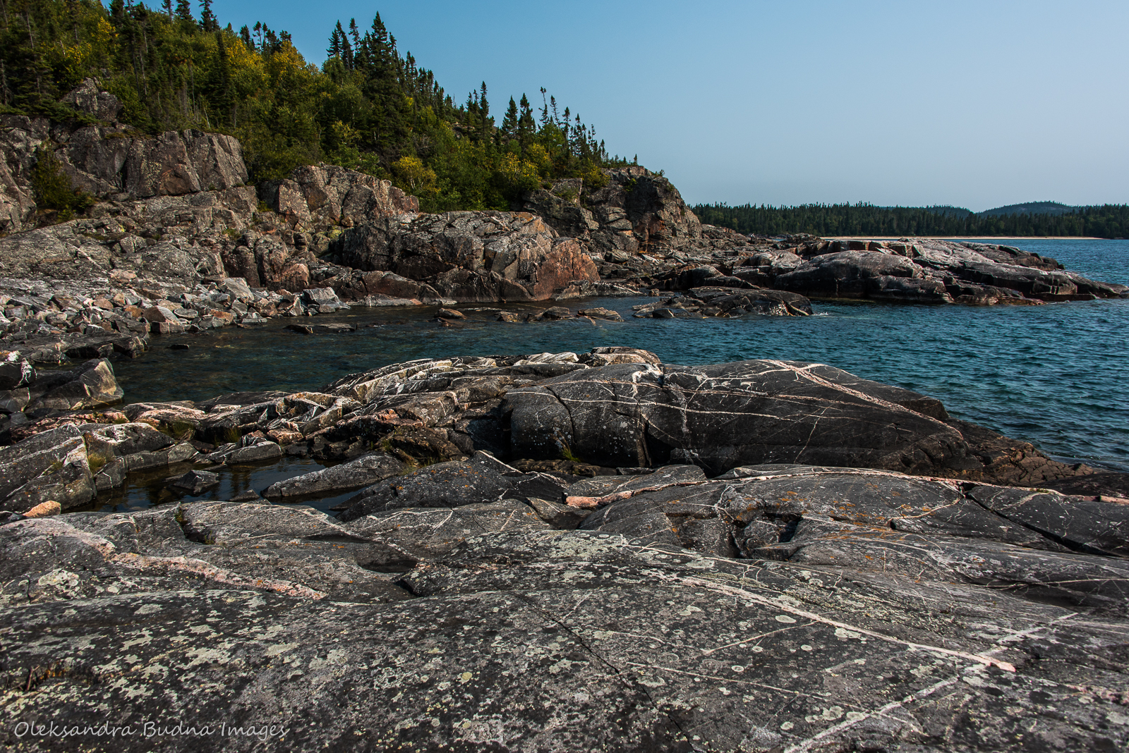
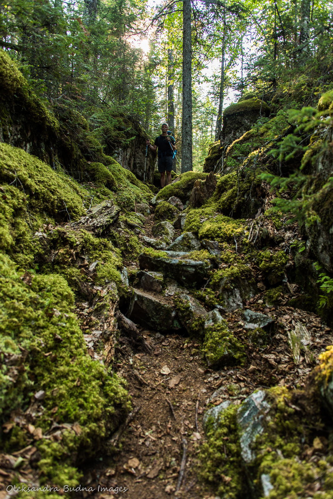
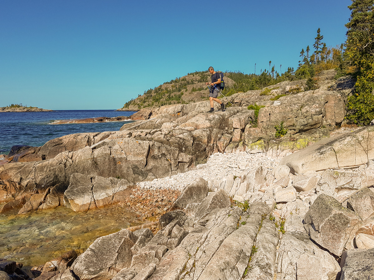
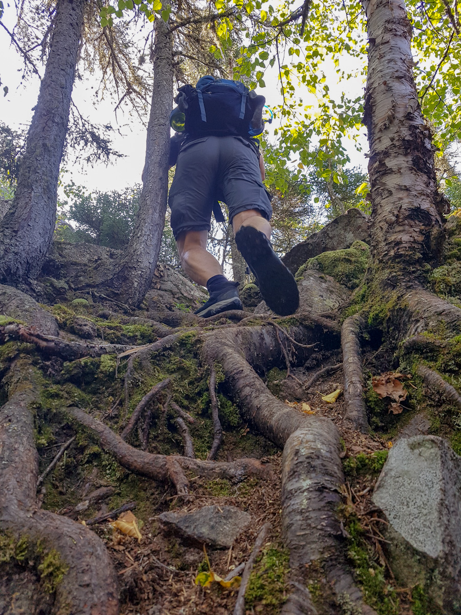
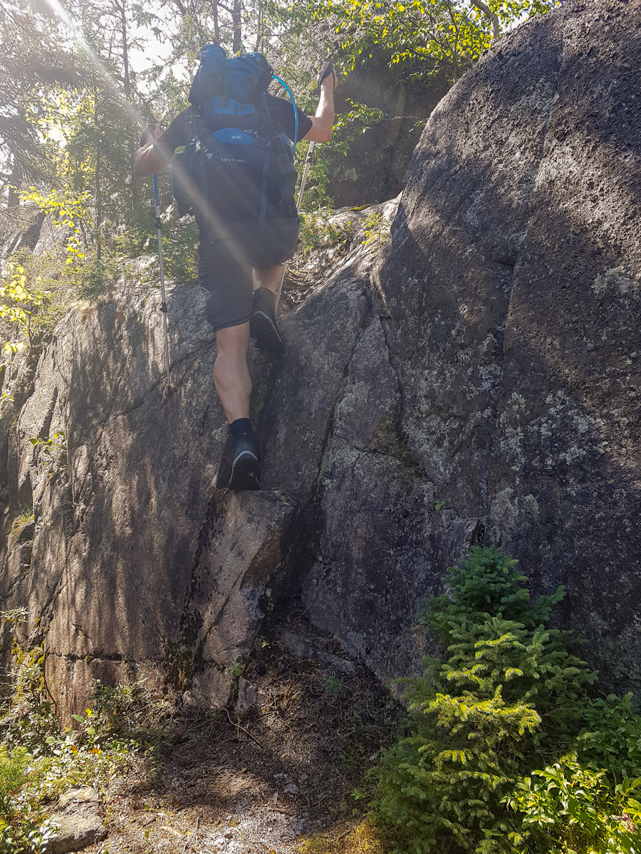
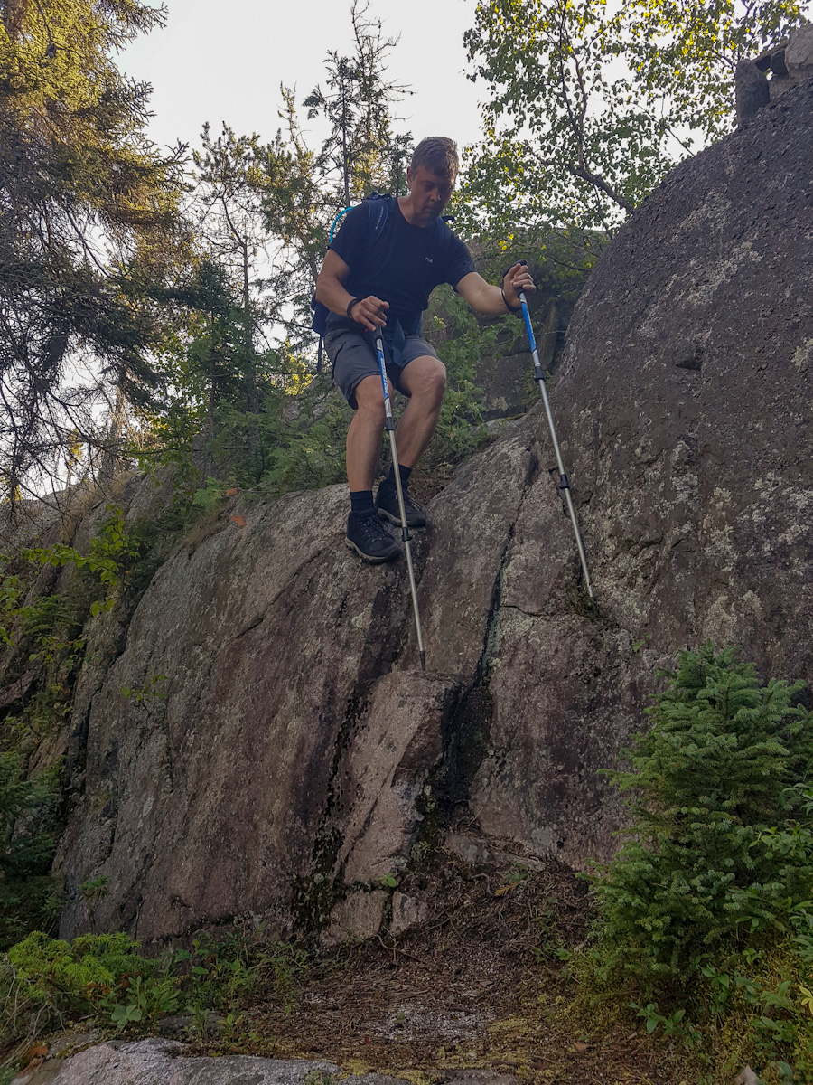
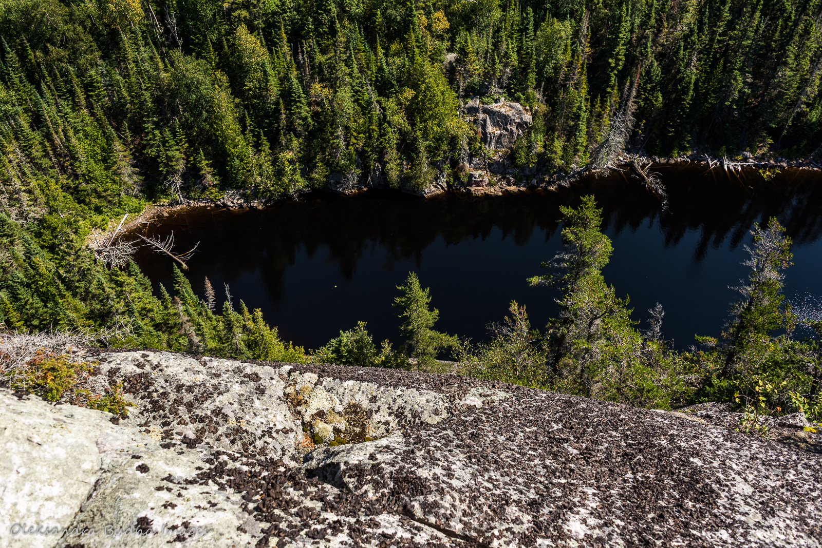
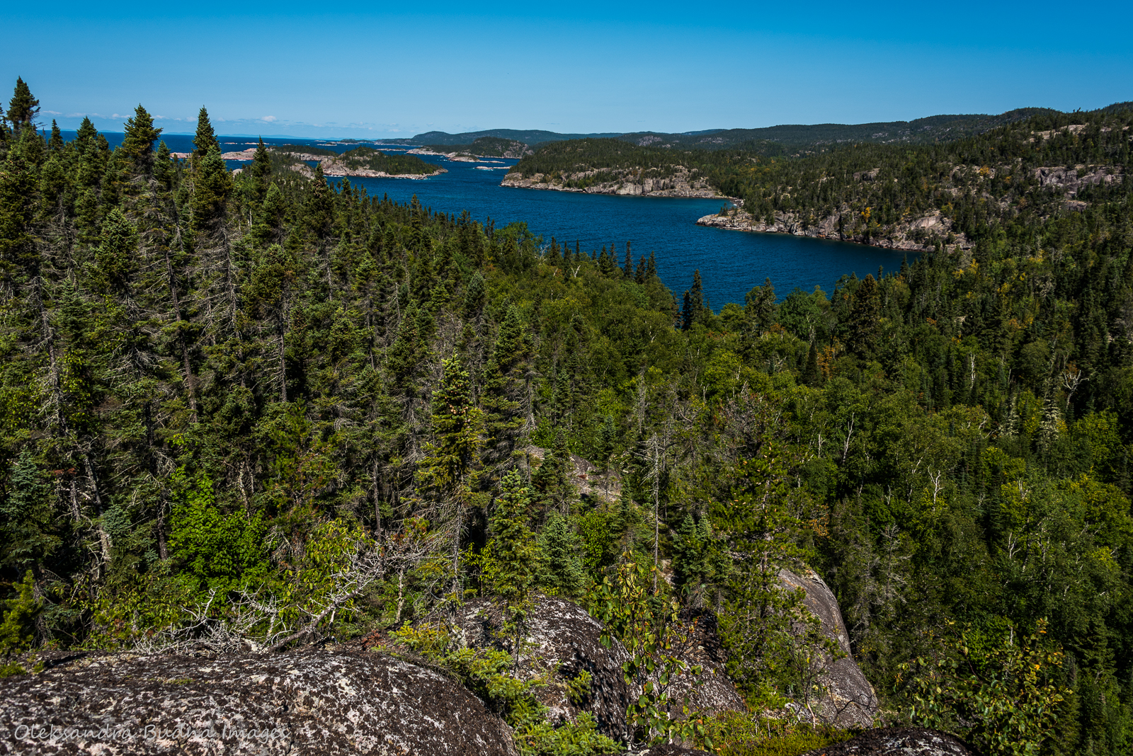
Pukaskwa National Park is located at the edge of Gi chi Gamiing, the world’s largest freshwater lake by surface area, on the traditional territory of Anishinaabe people who have been living here since time immemorial and have deep connections to this land. It is the longest undeveloped stretch of the Lake Superior coast. The Coastal Hiking Trail can only be accessed on foot or, in some places, by boat, and, unlike other backpacking trails, it has very few markers to point the way. Except for cairns along its rocky stretches and an occasional yellow bucket or green toy hat to indicate where the trail turns inland, it is an unmarked path that winds through boreal forest, over rushing rivers and meandering streams, across two suspension bridges, along endless sandy beaches, treacherous fields of cobblestones and rugged rocky landscapes. As a ranger explained to us during our orientation session before the Mdaabii Miikna hike last year, “you have to use your trail sense.” After a couple of days on the trail, we start to understand what it means. We learn to read it, recognize where hiking boots have passed before us, even on the rocky surfaces that don’t give away too much information.

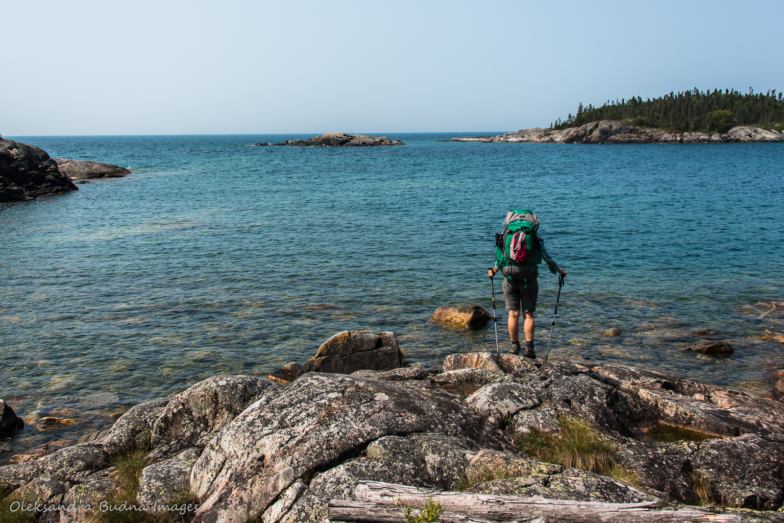
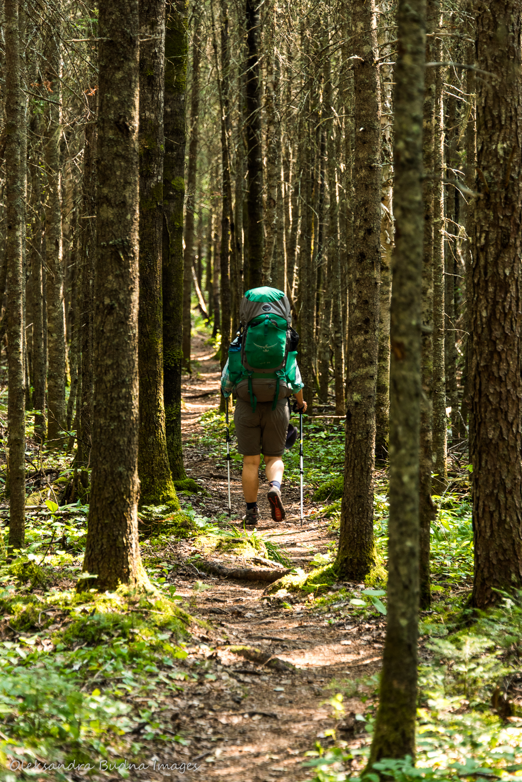


This 60-kilometre, mostly unmarked trail winds through boreal forest, over rushing rivers and meandering streams, across two suspension bridges, along endless sandy beaches, treacherous fields of cobblestones and rugged rocky landscapes.
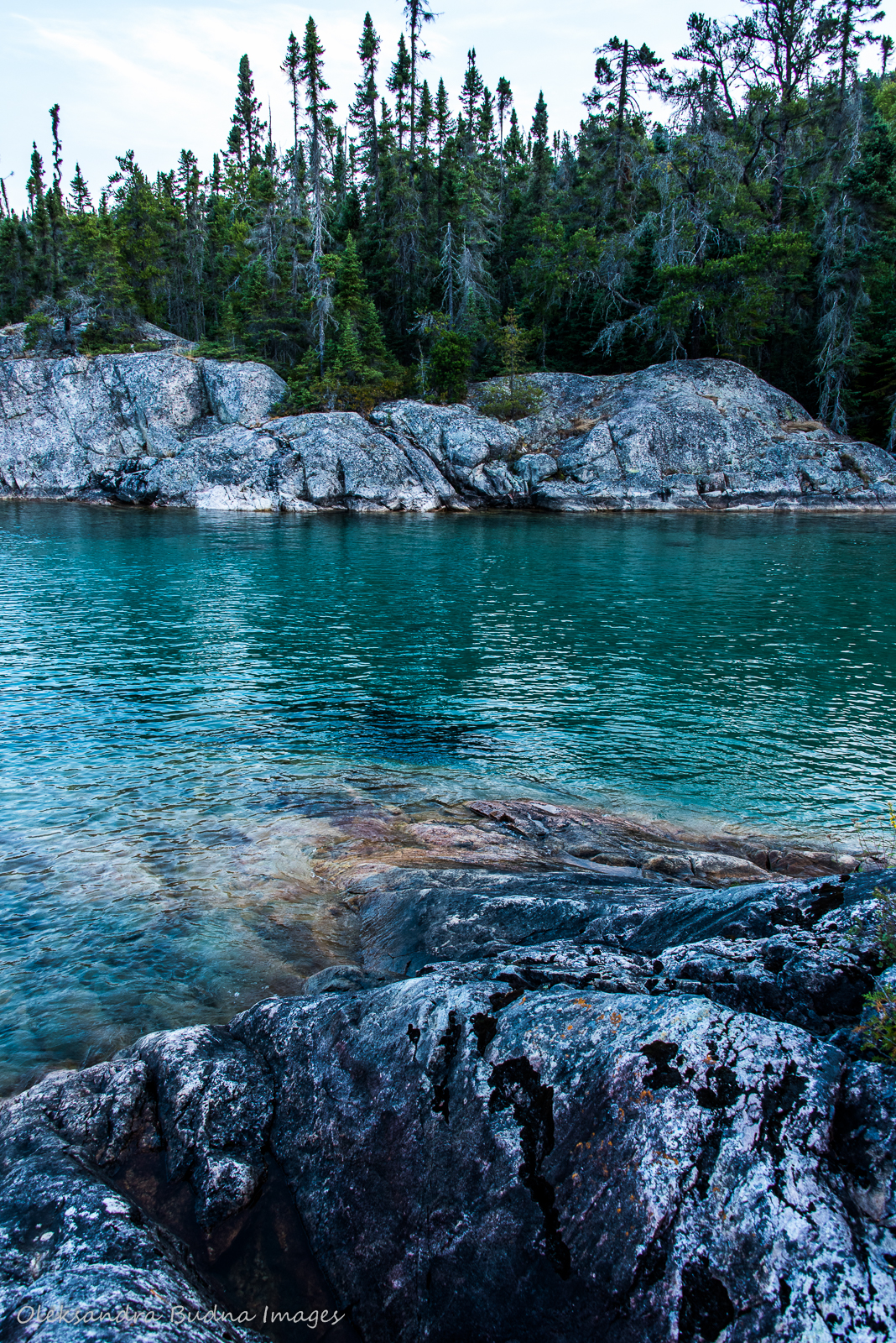
While unmarked, the trail leaves numerous marks on us. After nine days, it is written all over our bodies in scratches, bruises and countless blisters. But its imprint goes much deeper. The wild beauty of Gi chi Gamiing, her ever-changing landscapes, her extreme moodiness and exhilarating fits of rage, the soul-nurturing serenity of early mornings and epic sunsets – by the end they are all engrained into every fibre of our beings.
It takes some time to adjust but after a couple of days I lose myself in the rhythm of the trail; our pace changes daily depending on the difficulty of the terrain and severity of our blisters. As I walk, I collect words scattered along the trail, hidden under rocks, caught between tree branches and roots. I stash them in my pockets for later so I can string them together like necklaces or press between pages like leaves and flowers.


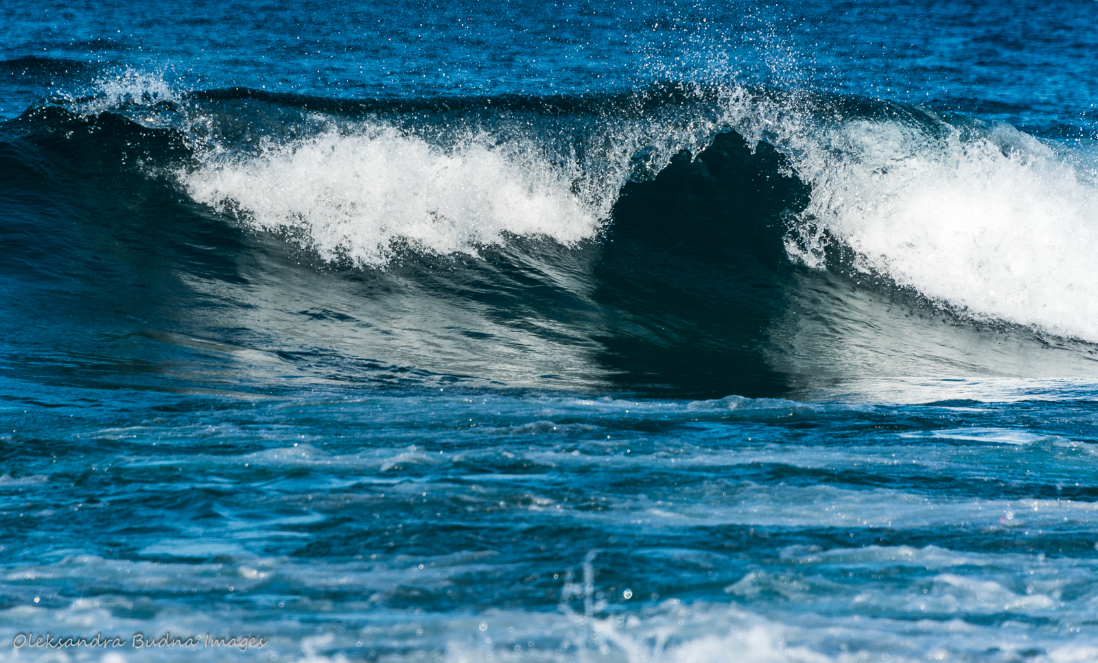

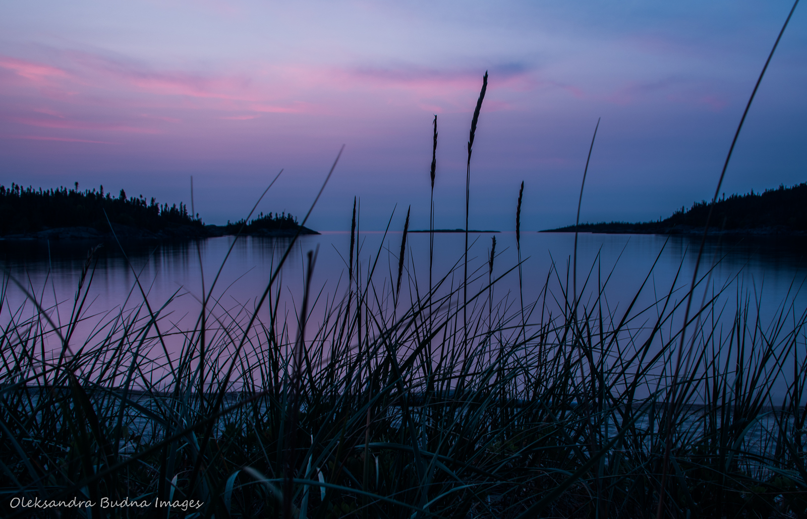


After nine days on the trail, the wild beauty of Gi chi Gamiing, her ever-changing landscapes, her extreme moodiness and exhilarating fits of rage, the soul-nurturing serenity of early mornings and epic sunsets are deeply engrained into every fibre of our beings.
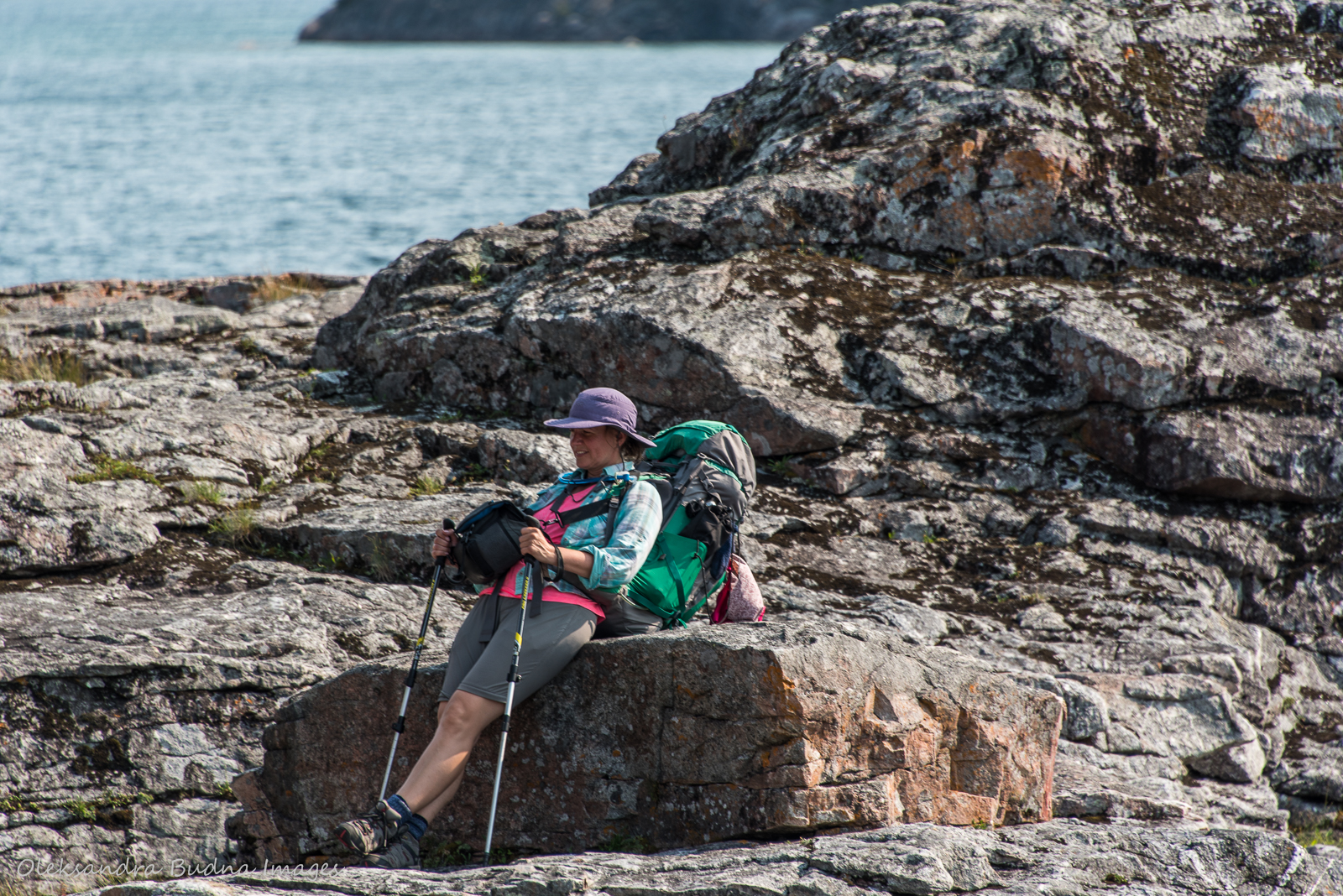
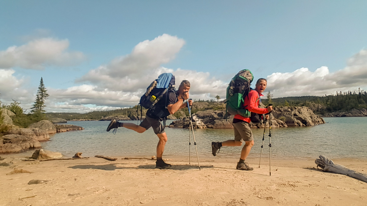
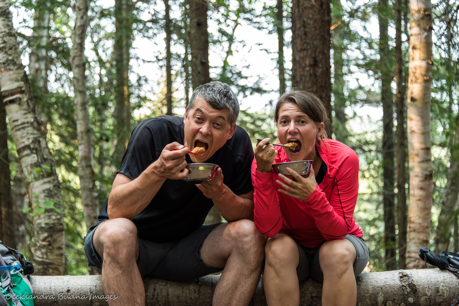
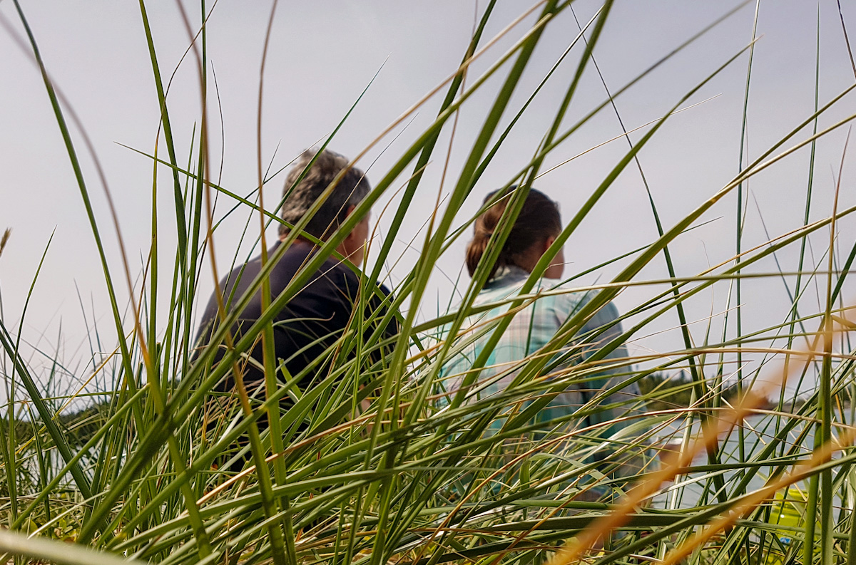
We meet people along the way: groups of friends, couples, extended families, a mother-daughter duo, a woman travelling alone with her two dogs, even a solo kayaker making his way from Silver Islet near Thunder Bay all the way to Sault Ste. Marie. We stop to exchange stories and tips, our conversations peppered with “Which site are you coming from?” and “How far are you travelling tonight?”, talks of blisters and best hiking socks, previous hiking experiences and future travel plans. After these conversations, I realize that everyone is hiking their own trail, even if we are all walking along the same path. Not only because we have different starting points, different itineraries, different distance covered each day, but also because we are all driven by our own reasons to don hiking shoes, hitch a backpack on our shoulders and walk for days in a row.
So I start thinking of my own reasons. Of incredible landscapes that few people get to see. The remoteness of this awe-inspiring place where I can completely disconnect and shower my body and soul in Gi chi Gamiing’s cool waters. The simplicity of it all when I can put all my life into a backpack and carry it with me wherever I go.


The trail allows me to disconnect, shower my body and soul in Gi chi Gamiing’s cool waters and lose myself in the world so reverentially grander than our human surroundings.
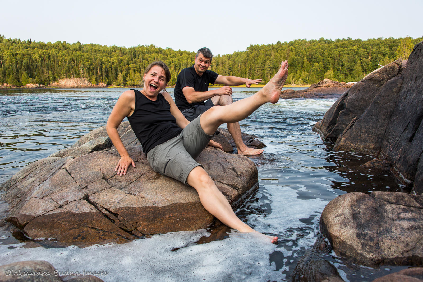
I think of confidence in myself and trust in my hiking partner that I build every step of the way. The intense presence with which I inhabit every moment and the ability to lose myself in the world so reverentially grander than our human surroundings. About the gift of time that the trail grants us: the time to reflect and connect, and the time for silliness and joy.
Most of all, I think about the feeling of freedom. The trail doesn’t expect me to look or behave a certain way, all it asks of me is to walk. Fast or slow, there is no correct pace on the trail – as long as I am putting one foot in front of the other toward my destination, whatever it may be, I am already doing great.


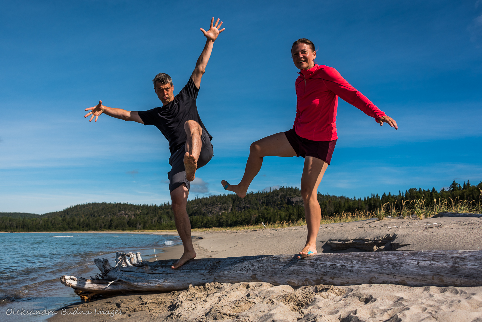


All the time in the world – for reflection, connection, silliness and joy – as well as the feeling of freedom are some of the biggest gifts the trail grants us.
Part II: Prose
Now over to more practical aspects of the trip. Before I go into details of each day, here is some general information. As I already mentioned, the Coastal Hiking Trail is 60 kilometres long. It is linear, meaning if you hike all the way to the end, like we did, you have to come back the same way. That, of course, means more days on the trail, more food, and heavier backpacks. Depending on your time and abilities, you can also hike till any point along the trail and then retrace your steps.
A lot of people choose to get dropped off at the south end at North Swallow River and then hike back to the trailhead. This option comes with drawbacks of its own. For starters, the water taxi isn’t cheap. Plus, if you get Lake Superior on one of its tumultuous days, your boat ride may get cancelled. We met two groups who had to change their plans because of bad weather.
The planning guide recommends 10-14 days to hike the trail both ways. We ended up with nine mainly due to site availability. It was manageable even though we had a couple of pretty long days. If When we do it again, we will definitely take more time. Not only to shorten our daily hikes but also to enjoy the campsites, most of which are spectacular.
One thing to consider is the weather. We were lucky to only get about 30 minutes of rain during the entire trip. In the rain, many sections would have been much more challenging. Still, good weather or not, the trail tested our strength and resilience many times but it couldn’t beat us. I went in fully prepared for muscle pains and aches but in the end it was the blisters that got to me the most. Other than that, my body welcomed all the activity – reminding me every day that humans are designed to move, something we often forget, especially after being homebound over the past year.
Day 1: Hattie Cove (Bii to bii gong, which means “water between two rocks”) to Hook Falls
Distance: 8.8 km + a 1.5-kilometre detour
Time: 4 hours
This part of the trail is fairly easy. Plus, it was already familiar to us, or at least most of it, since we hiked to Chigaamiwinigum Falls last year. So propelled by our excitement, still fresh and blister-free, we zipped through that part of the trek in one seamless fit. We marvelled at Chigaamiwinigum Falls: water revving through a 30-metre gorge is a truly impressive sight.


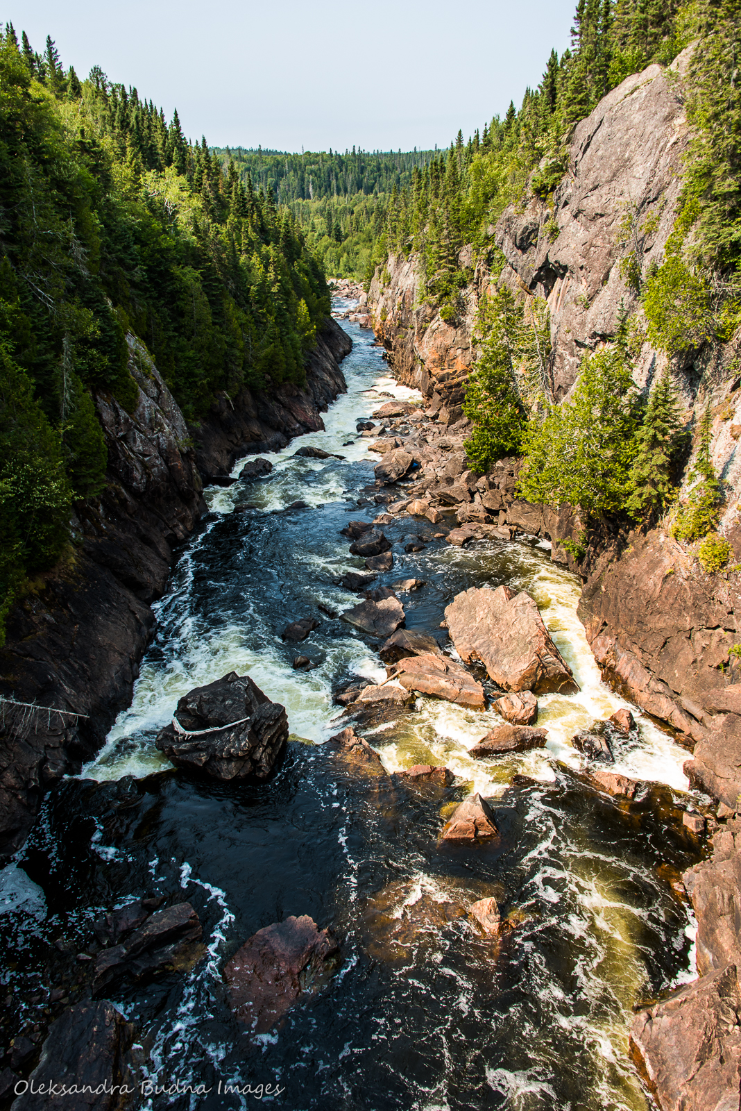
The first stretch of the trail was easy; Chigaamiwinigum Falls were definitely the highlight of the day.
After that, it was only a kilometre or so to Hook Falls but somehow that last section felt longer that the rest of the trail that day. Eventually, we got to our campsite – HF3. There isn’t much I can say about it, except that it offered us a spot to pitch our tent. We spent the evening on the rocks down by Hook Falls before retiring for the night.


We spent most of the evening on the rocks by Hook Falls.
Day 2: Hook Falls to Fish Harbour
Distance: 16.6 kilometres
Time: 8.5 hours
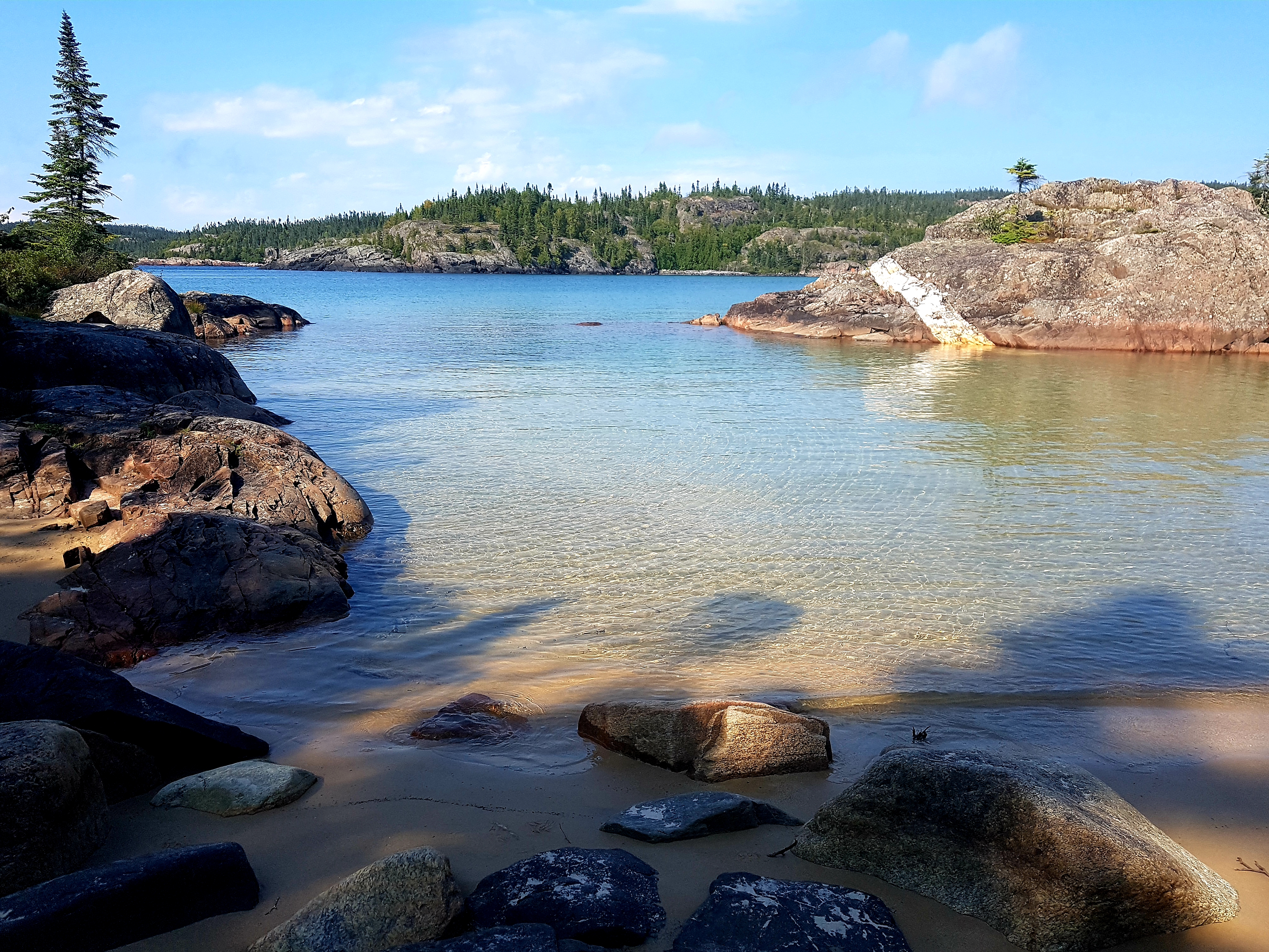
This was our longest trek with backpacks. Initially, we were planning to stop at Morrison Harbour (Miziinack onigiigan) but then during booking switched to Fish Harbour. That added another three kilometres to our hike. Once we reached our destination, we knew we’d made the right decision: Fish Harbour is a much nicer spot. In fact, the planning guide describes it as a painting right out of an art gallery.
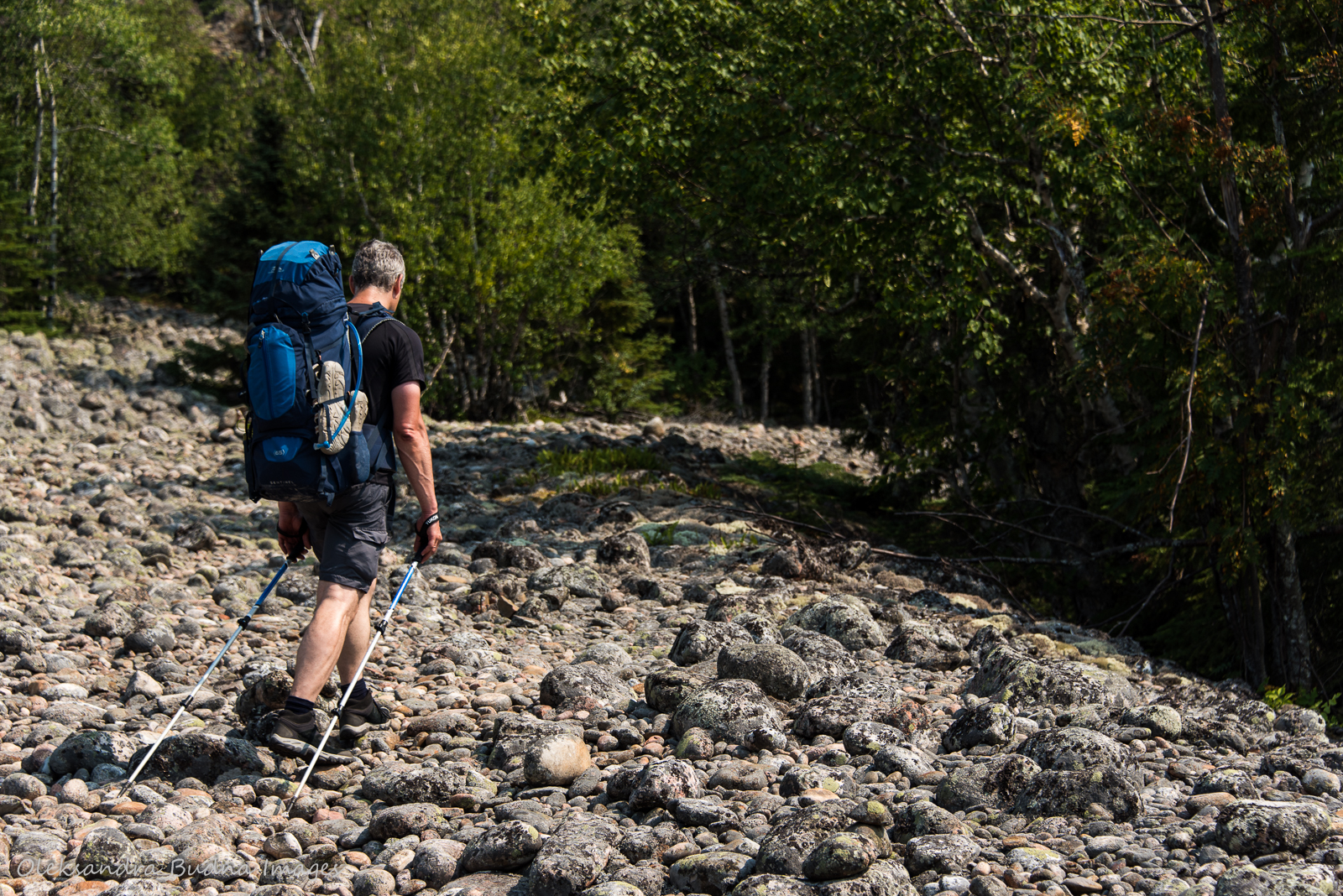
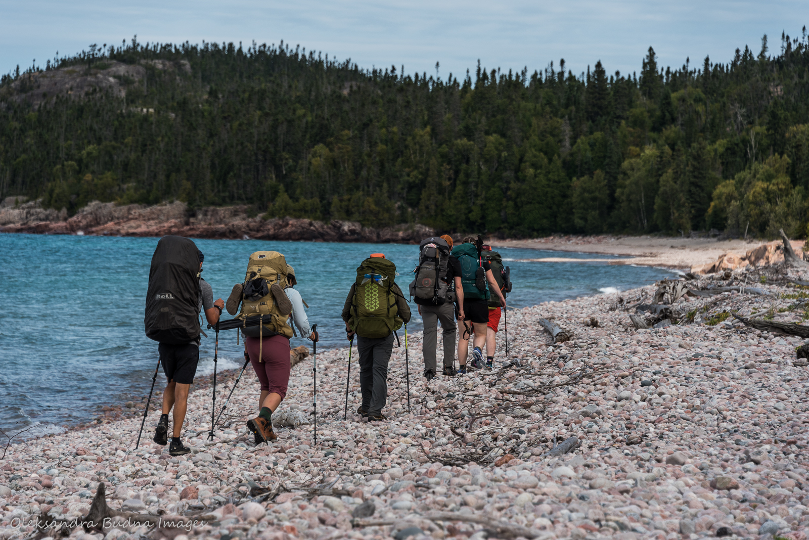
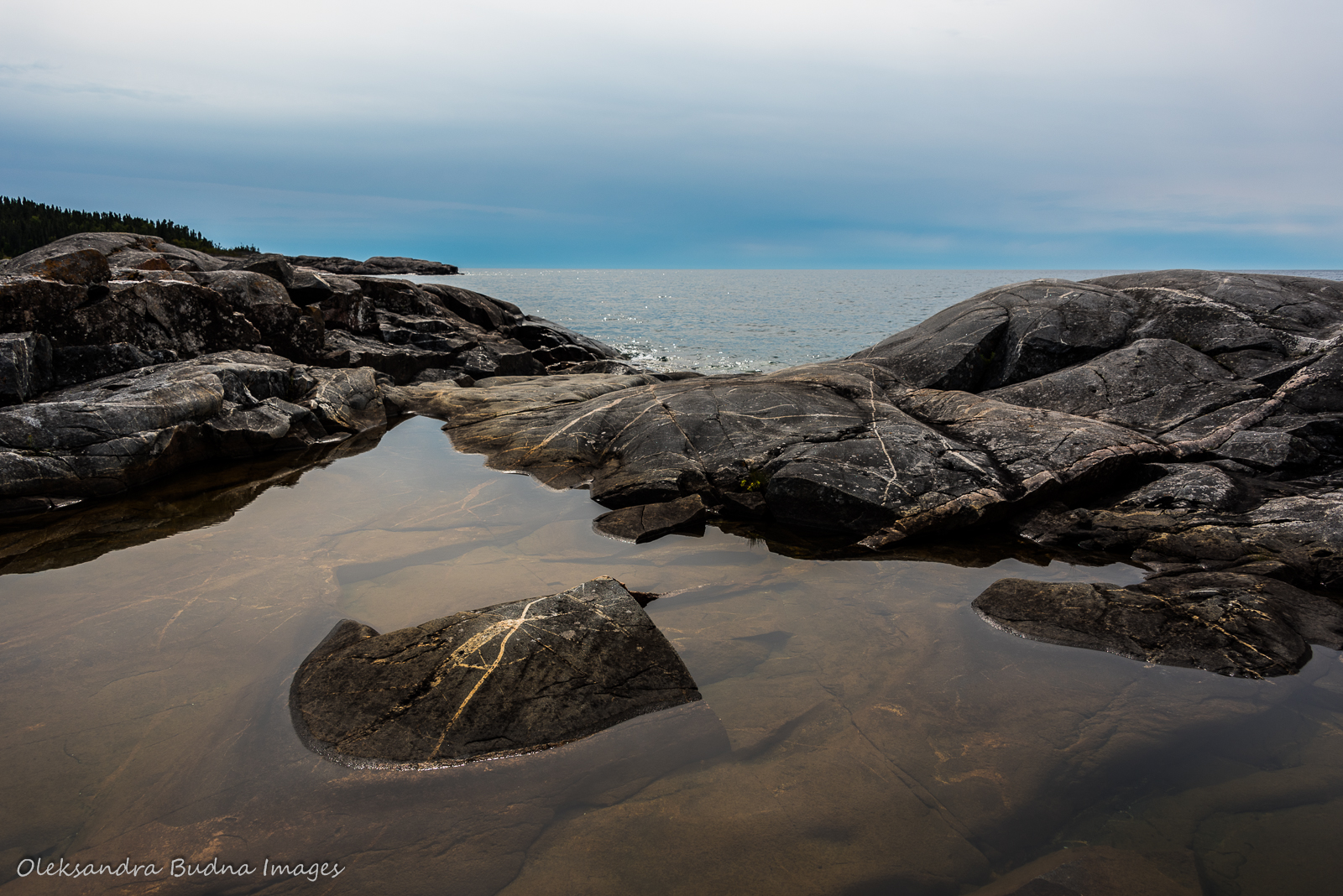
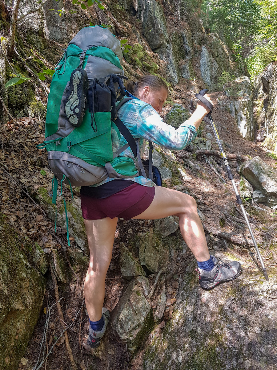
Reaching that location, however, required extra work. Past Willow River, the trail started to get more challenging, sending us up and down but also offering beautiful stretches along the coast. The most dangerous parts were fields of cobblestones that had sprained ankles written all over them.


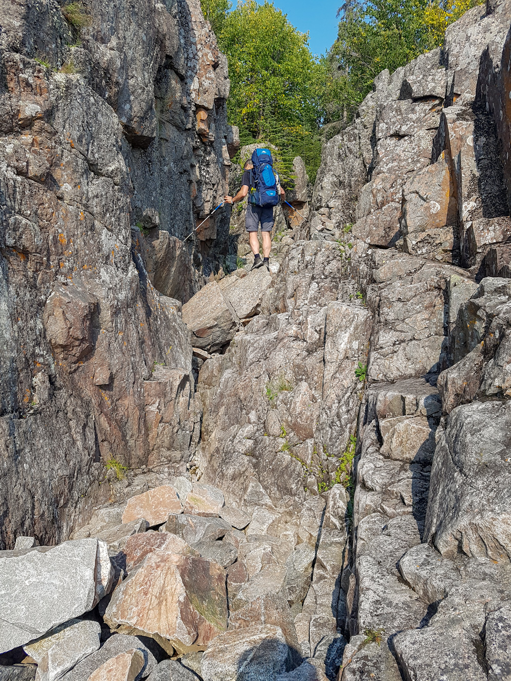

On Day 2, things started to get more exciting; challenge of the day – fields of cobblestones that had sprained ankles written all over them.
Campsites at Fish Harbour are beautiful and the setting is indeed picturesque. The water, however, was on the cold side. And it ended up being the buggiest of all the sites sending us into the tent shortly after the sunset. I guess mosquitoes wanted to make sure we got a good night rest after such a long hike.

Too bad we couldn’t enjoy the pretty Fish Harbour for too long – mosquitoes sent us into the tent right after the sunset.
Day 3: Fish Harbour to Fisherman’s Cove (Ganiimebinewan)
Distance: 12.3 kilometres
Time: 7.5 hours
While we had a shorter distance to cover that day, it took us almost as much time as the day before. That’s because not every kilometre on the trail is created equal. The stretch between Oiseau Bay and Fisherman’s Cove is one of the most challenging, but also most beautiful parts of the trail. Taking more time to scramble over rocks, worsening blisters and a constant desire to stop and take in the views – a combination of these factors slowed us down.


The hike from Oiseau Bay to Fisherman’s Cove was beautiful, even if a little challenging.
At the end of it, we were promised a gorgeous and private campsite since the two sites at Fisherman’s Cove are separated by a rocky peninsula. Imagine our dismay when we arrived to find a group of twentysomethings who’d passed us on the trail earlier setting up tents in the corner of our campsite. We assumed they were just crashing. Plus, the fact that they greeted us with a condescending “You made it” didn’t help. For a bit, we kept glaring at each other until I finally decided to talk to them. Turned out they had a reservation for the other site but didn’t realize it was further down the trail. They retreated to their own campsite; we got our privacy back. Communication does wonders!
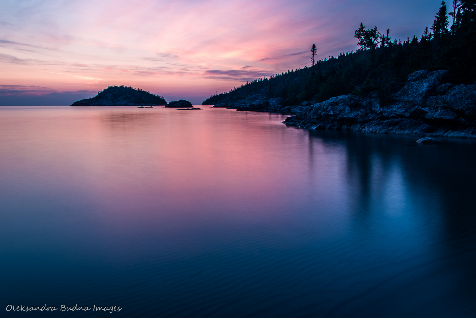
Fisherman’s Cove was my favourite campsite along the entire route: a beautiful sandy beach in a sheltered cove, emerald green and, most importantly, warm waters, jutting rocks, an epic sunset – I just couldn’t get enough of the place.


Fisherman’s Cove with its sheltered sandy beach and emerald green waters was my favourite campsite of the entire trip.
Day 4: Fisherman’s Cove (Ganiimebinewan) to White Gravel River (Gaziinins dongang ziibi)
Distance: 7.1 kilometres
Time: 4.5 hours
Our destination that day was supposed to be Hideaway Lake 17 kilometres away. But after we looked at the map again and at our feet, which were becoming a patchwork of band-aids, we realized it was an ambitious goal and we needed to set our sights somewhere closer.
We chose White Gravel River for two reasons. It has three campsites, unlike the stop after that – White Spruce Harbour (Migizi awatik goonsing), which only has one. Three campsites meant a higher chance that at least one of them would be free. Plus, we had White Gravel River booked for the next night so stopping there would mean we could stay in the same spot.
During the orientation, we were told we had to get to our reserved campsite each night, barring an injury or bad weather. In that case, we could stay on the beach next to another campsite along the way, asking the site occupants first, of course. And yes, we didn’t technically have bad weather or an injury, unless you count blisters, but it was the only time we deviated from our itinerary and we didn’t just crash on someone’s campsite. We sent a message to our kids through Garmin InReach and asked to check if any sites were available. Two of them were, including WGR2, the site we had booked for the night after, so it was meant to be.
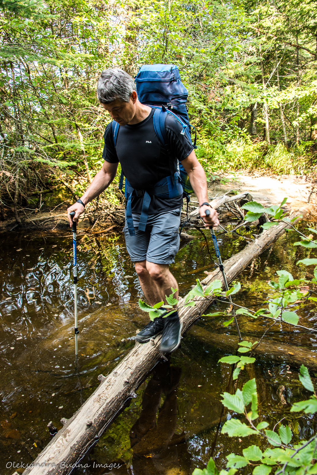
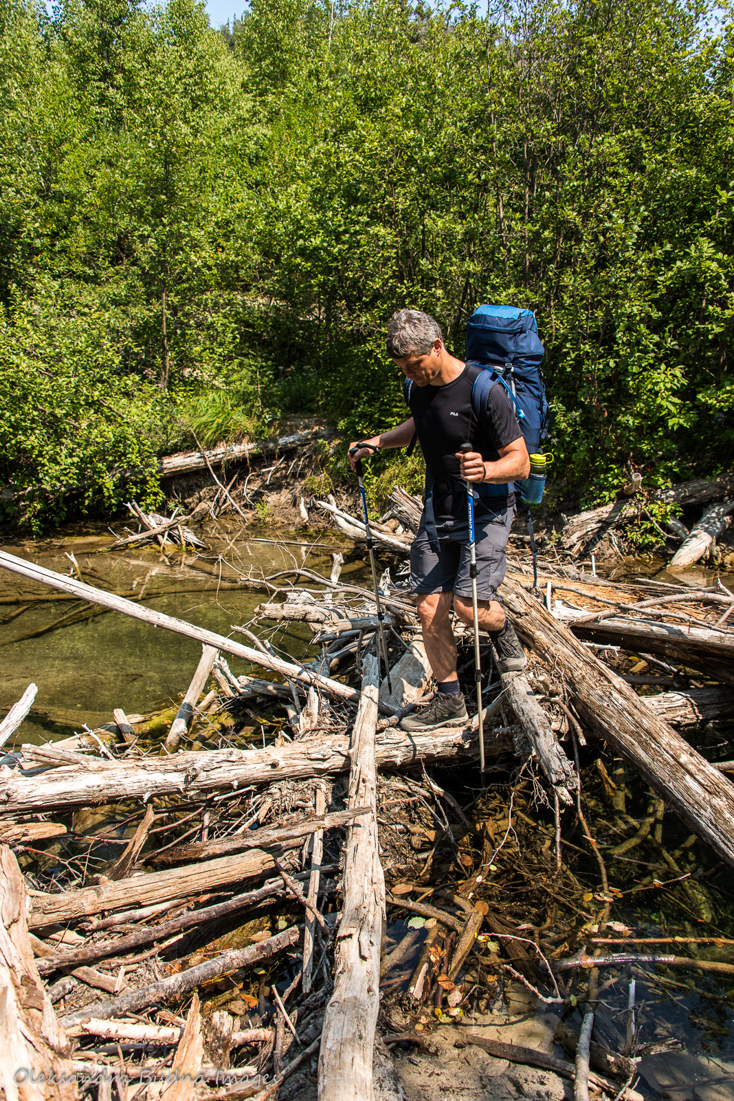
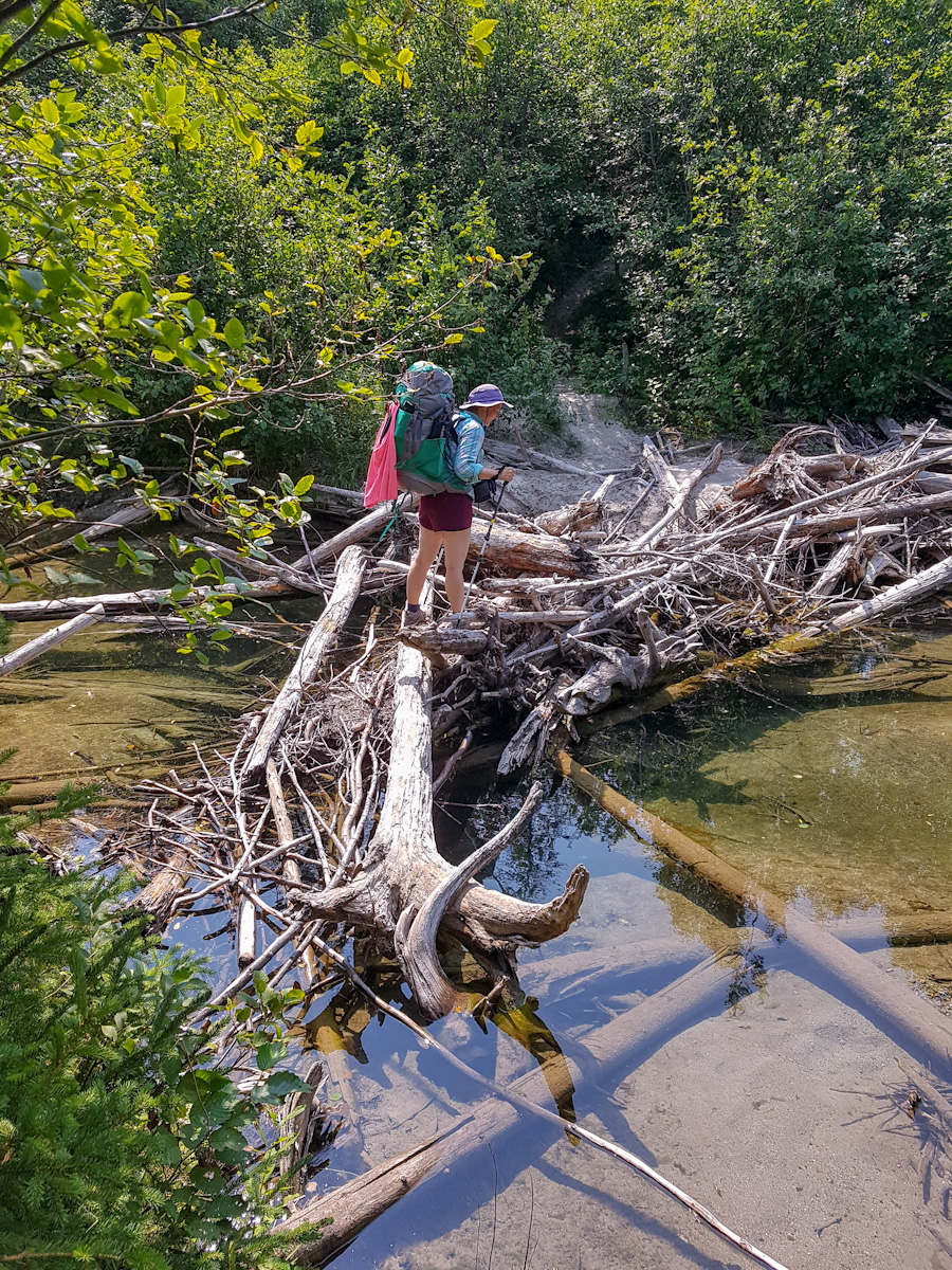
Even though our hike was significantly shorter that day, it still took us over four hours. The section between Fisherman’s Cove and White Gravel River is a steady climb through the woods to the highest point along the trail. Not technically complicated but still time consuming. The biggest obstacles awaited us at the end once we got to White Gravel River. First, we had to cross the above-mentioned river. We didn’t want to get our sandals wet (changing into dry sandals at the end of the day is one of the trail luxuries) so we opted to go barefoot – a slow, not to mention painful, process on gravel and cobblestones. After that, the campsite seemed so close and yet so far away. As we hobbled across the beach, the skies decided to unleash some water. Hard as we tried to walk faster, it was not possible on round and shifting rocks. Stopping for rain jackets seemed counterproductive at this point (we did cover our backpacks to protect the gear) so by the time, we arrived at the campsite, we were soaking wet. By the time we set up our tarp, the rain went: “I was just kidding. I have better things to do.” And just like that it was over. No complaints on our part even if we set up that tarp for nothing.


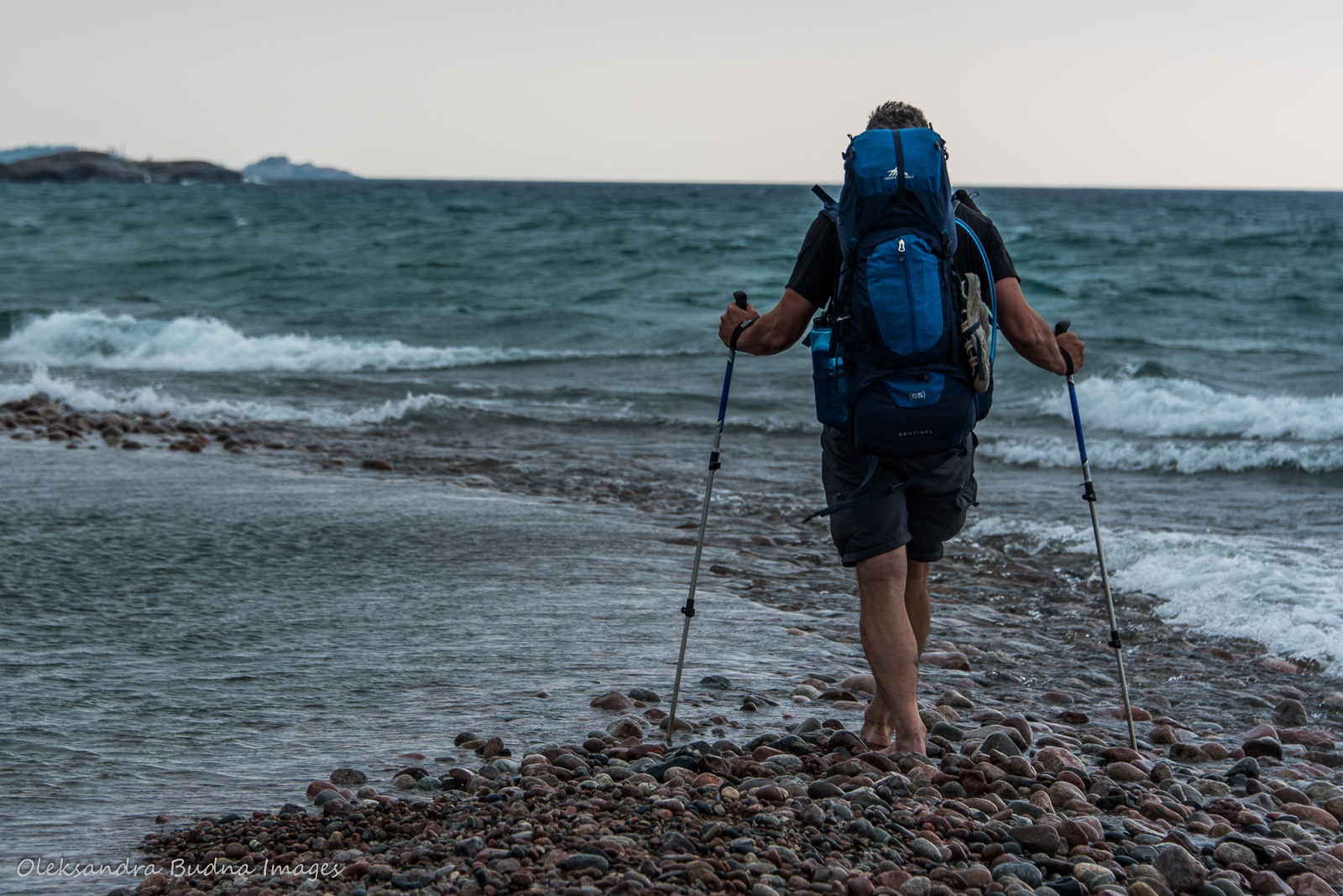
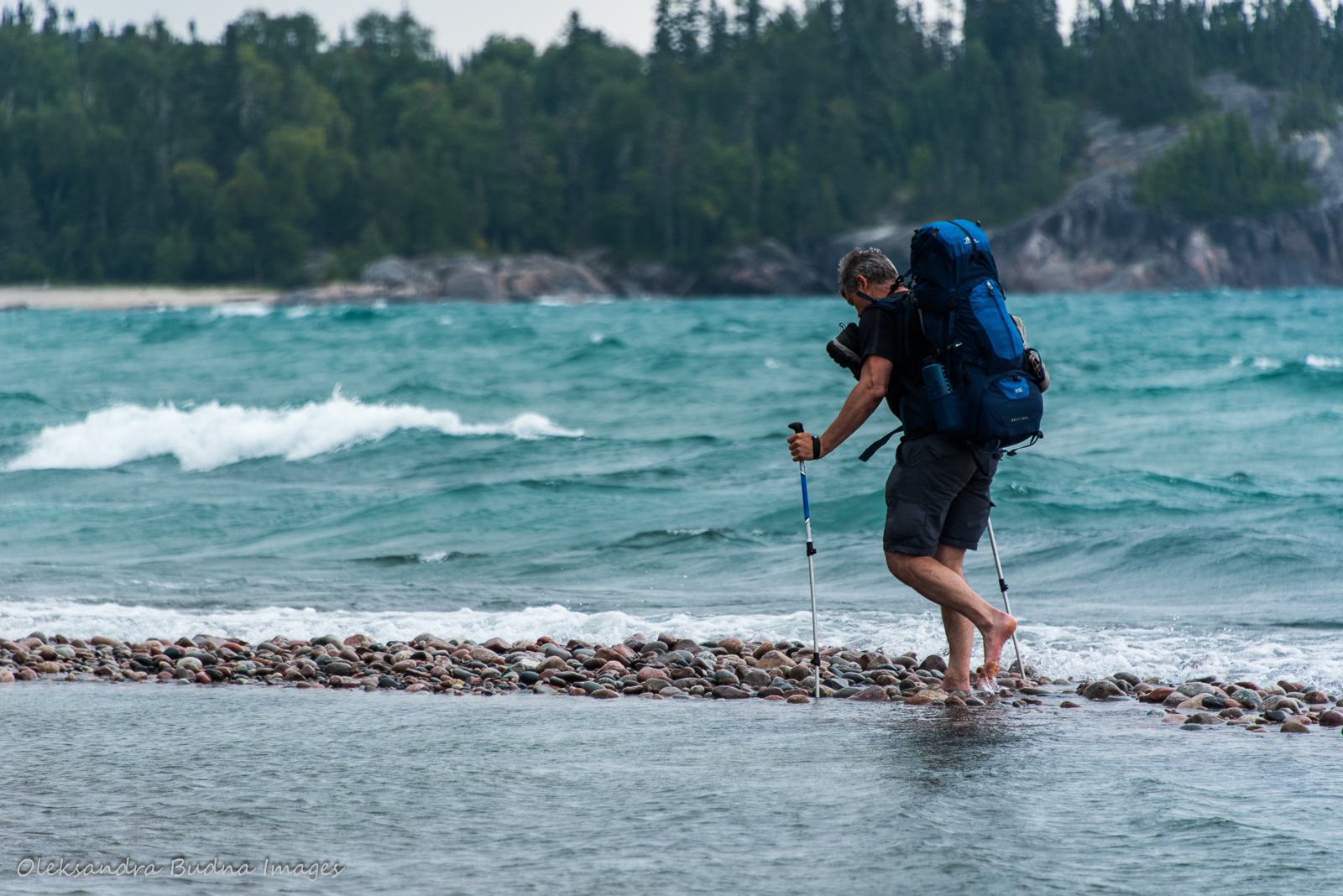
Day 4 featured a hike to the highest point along the trail, a river crossing and a walk across a cobblestone beach.
With the rain gone, we had a lovely evening on the beach. If I had to choose a spot where I could spend two nights, White Gravel River wouldn’t be at the top of my list. There are more beautiful campsites along the trail in sheltered bays with sandy beaches (looking at you, Fisherman’s Cove and White Spruce Harbour). Instead we got cobblestones and a wide open harbour where winds and waves travelled freely, breaking at our feet with ferocious intensity. Yet, Lake Superior’s rage was an invigorating spectacle, not to mention resulted in some great photos. So in the end, I wouldn’t have it any other way.
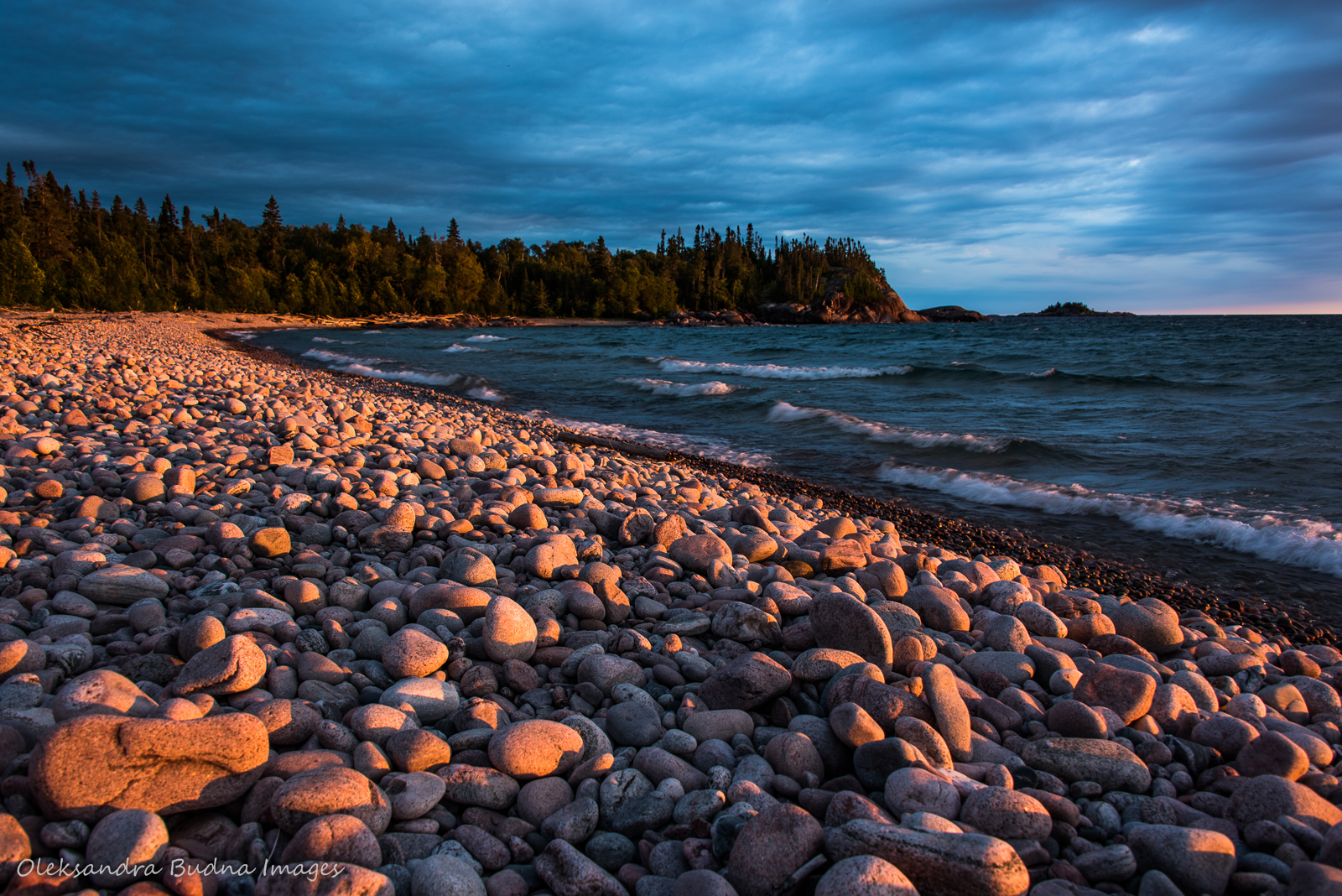


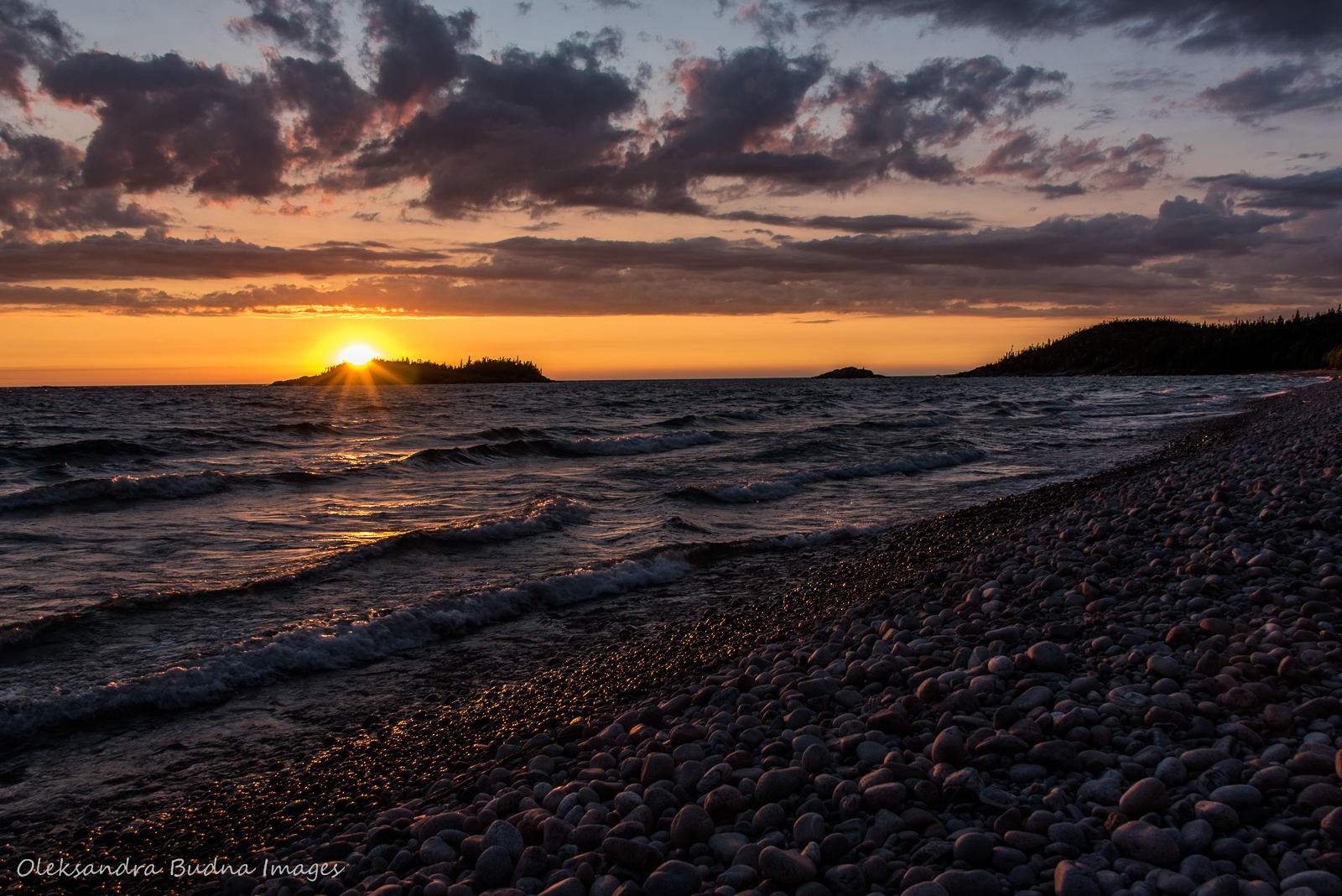
While White Gravel River wasn’t at the top of my favourite campsites list, we spent a relaxing evening there watching a moody Lake Superior and an epic sunset.
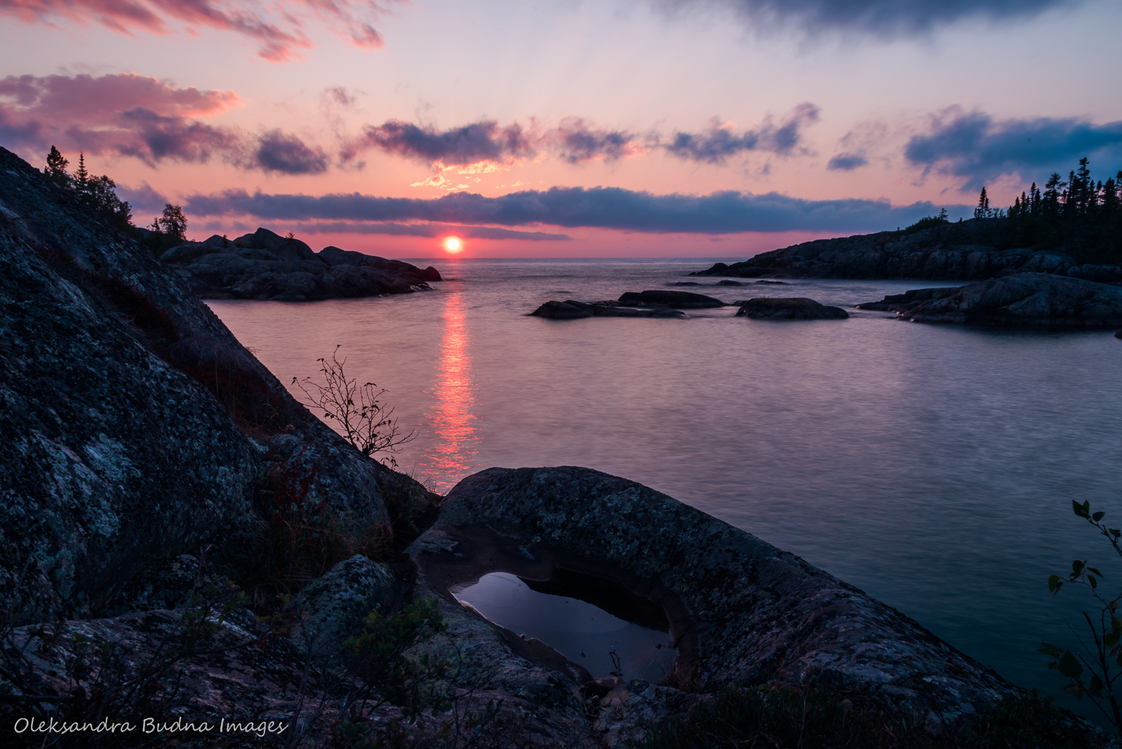
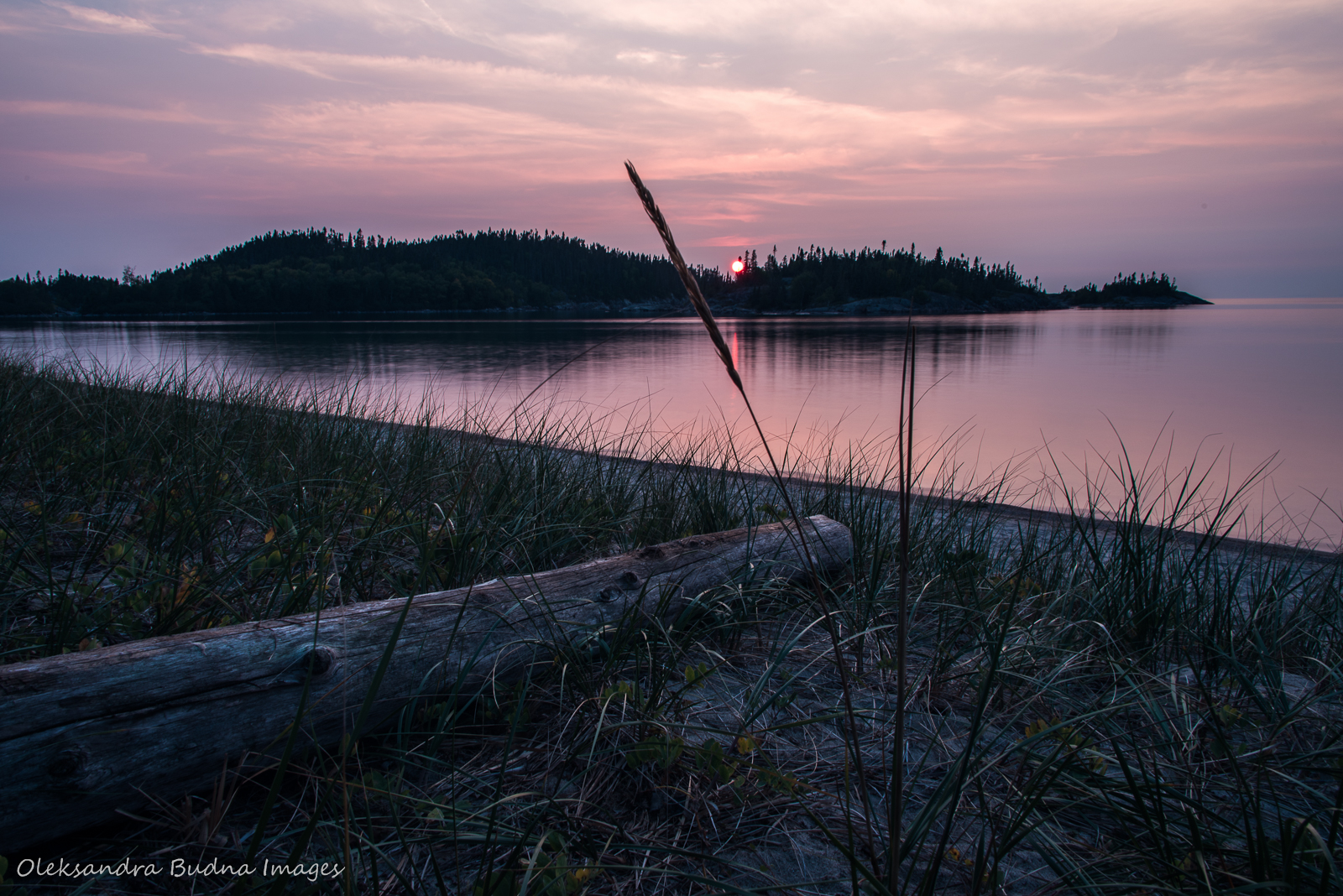
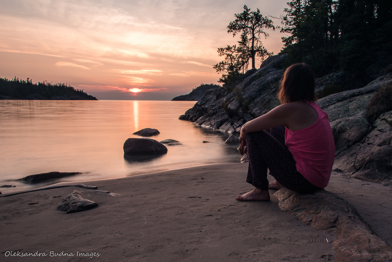
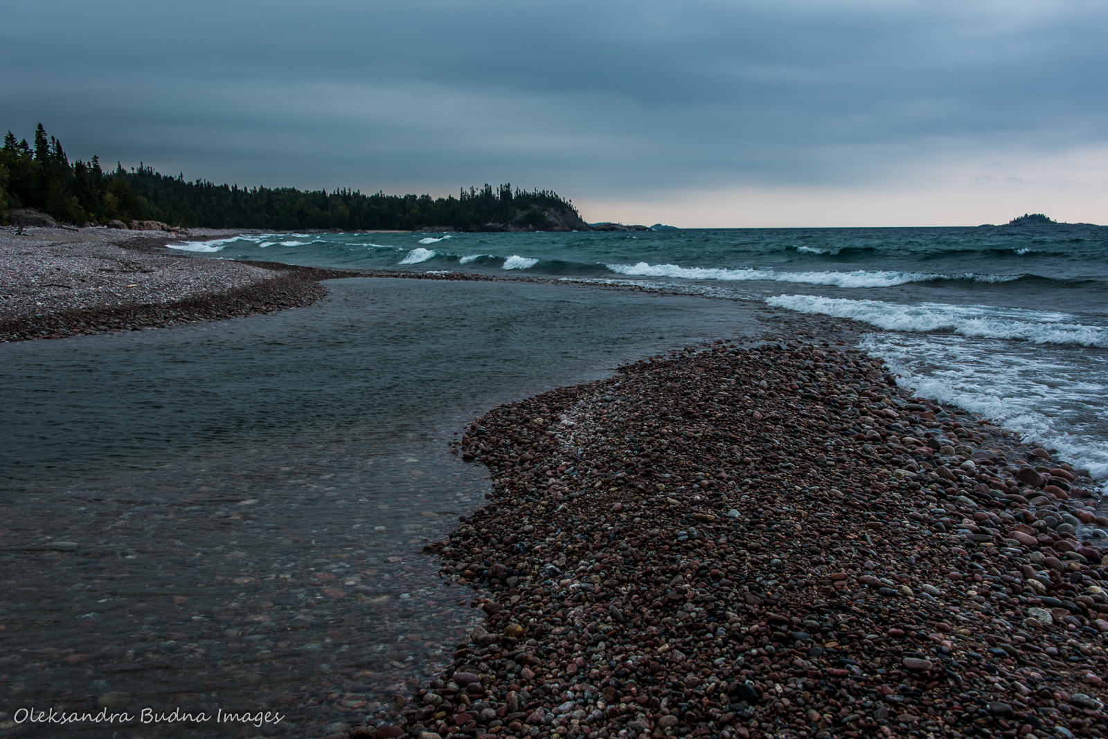
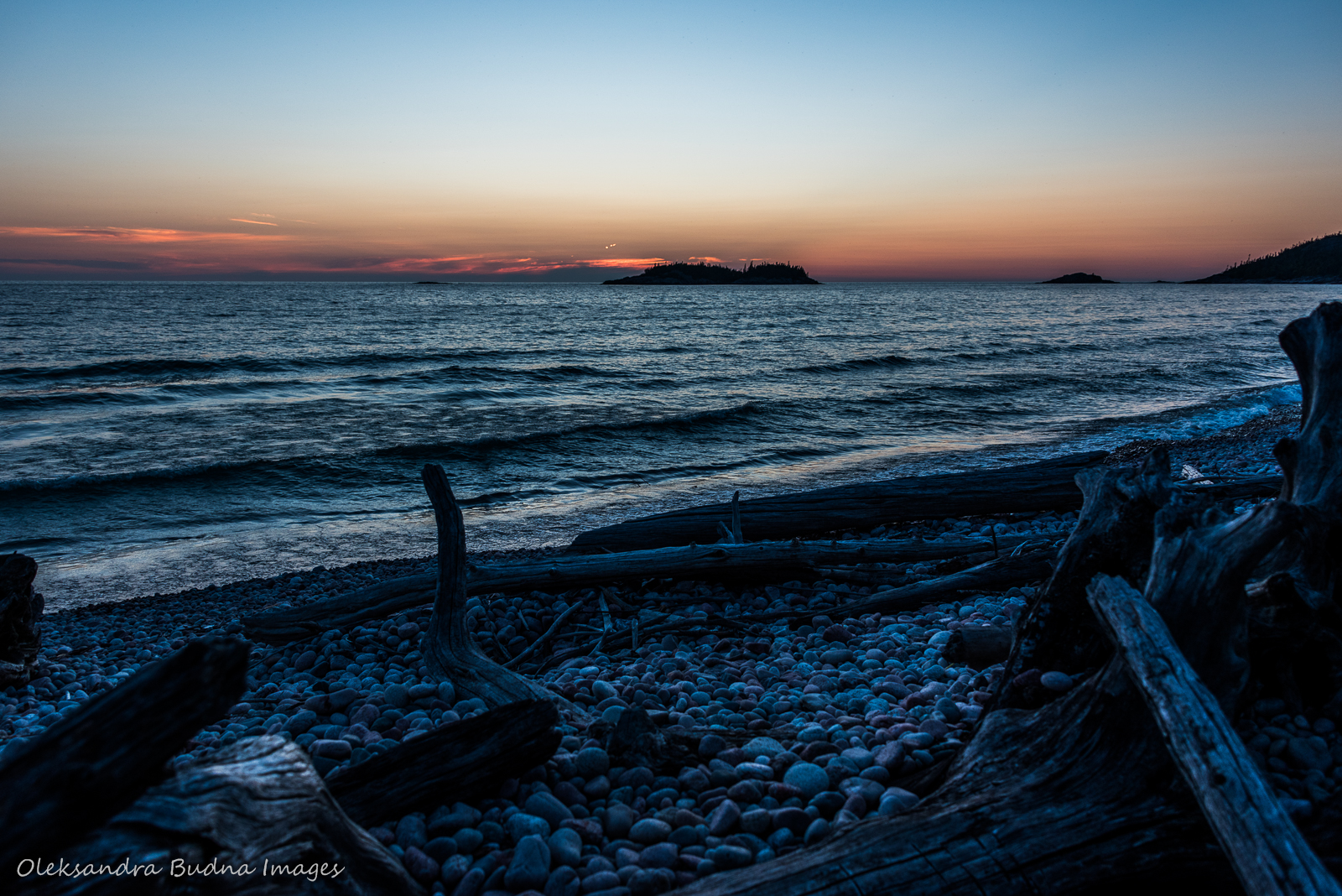
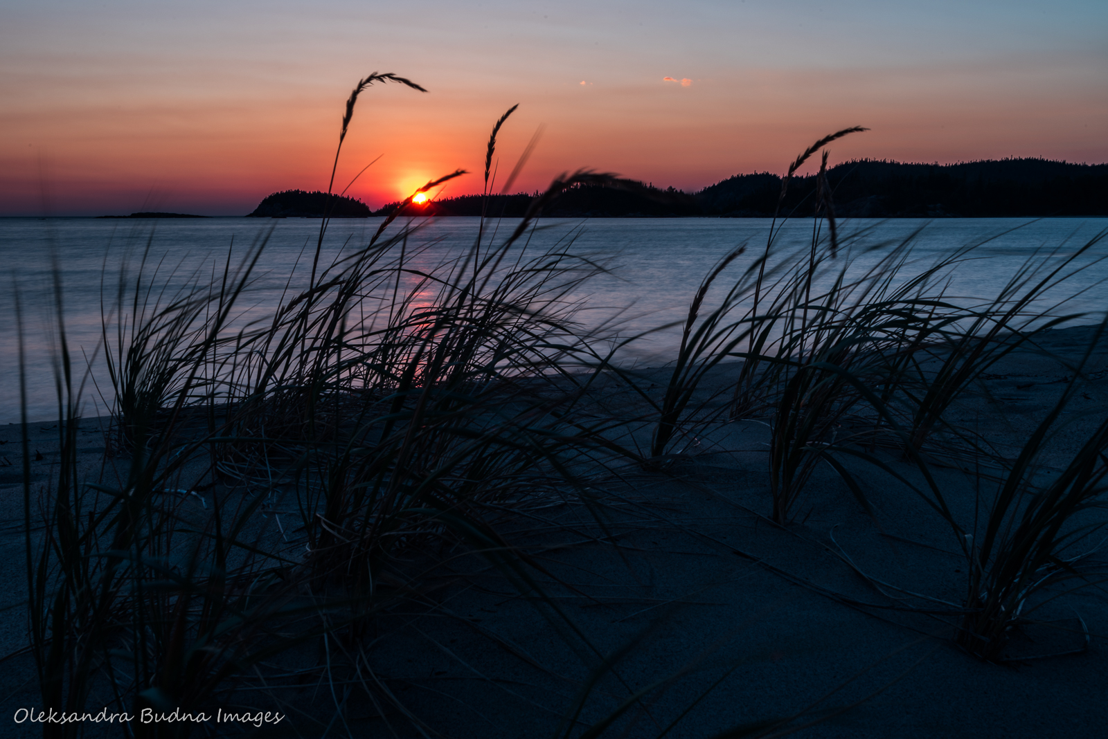
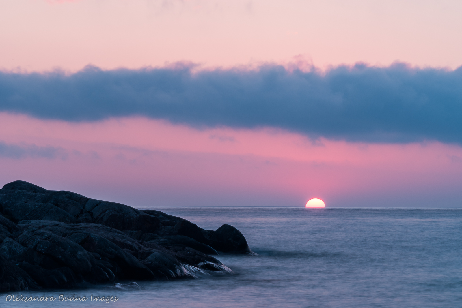
That night, I woke up to a full moon, the kind that turns night into day and leaves shadows on the ground. Gi chi Gamiing was still restless – a moving, living, breathing mass of water, white caps glowing in the moonlight. Mishipeshu, the Great Lynx or Water Panther, who, according to Ojibwe, is responsible for the Lake’s moodiness, was thrashing his tail, throwing wave after wave at the shore in fits of fury, then retrieving them only to strike again with more power. As I stood there watching this spectacle, I couldn’t help but feel enthralled and humbled by the power of this magnificent Lake.
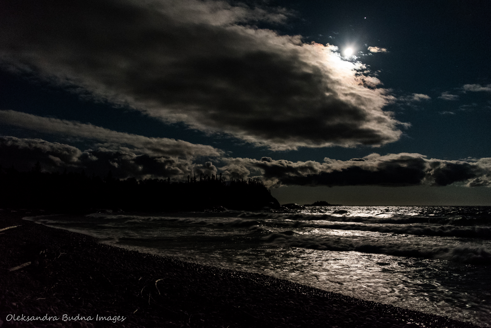
Gi chi Gamiing in the moonlight was one of the most memorable and humbling moments of the entire trip.
Day 5: White Gravel River (Gaziinins dongang ziibi) to North Swallow River (Giiwednong zhaashawinibiis wi ziibi) and back
Distance: 28 kilometres
Time: 11 hours
Now that we didn’t have to move camp, we decided to spend the day hiking the rest of the trail. The distance from White Gravel River to the trail end is 14 kilometres. Even if we didn’t have to lug our heavy backpacks, it still meant 28 kilometres to cover in a day. We decided not to let that number intimidate us and just go. We could turn back at any point, after all.
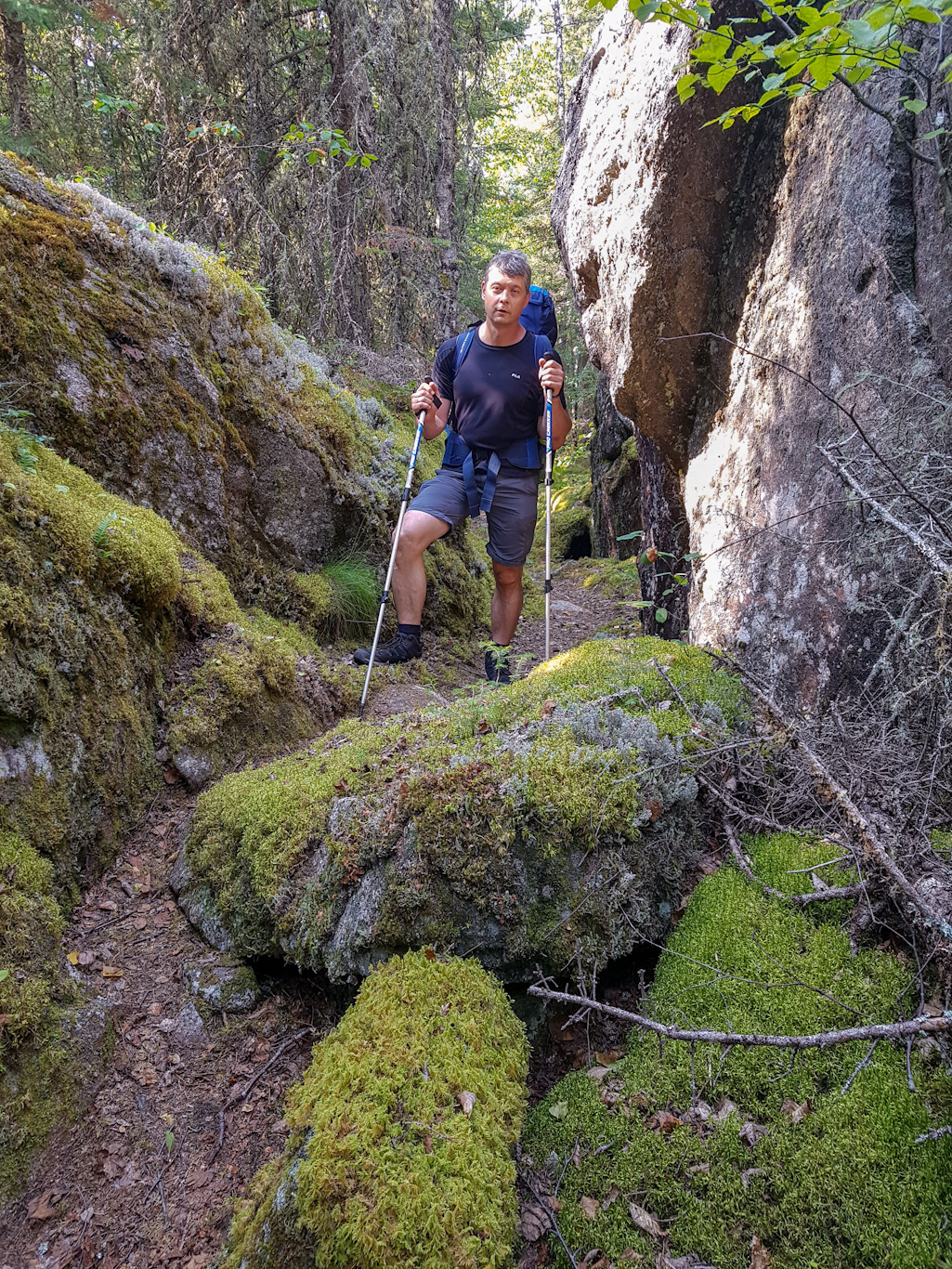
The section before White Spruce Harbour was a breeze, one of the flattest and easiest parts of the trail. After that, the trail started its usual up and down gymnastics, making us question at what point we should stop calling it hiking and refer to it as bouldering, while constantly repeating: “Imagine doing it with a backpack.”


Since we didn’t have to move camp, we decided to hike the rest of the trail – 14 kilometres from White Gravel River to North Swallow River and back.
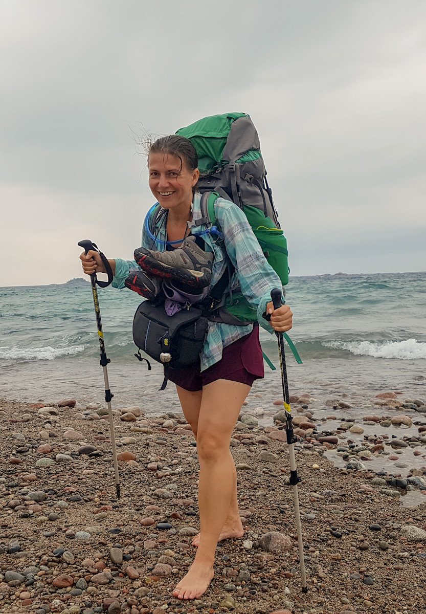
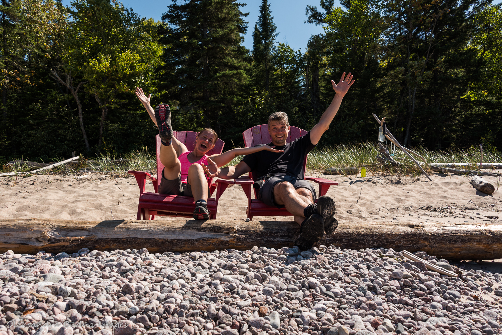
By the time we approached Hideaway Lake, I started to entertain the idea of spending some time at the campsite since we didn’t get to enjoy it the night before, and then heading back. Unfortunately, the site was already taken. Plus, as my husband pointed out, we hadn’t come this far to turn back now. So we kept putting one foot in front of the other until we found ourselves by the iconic Parks Canada red chairs at North Swallow River. They were occupied by a group of guys who spoke in monosyllables but they graciously agreed to vacate them so we could take a few photos.


We finished the trail one way; now all we have to do is hike 60 kilometres back.
After that, all we had to do was hike 14 kilometres back to our campsite. We walked onto the White Gravel River beach, hungry and exhausted, right after the sun dipped into the lake. There was just enough light left to make and eat dinner. As we sat on a log watching much calmer waters, it dawned on us that we were officially past the halfway point of our hike.
After 28 kilometres and 11 hours of hiking, we got back to White Gravel River right after the sunset.
Day 6: White Gravel River (Gaziinins dongang ziibi) to Oiseau Bay (Wiso wikwedon)
Distance: 14.3 kilometres
Time: 7.5 hours
I was dreading the day knowing that we would have to cover two of the hardest sections of the trail. Surprisingly, it went easier than expected. The fact that we were familiar with the terrain helped, even if it didn’t feel like we were hiking the same trail at times: climbs became descents, sections that used to go down now turned upwards.


Our hike from White Gravel River to Oiseau Bay covered two of the most challenging sections of the trail.
Our reward at the end of the day was a beautiful beach at Oiseau Bay, another of my favourite locations. The only slight drawback was a bit of a walk from the campsite to the beach. After a day of walking, the last thing you want to do is more walking. Other than that, the sand was soft and endless, the water crystal clear and invigorating, the sun gentle and balmy.


Oiseau Bay with its long sandy beach and refreshing waters was a beautiful place to spend the evening.
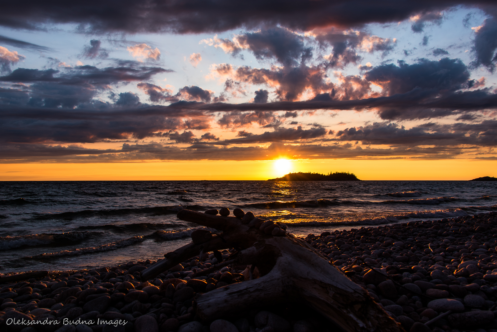
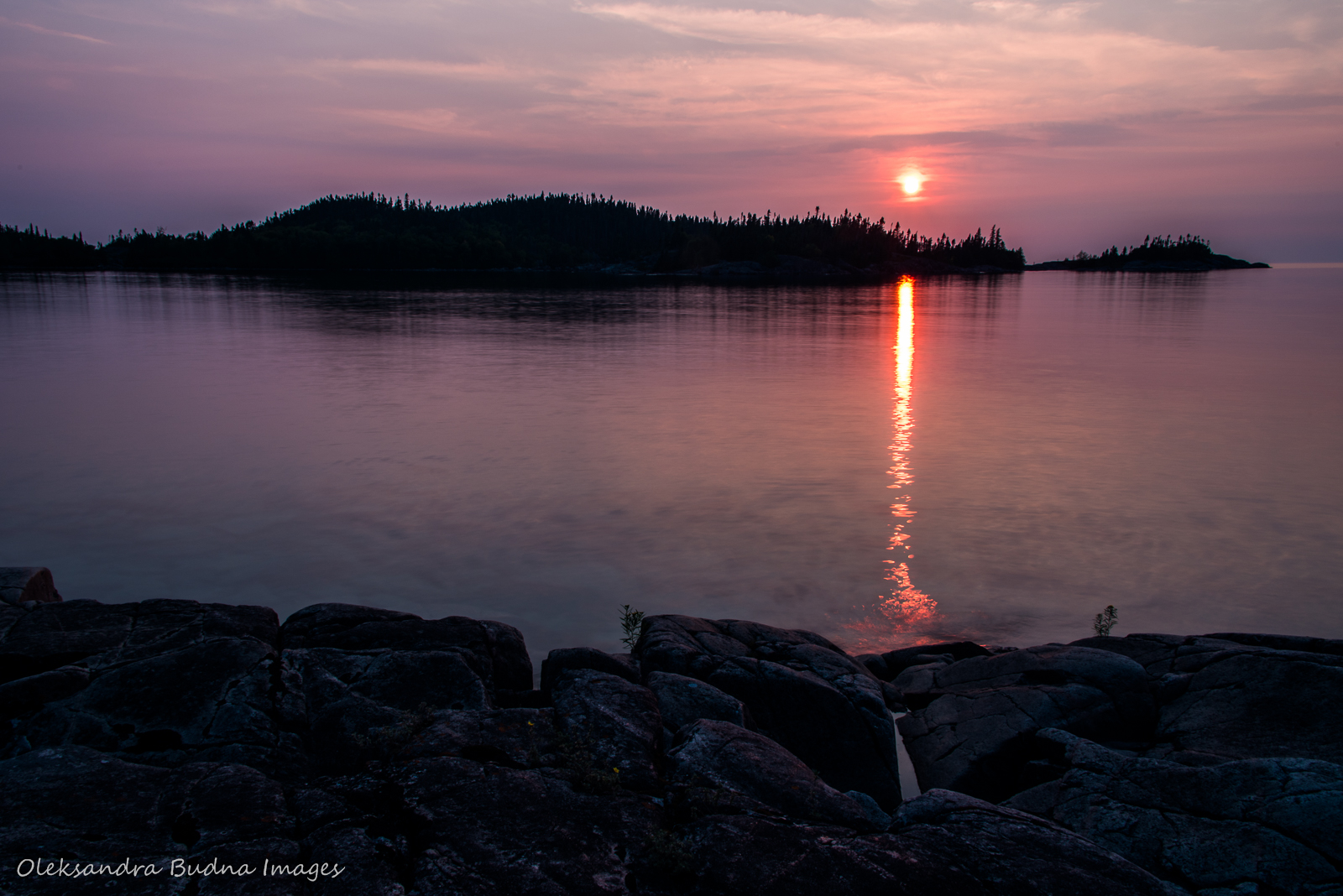
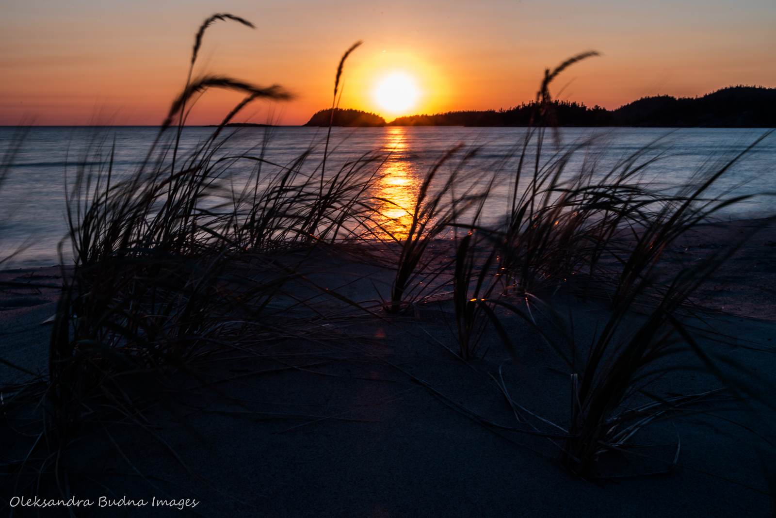
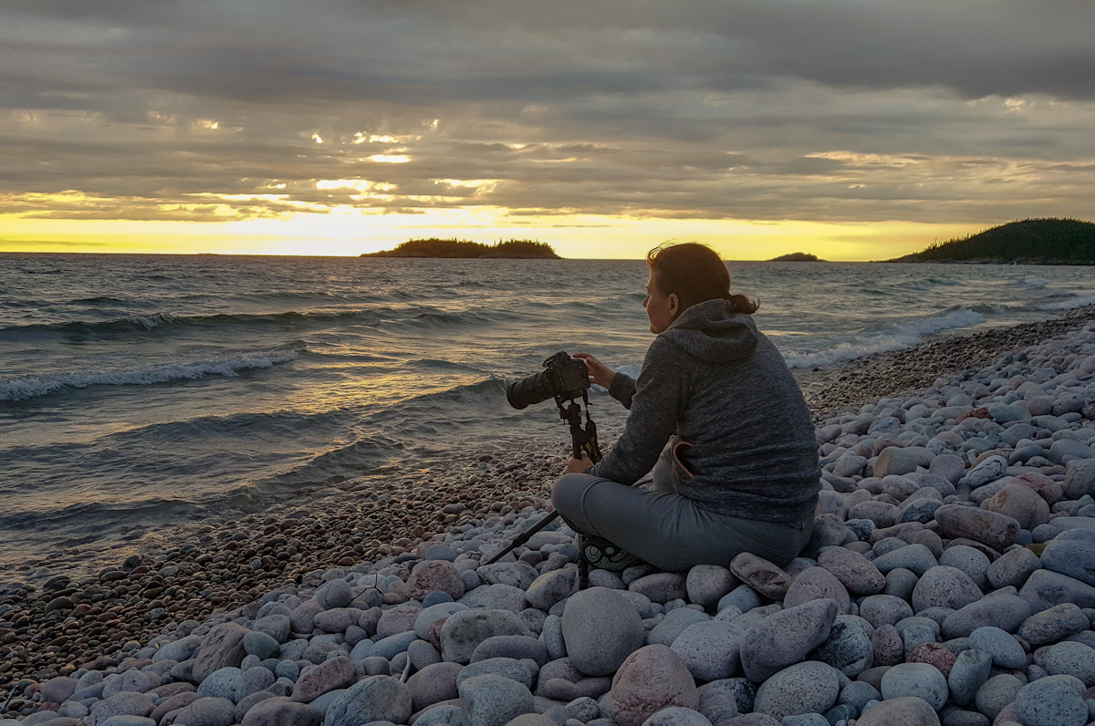
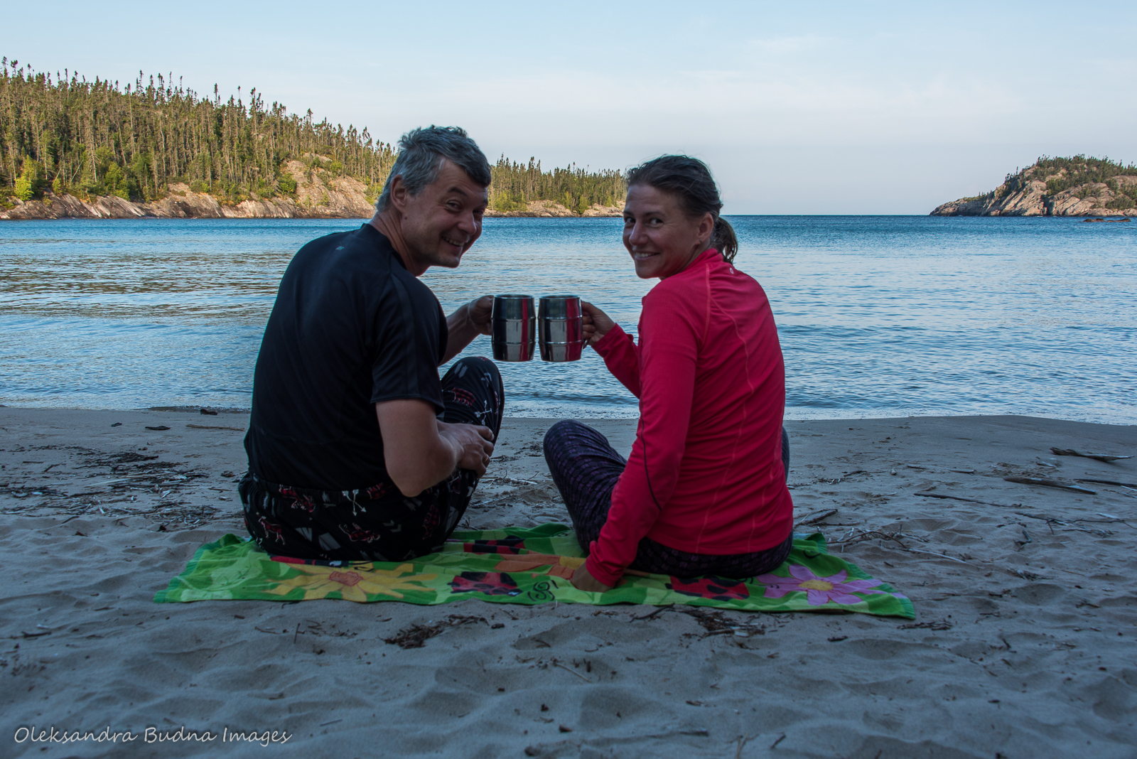
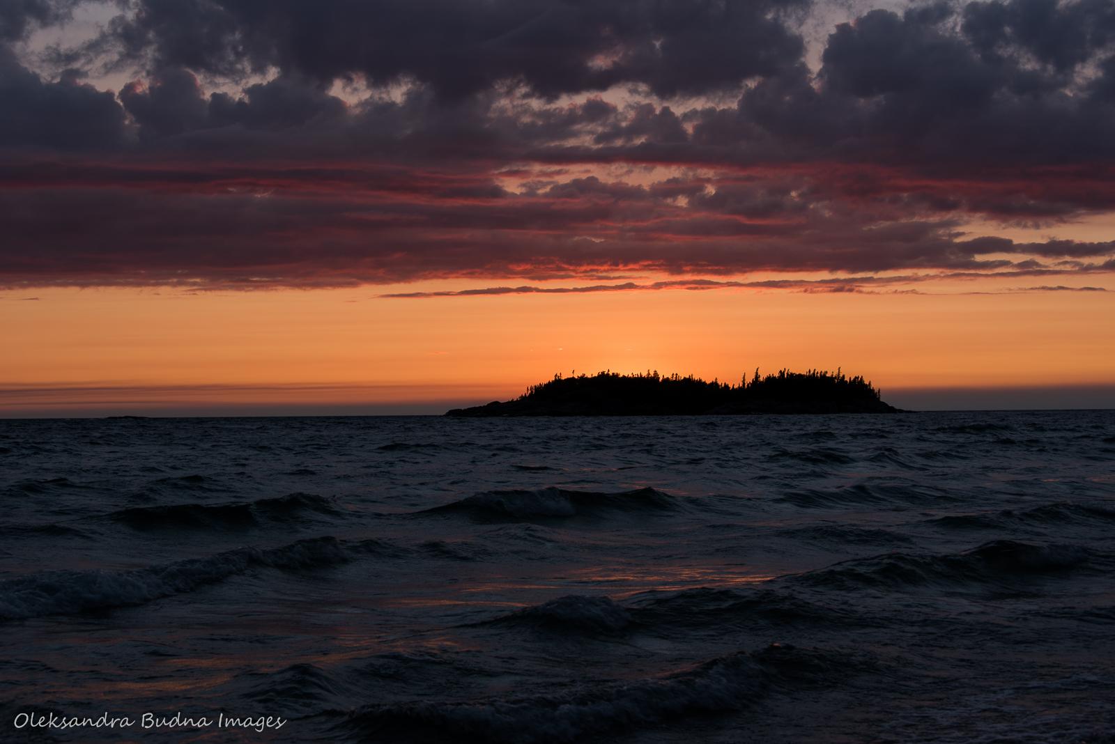
After we set up our tent and made dinner, we brought it with us to eat on the beach, something we were doing the entire trip. Being so close to Lake Superior, we wanted to spend as much time as we could watching its constantly changing waters. That evening we were gifted with another epic sunset.
One of the many spectacular sunsets we were gifted with during our trip.
Day 7: Oiseau Bay (Wiso wikwedon) to Willow River (Wedoopki ziibi)
Distance: 14.1 kilometre
Time: 7.5 hours
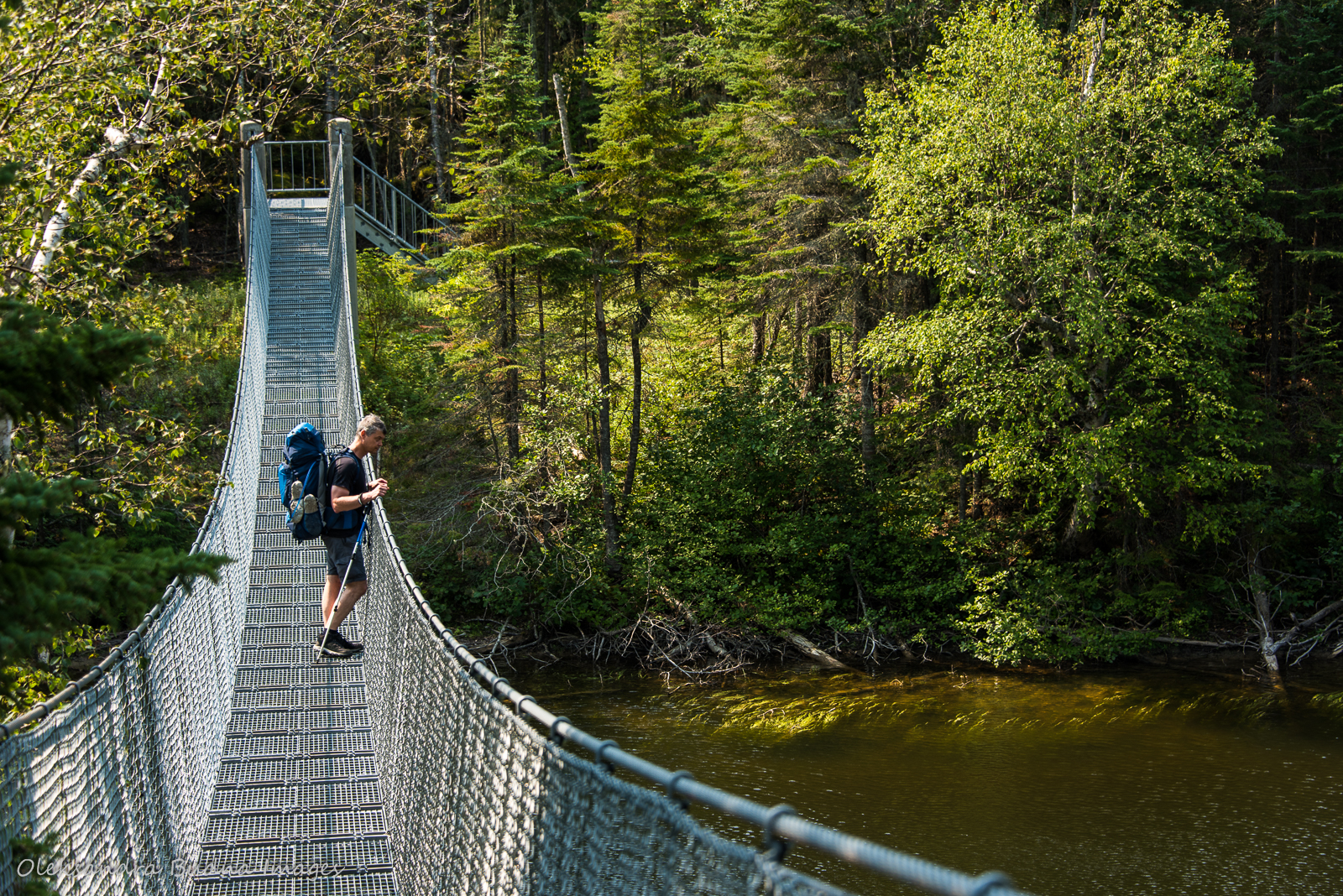
Unlike the previous day, I expected this one to be much easier. But my blisters had different plans. It was my worst day on the trail. As I slogged along, I started to think this hike would never end. The suspension bridge over Willow River that would signal that we were near seemed to be moving away from us. By the time it came into view, I couldn’t even master relief. All I could think about was taking off my hiking shoes and plunging my feet into the water. And then crawling into the tent and falling asleep.


Even though the trail was getting easier, blisters made it the hardest day on the trail.
When we arrived at our campsite we found a group of eight men feeling totally at home there. Their destination that night was Morrison Harbour but once they realized they wouldn’t be able to make it, they decided to stop at Willow River. They figured no one was going to claim the campsite since it was already after 7. That is until we showed up waving a permit. It took them about half an hour to relocate to the beach, all to the constant chorus of “we are sorry.” And they already had the campfire going and a stack of wood prepared, for which we were very grateful.
Willow River was a bit of a shock, even without this little drama. After days of seeing very few fellow hikers, we were surrounded by people in every direction. This location with four hiking sites, two paddling sites (all of them occupied), plus our eight new friends on the beach, felt more like a hotel and less like a backcountry campsite. And even though we were happy to see two groups we’d met earlier on the trail and who already felt like friends, I was looking forward to getting out of there and heading to our favourite campsite on Picture Rock Harbour.

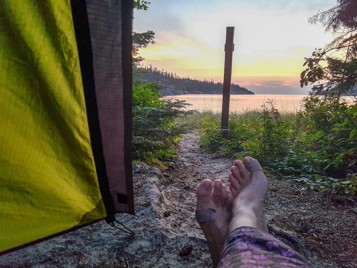
Never miss a sunset, no matter how tired I am at the end of the day.
Day 8: Willow River (Wedoopki ziibi) to Picture Rock Harbour South (Ga oname kwa)
Distance: 13.2 kilometres
Time: 4.5 hours
Staying at Picture Rock Harbour South was a highlight of our Mdaabii Miikna hike last year. Even our kids agree and they weren’t the biggest fans of that adventure as evidenced by their refusal to backpack the Coastal Hiking Trail with us. A beautiful setting, milky green waters with an almost tropical feel (until you get into those waters), a campsite with a bench lovingly made by previous occupants – we fell in love with the place during our first stay and decided to revisit it as part of our Coastal Hiking Trail trip.
Getting there required a bit of a detour and added another eight kilometres to our overall hike but it was worth the extra distance. Plus, the trail was nearing its end and I was happy that my last memories of it wouldn’t be my disastrous hike the day before or our less than stellar stay at Willow River.
We arrived at the campsite before 4 giving us plenty of time to relax. The location was just as spectacular, the water just as clean and even slightly warmer than last year, the bench just as inviting. It was everything I dreamed of, except for a tent that was already pitched on our site. This time it was a solo kayaker making his way from Thunder Bay to Sault Ste. Marie who also assumed that no one would show up. By then he’d spent over 30 days mostly by himself so three campsites full of people felt like a crowd. After we helped him move his tent, he spent the evening going from site to site chatting to different groups.


We fell in love with Picture Rock Harbour last year and decided to revisit it as part of our Coastal Hiking Trail trip, even though it required a bit of a detour to Mdaabii Miikna trail.
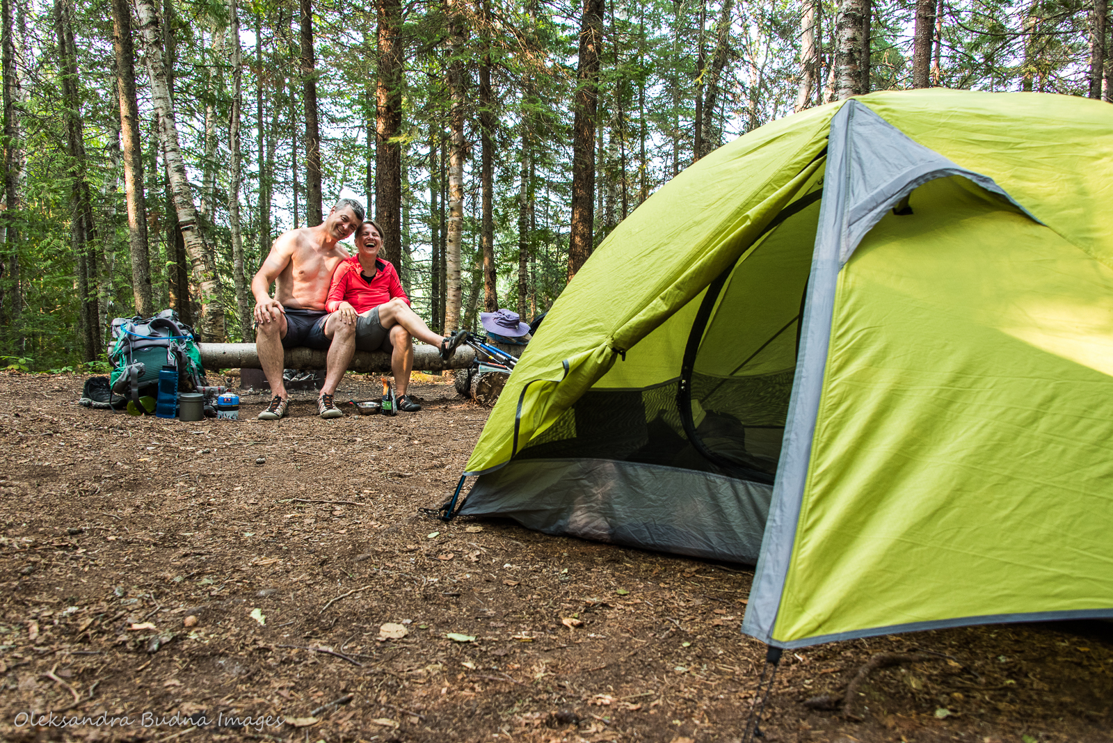
My husband and I had a lovely, slow evening swimming, watching the sunset and reminiscing about all our adventures on the trail. Even though we still had one more day of hiking back to Hattie Cove ahead of us, the trip was starting to feel like a thing of the past, something you remember fondly as you go through photos and share stories with your friends.


Special moments on the trail: a beautiful sunset and a campfire.
Day 9: Picture Rock Harbour South (Ga oname kwa) to Hattie Cove (Bii to bii gong)
Distance: 10.2 kilometres + 1.5-kilometre detour
Time: 3.5 hours
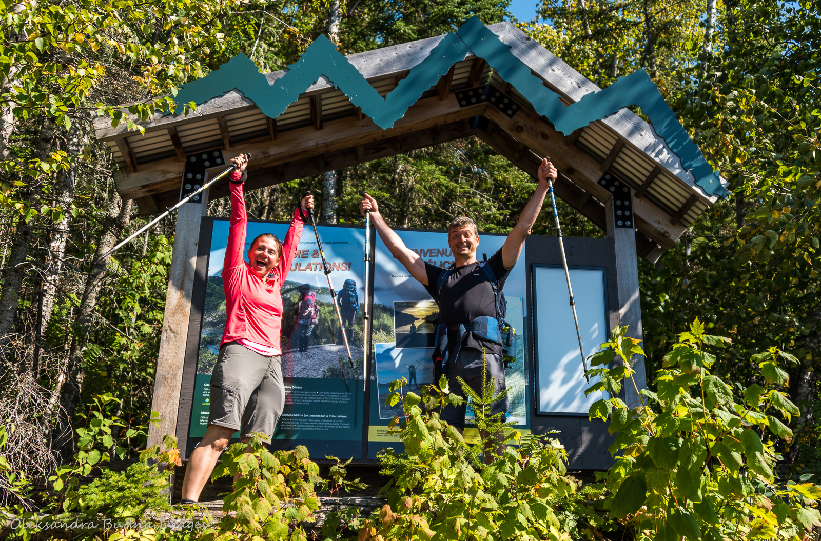
With lighter backpacks and flatter terrain, our hike that day felt like a walk in the park. Once we emerged at the Coastal Hiking Trail sign, it was hard to believe that it’d only been nine days since our official “beginning of the hike” selfie. It felt like months of adventures and years of trail wisdom stood between us and those blister-free people in clean clothes with freshly washed hair. That’s the life on the trail: it unfolds outside of the usual time constraints.
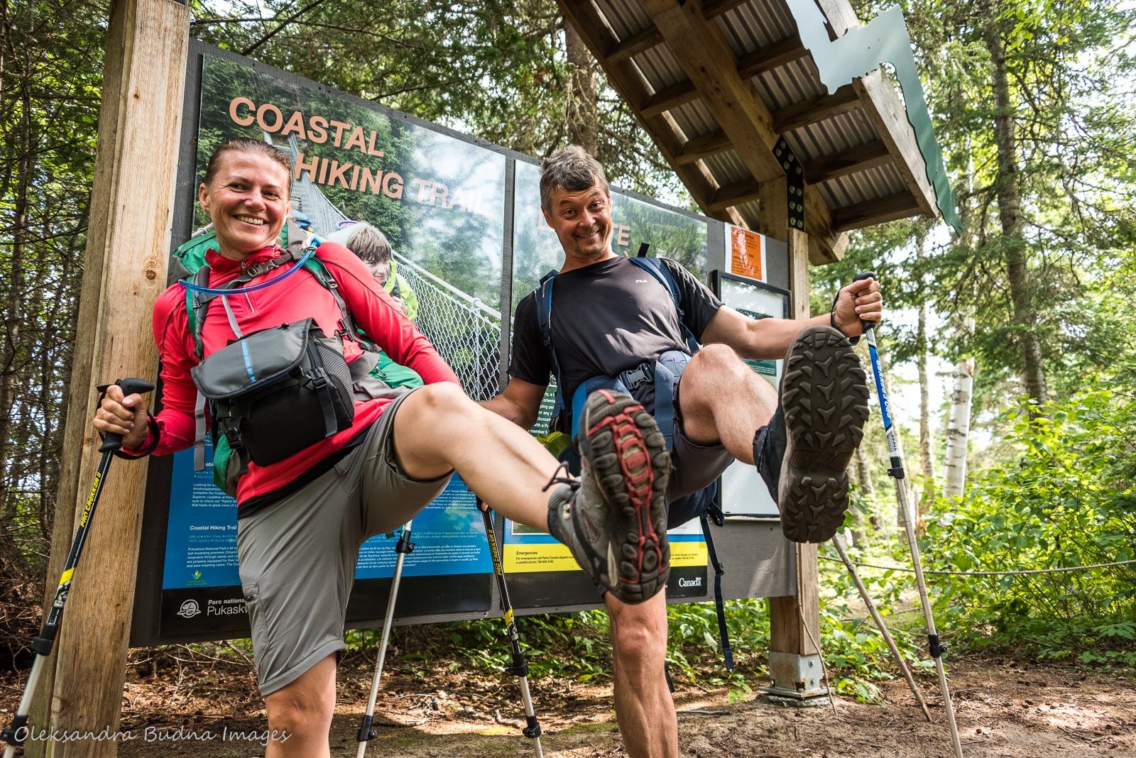
And we are done: 130 kilometres, 9 days, countless memories, one epic adventure.
After a few photos and a quick stop at the registration office to let them know we made it out alive and well, we left the park proudly clutching our Pukaskwa Coastal Trail patches. Our feet were blissfully tucked into flip-flops; our shoulders felt weirdly light without backpacks. Our spirits were souring, our souls content. Our hearts were overflowing with incredible memories and love for this majestic place – love as boundless and deep as the Lake itself; our heads already buzzing with plans of return trips to Gi chi Gamiing’s wildest shore.


I just read you Pukaskwa backpacking trip report. While I’ve paddled the coast 23times, I thought I’d backpack the trail this summer instead. Did you guys carry any kind of 2way satellite communication device? If so, which one?
Also how obvious was the trail to follow between Oisseau Bay and the end? Thanks for your insights, and a great trip report.
LikeLiked by 1 person
Yes, we have Garmin InReach Explorer: https://www.garmin.com/en-CA/p/561269
And we had no problem finding the trail past Oisseau Bay.
Have a wonderful trip. We’ve always been more into canoeing but this trail turned us into backpackers too. Planning to do La Cloche Silhouette in Killarney this summer.
LikeLike
Did you have troubles finding the trail from Ousseau to the end?
LikeLike
No, we didn’t. I think once we lost it for a few minutes but very quickly realized it wasn’t going anywhere. So we backtracked and found the trail again.
LikeLike
Awesome write-up and amazing photos! I’ve backpacked the Lake Superior Coastal Trail and planning to do Puk this summer. Just curious what time of year you went? trying to plan a good balance of days not too short but bugs not too bad. Aiming for late July/Early August.
LikeLiked by 1 person
Thank you for reading! And sorry about a late reply. We did it in mid-August. There were some mosquitoes in the evening but not too bad. Also, it was pretty dry, which helped because rocks get slippery when it rains. Enjoy your hike! It is a beautiful trail.
LikeLike
I read that there are few trail markers. Was it hard to stay on the trail, or find it?
LikeLike
That’s true. Trail markers are few and far between, mostly indicating where the trail turns inland from the beach. But we didn’t have any issues staying on the trail., It’s easy to see and find most of the time. Once or twice we took a wrong turn but quickly realized it and didn’t lose much time.
LikeLike