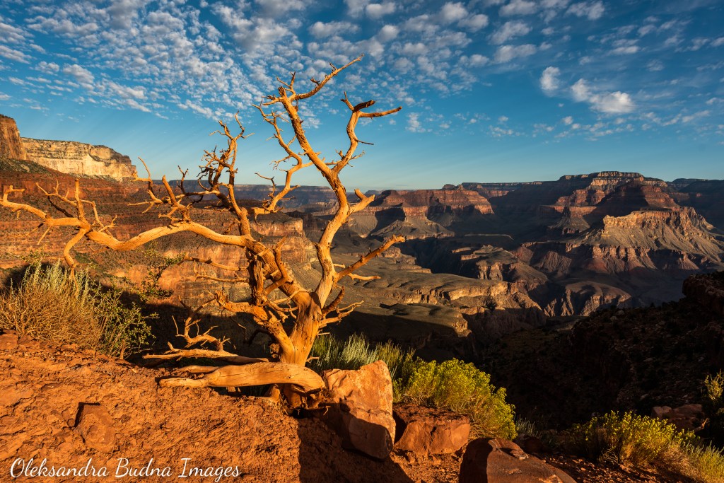
The Grand Canyon is the kind of place that cracks your heart open and stays with you long after you leave its craggy outlines behind. I remember the first time I saw it from the Bright Angel Point Lookout on the North Rim. It was right after the sunrise. We arrived the night before, set up our tent in the dark just as it was starting to rain so there was nothing to do but go to sleep after finishing our dinner in the car. Now that the dark and rain cleared up, I was in a hurry to see this famed natural wonder. After an uncomfortable shuffle along a 800-metre long trail, long enough to make me regret my choice of footwear – flip flops were considerably slowing down my progress, I finally got to the lookout and couldn’t help but inhale at the sight. A chasm gaped in front of me – the Earth cracked open, its innermost essence exposed.
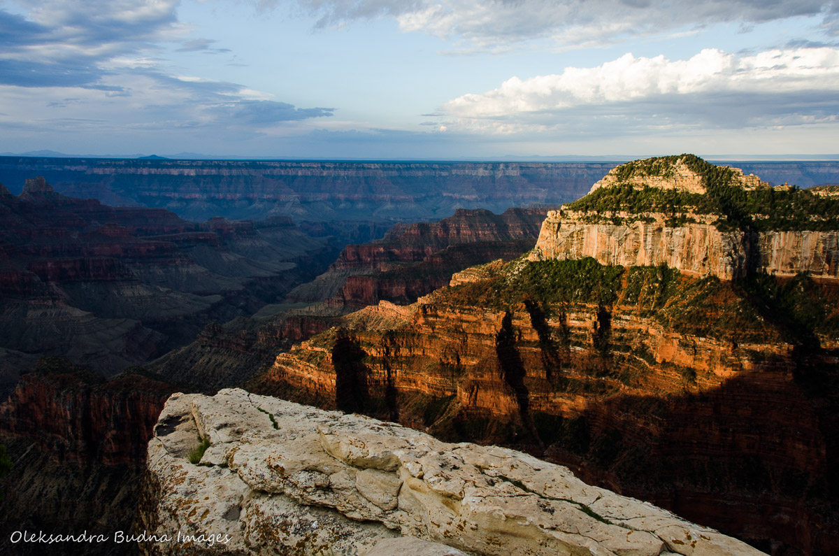
My first ever view of the Grand Canyon from the Bright Angel Point Lookout on the North Rim back in 2016
About six million people visit the Grand Canyon every year. Around five per cent of them make it below the rim; only one per cent venture all the way to the bottom. After enjoying its majestic views from both the South and North Rims and making a couple of short trips inside during our previous visit, we decided to come back and become part of the one per cent. The plan was to hike down the South Kaibab Trail and then come back to the South Rim via the Bright Angel Trail. Not exactly a rim-to-rim trek I was envisioning after our first visit but still an opportunity to read the Grand Canyon’s multi-layered story and experience it in all its grandeur.
Even without a few extra miles that hiking from a higher North Rim would add, we were still looking at 26 kilometres we were hoping to cover in one day. Add to that an elevation change of almost one and a half kilometres, a desert environment, lack of water during some stretches of the trail, high temperatures in the middle of August that would get 10-15 degrees higher at the bottom – it was shaping up to be a challenging day.
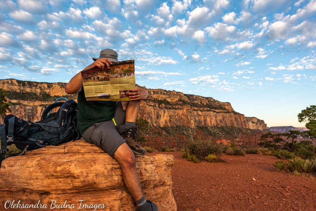
After extensive research, we felt ready for the challenge. That is until we arrived in the park. “Don’t attempt to hike to the bottom of the Canyon and back as a day trip” was a message practically screaming at us from every information board and brochure. After reading a few of those, I started to get this nagging feeling at the pit of my stomach. Was it doubt? Luckily, my husband and kids were less easily swayed. So to calm down my fears we decided to ignore the information boards (because what do they know about our abilities?) and figured we needed to get more information, i.e. talk to a park ranger.
“We’d like to learn more about getting to the bottom of the Canyon,” we tried to instill confidence in our request as we approached a ranger at Verkamp’s Visitor Centre.
“You are in luck,” he guffawed, “we have a zip line that goes all the way down and then an elevator going up.”
“That’s what we heard,” we quipped back.
After that exchange, the ranger pulled out a map and walked us through specifics of each section of the trails, some with names like Devil’s Corkscrew. (Spoiler alert: It did live up to its name.)
“As long as you start very early in the day and bring lots of water, electrolytes and food, you will be okay,” he wrapped up his virtual tour.
(Another spoiler: We were indeed okay for the most part. But it was a challenging hike that took us 15 very exhausting hours to complete and shouldn’t be taken lightly. Around 250 people are rescued from the Canyon every year and, unfortunately, deaths due to dehydration or overhydration, cardiac arrest, heat or starvation after getting lost are not unheard off. So proper planning and respecting your limits are extremely important.)
We thanked the ranger for such a detailed walk through, grabbed a map and headed back to our campsite to start preparing for our hike the next day. We popped back to the rim to watch the sunset – a collective activity that is a must at the Grand Canyon. After that, it was time for bed so we could get enough sleep for our 3:30 a.m. wake-up call.

Sunset over the Grand Canyon: a must see spectacle that brings together hundreds of people
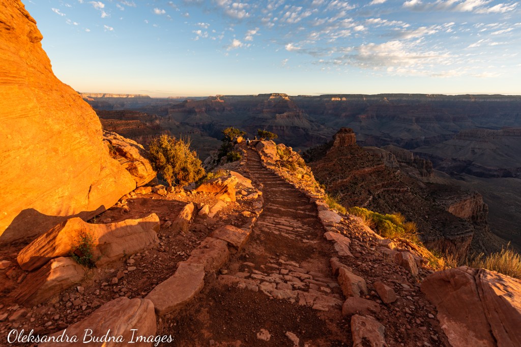
By 4:30 a.m. the next morning, we were at the shuttle bus stop waiting for the yellow line bus to take us to the South Kaibab trailhead. The trail starts off the Yaki Point Road, which is closed to car traffic so the only way to get there is by shuttle bus. Luckily, they start running an hour before sunrise (and they are free).
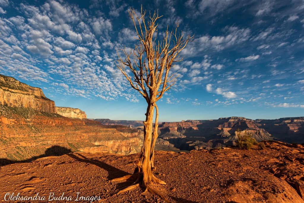
Shortly after five, we were standing at the edge of the Canyon ready to start our journey back in time.

Ready to start our travel to the bottom and back in time
With nearly 40 rock types that date back 250 million years at the top all the way to 1.8 billion years at the bottom, the Grand Canyon offers a detailed transcript of deep geological time. Messages of pre-human history are encoded in its multicoloured layers, each one revealing the conditions typical of the period when it was formed: ancient shallow seas, sand dunes of an extinct desert, coastal plains, cooled magma. The Grand Canyon remembers. But it also has gaps in its impressive memory – 14 unconformities where certain eras are missing from this vertical geological record about a mile deep.


Nearly 40 types of rocks make up the Canyon walls, some dating back 1.8 billion years.
We hit the trail just as the early morning light spilled over the Canyon and the upper layers acquired a telling golden tint. It wasn’t until we reached the Ooh-Aah Point about 1.4 kilometres down the South Kaibab Trail that the sun emerged from behind the rim, now running slightly above us, giving a special meaning to this aptly named stop along the trail.
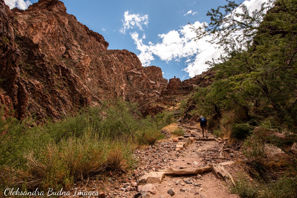
As we continued our descent, the wiggly contours of the rims kept lifting up until they eventually disappeared from view. The trail alternated between zigzags clinging to the sides of almost vertical cliffs, occasional flatter and straighter passages running down gentle slopes and a few sections that looked like yarn unspooled by a mischievous cat.


South Kaibab Trail is 11 kilometres of switchbacks, zigzags, twists and turns.
With every step of the way, the Earth’s history unfolded right in front of our eyes: limestone, sandstone, shale, mudstone, siltstone, dolomite – ranging in colours from grey and creamy to burnt orange and rusty red, some with fossils buried in them, other not so much, depending on the time of their formation – followed by granite, darker schists with lighter bands of gneiss at the bottom. The names of different types of rocks and the eras that defined each of those layers brought vague recollections from our high school science class. The feeling of awe, however, was overwhelming and palpable, not only at the scale of the Canyon but also its timeline that made our insistence on measuring time in minutes, hours and even years inconsequential and even laughable.
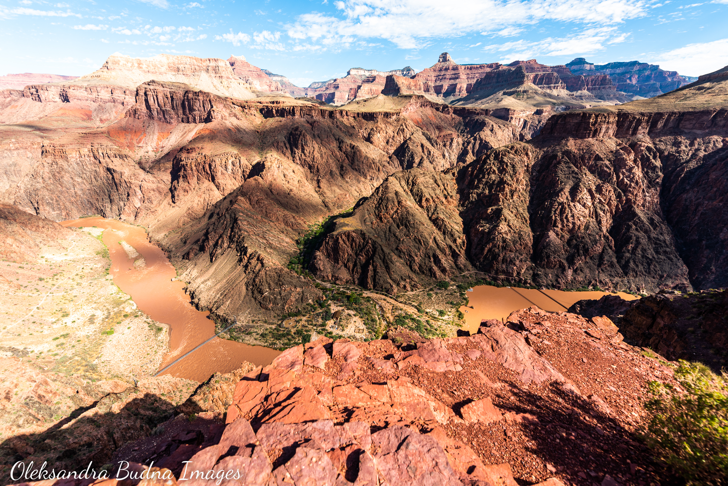
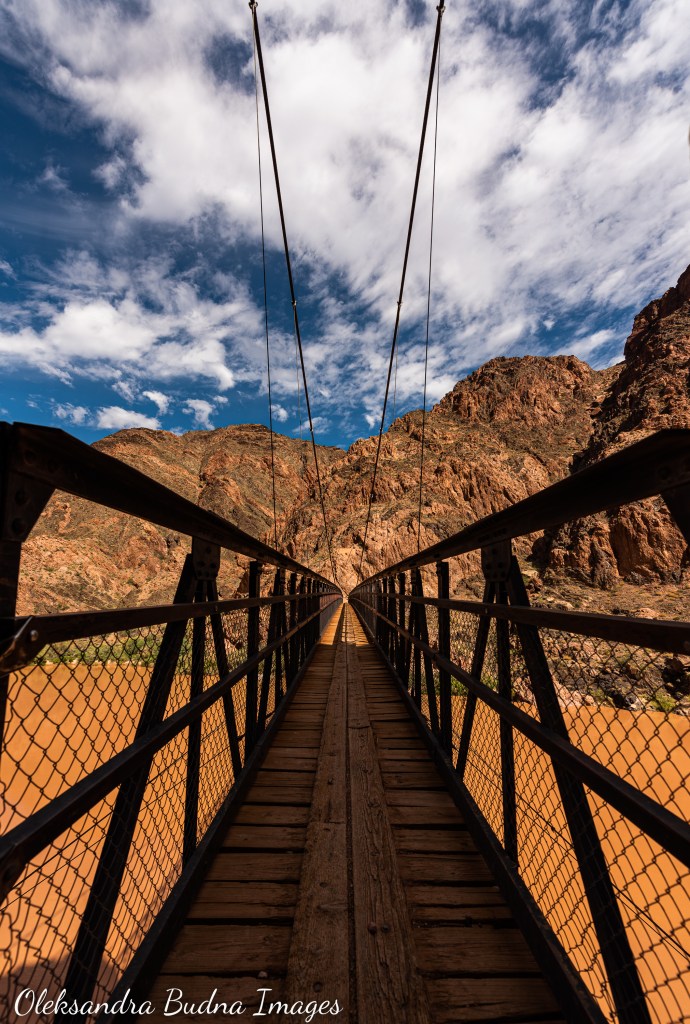
Almost at the bottom: a view of the Colorado River with the Black Bridge on the right, the Silver Bridge on the left and the Bright Angel Campground in between
The South Kaibab Trail is about 11 kilometres long top to bottom. And while going down was definitely easier than going up, it still took us close to four hours to get to Colorado River. The biggest challenges were a strain on our knees, no shade (that’s why an early start is so vital) and no water source along the way (so bringing enough water for this stretch is essential). There were a few stops along the way with surprisingly clean compost toilets and a shelter at the Tipoff Point. We used it to rest and have that very important salty snack.
We met a few people along the way, including a park worker who was cleaning those immaculate toilets as she hiked down, which explained their well-maintained state. Some people overtook us, other lagged behind; a German-speaking family of four in pristine white shirts kept popping up at different stops so eventually we started smiling and nodding at each other.


We met a few people along the way, a couple of bighorn sheep and our first ever rattlesnake, which was the most exciting encounter of the day.
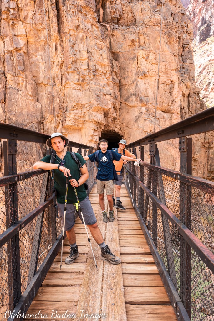
Sometime after nine, we walked through a tunnel and emerged onto the Black Bridge. The Colorado River, barely visible from the rim, was now a raging force right under our feet. As we watched its muddy brown waters rush by, I thought that the Grand Canyon is just as much a story of water as it is a story of rock. If it wasn’t for the Colorado River’s persistence over the past six million years, we wouldn’t be able to witness this deep geological time etched into the Canyon’s walls. Its work of deepening and widening the Canyon continues to this day.
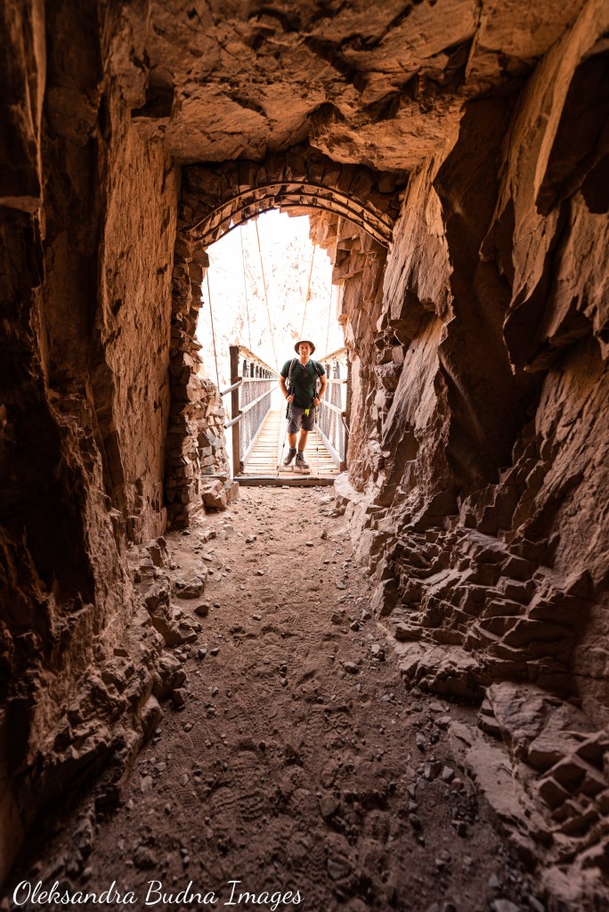
Through the tunnel and onto the Black Bridge: now all we have to do is hike back up
The power of water doesn’t reside in the Colorado River alone. It lives in its tributaries, the Little Colorado River, the Paria River, Kanab and Havasu Creeks, as well as dozens of permanent and ephemeral springs and seeps – the lifelines of the Grand Canyon that support a wide range of plant and animal species. They’ve also made human life in the Canyon possible for tens of thousands of years.


The Grand Canyon is just as much a story of water as it is a story of rock.
After crossing the Black Bridge, we came across the remnants of a Hopi village nestled between the Colorado River and Bright Angel Creek, one of the many reminders within the Canyon’s walls that it hasn’t always been Grand. Before it was proclaimed the Grand Canyon National Park a little over 100 years ago, it had been home to many Indigenous peoples living in and around this area who were displaced when the park was created.

Remnants of a Hopi village, one of the many reminders that Indigenous peoples have called this place home for tens of thousands of years
The Havasupai is the only tribe that continues to reside inside the Canyon today, their ancestral lands significantly reduced. However, eleven tribes – some, like the Hualapai tribe, live along the Canyon’s Rim, others further away – maintain strong connections to this incredible place. To them, the Grand Canyon is known by many different names. The Hopi call it Öngtupqa or “salt canyon”. To Yavapai, it is known as Wi:kaʼi:la. The Navajo or Diné people call it Bidááʼ Haʼaztʼiʼ Tsékooh. The Paiute name for the Grand Canyon is Kaibab, which means “mountain turned upside down.” In the Southern Paiute language, it is also known as Paxa’uipi or “big river canyon.”
For many, it is a sacred place to which they trace their origins. The Zuni call their place of emergence Chimik’yana’kya dey’a, known today as Ribbon Falls. The Hopi believe they emerged from a place called Sipapuni, the confluence of the Little Colorado and Colorado Rivers. To Navajo, it has been not only a spiritual sanctuary but also provided a physical refuge when in the 1860s the U.S. Army, led by Colonel Kit Carson, forcibly marched the Diné to Fort Sumner in New Mexico. Their stories are encoded in the Canyon’s walls, stories of movement and migration, strength and perseverance, worship and awe. Stories that add more layers and much deeper meaning to this geological wonder. Stories written in petroglyphs and pictographs, in remains of villages and granaries built into the rock, in trails that they have walked for generations. Every step along those trails is a reminder of the reverence the Canyon’s first inhabitants and caretakers continue to hold for this place.
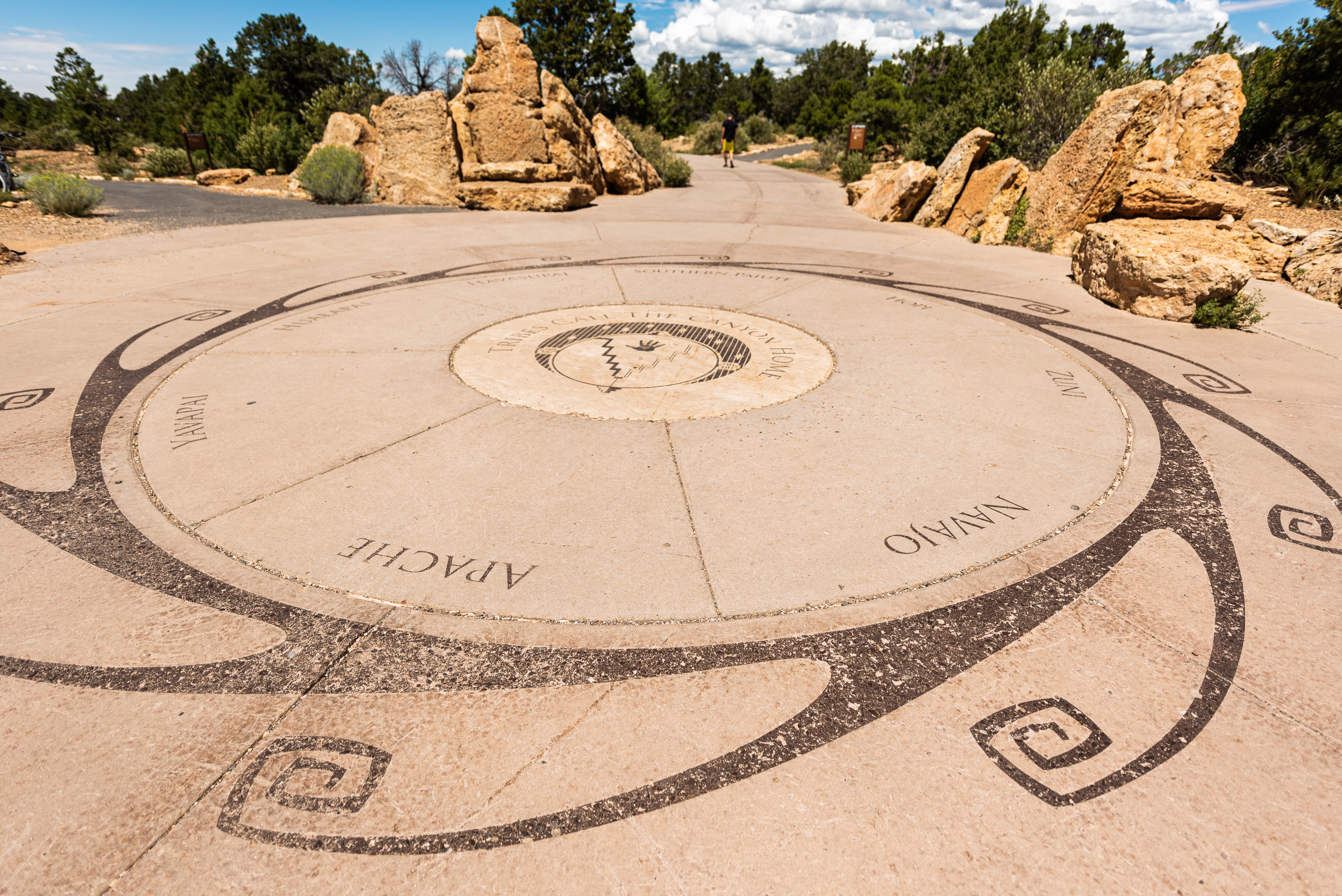
Eleven federally recognized tribes have deep connections to the Grand Canyon: the Havasupai, Hopi and Hualapai tribes, the Navajo and Yavapai-Apache nations, the Pueblo of Zuni and the Southern Paiute including the Kaibab, Las Vegas and Moapa bands of Paiute Indians, the Paiute Indian Tribe of Utah and the San Juan Southern Paiute Tribe.
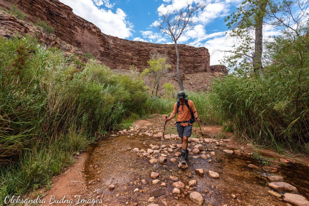
One of those trails – now called the Bright Angel Trail – took us back up to the South Rim. Unlike the South Kaibab Trail we hiked down, this one offered several stops along the way where we could refill our water bottles and pouches. All thanks to the high pressure pipeline that carries water from the Roaring Spring tumbling down the North Wall all the way to the South Rim. It also supplies water to Phantom Ranch and Bright Angel Campground at the bottom of the Canyon where you can find not only drinking water but also flush toilets (what a luxury!). The Garden Creek that parallels the Bright Angel Trail for much of the way offered lush vegetation and places to cool off, stick our feet into a refreshing stream and soak our t-shirts and hats to bring our body temperatures down, even if they didn’t stay wet for too long.


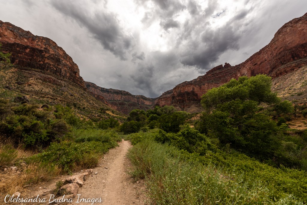
Our much longer and more strenuous hike back up the Bright Angel Trail: more switchbacks and zigzags, significantly fewer pictures
One of the stops along the way – the Havasupai Gardens – offered a great setting to rest and have lunch. The Havasupai Gardens, originally named Ha’a Gyoh before it was claimed by the National Park Service, was renamed last year at the request of the Havasupai Tribe. It is one of the many efforts to make park’s visitors more aware of the past and continuous presence of Indigenous peoples and their connections in the Grand Canyon.
After we finished our Mac & Cheese from Backpackers Pantry in the shade of cottonwood trees, it was another five hours of following the Canyon’s signature zigzags, switchbacks, twists and turns until we finally got to the top, our arrival announced by the floating orbs of our headlamps in complete darkness. Once there, I peered down the black chasm below. I thought of the forces that formed this natural marvel, of its many layers that we had just traced with our hiking boots, of the Canyon’s multicoloured walls overlaid with stories of Indigenous peoples that call this place home. Later, during our shuttle bus ride back to the campground, I wondered what kind of layer our human age, the Anthropocene, will add to the Grand Canyon’s already impressive geological record.

A beautiful Grand Canyon sunset as we approach the end of our hike

Pingback: Discover Unforgettable Hiking Vacations | Adventure Awaits