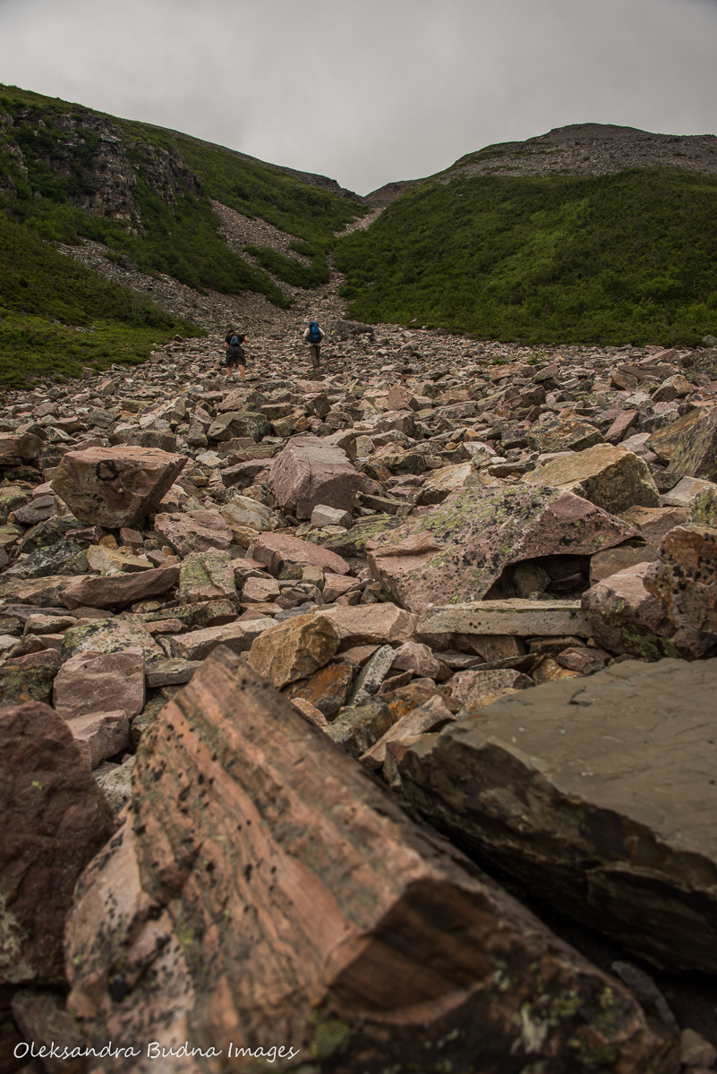
I adjust my camera bag and look up. Gros Morne Mountain looms in front of us, and the only way to the top is via a path strewn with rocks and boulders of various sizes. About a kilometre of a steep climb that will take us an hour to complete. Once we get to Gros Morne park’s highest point, we will trek across the top of the mountain and then come back down via a path clinging to the mountainside. Even before we begin, I know this 16-kilometre hike will not only be the highlight of our Newfoundland trip and the year in general, but also one of our all-time favourites.
Gros Morne Mountain is calling
Our three-week trip to Canada’s easternmost province had no shortage of special moments, which I tried to capture in the two-part trip report. But even among those incredible trails, spectacular views and unforgettable wildlife sightings, Gros Morne National Park, and UNESCO World Heritage site, stood out with its miles of ocean coast, majestic mountains and giant fresh water fjords deceptively named ponds. It definitely deserved its own post or two. So here I am, three months later, trying to translate the magic of the park into words. Luckily, I have hundreds of photos and the notes I kept throughout the trip.
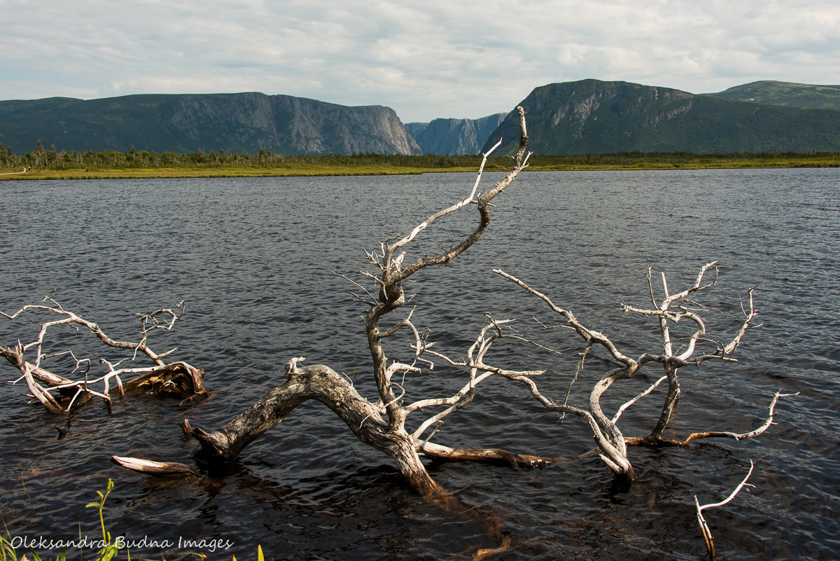
Gros Mornw park is 1,805 square kilometers in size and getting from its southernmost point all the way to the northern boundary can take over two hours. To avoid excessive driving, we decided to break up our visit into two parts and bookend our Newfoundland trip with stays at Gros Morne: four nights at the central Berry Hill campground and then three more at Trout River in the park’s southern part. A week wasn’t nearly enough to see everything Gros Morne has to offer but we made the best of it.
Chilly welcome
We drive down the ferry ramp at Port aux Basques and right into Newfoundland’s foggy embrace. We knew the island was famous for its wet weather, but after lots of sun at Cape Breton Highlands the day before we were hoping for a warmer welcome. Luckily, this rainy morning will turn out to be an exception over the next three weeks.
But we don’t know that yet, and as we take in Newfoundland’s moody landscape through water streaked car windows I am bracing myself for days spent in my waterproof jacket. We watch the green hills outside grow into mountains cuddling under a woolly blanket. I don’t blame them. I could use one myself. Maybe we can take a nap once we get to the campsite.
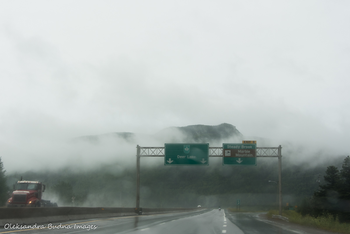
Not a very promising start to our trip
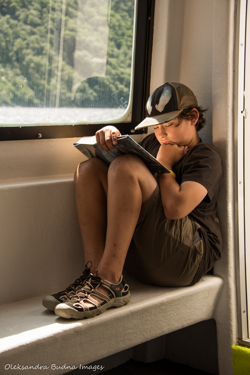
By the time we finish setting up our tent, the rain stops and with it go any thoughts of a nap. Our son is hankering to start geocaching. I know there are dozens of cache locations downloaded on his GPS so we may as well start early. We head to Rocky Harbour and Norris Point, two nearby communities, where we stop by the visitor centre and start our quest.
Tablelands looming across the Bonne Bay but we won’t get to them until part II of
our Gros Morne visit
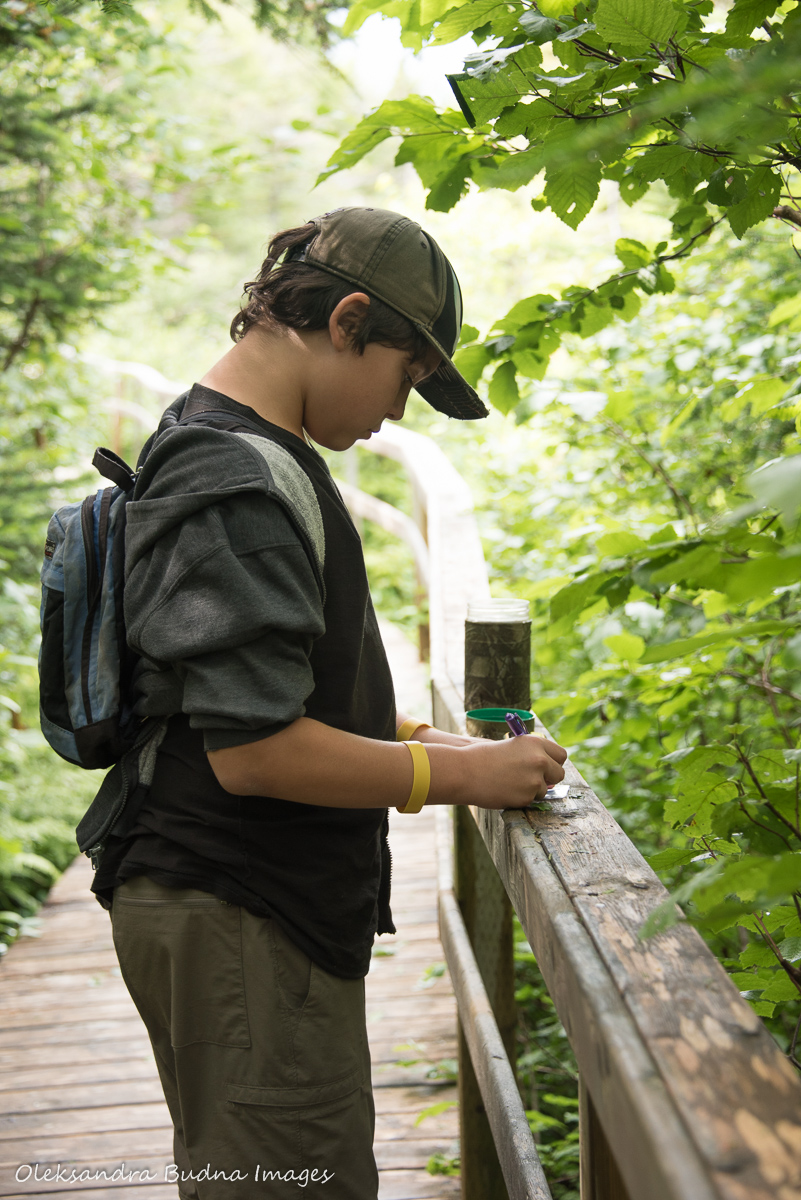

Geocaching, as always, an important part of the trip

Along with geocaches we find lots of interesting information

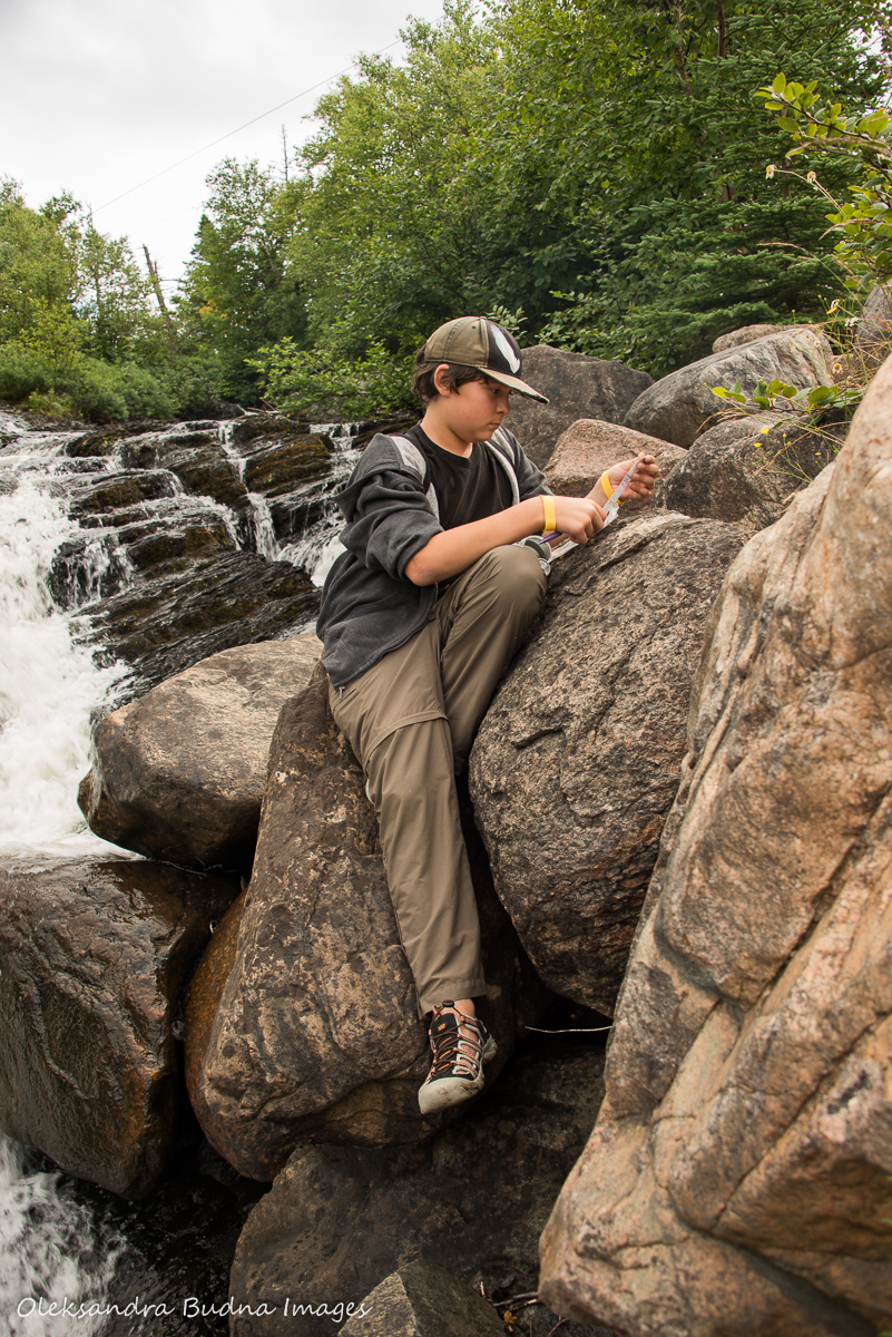

Geocaching takes us places we wouldn’t have visited otherwise
Three hours and five geocaches later, we end up at Lobster Cove Head. The lighthouse museum is now closed but with the sunset approaching we decide to stick around and head down to the beach. The sky is overcast but there is a narrow strip of blue peaking between the clouds and the earth. All we have to do is wait for the sun to drop low enough to shine through that chink in the grey armour.

Our son keeps himself busy with skipping stones. My husband gets to balancing rocks, a hobby he picked up a few years ago during our visit to Bay of Fundy.

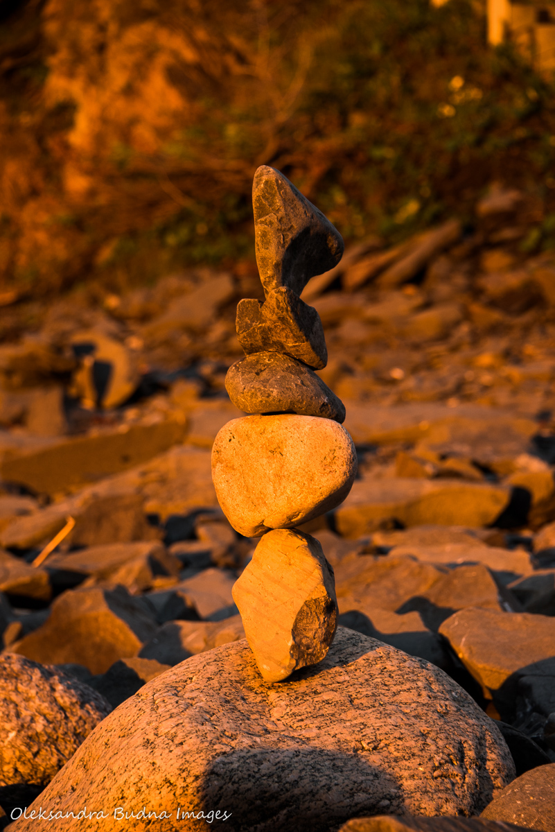
My husband’s rock creations
I scout the shore for a suitable shooting location. I know once the sun makes an appearance, the window for taking pictures will be narrow. I stumble upon an old wreck of a boat and its imperfections capture my imagination. How many stories of adventurous pursuits and fishing trips does it hold? How many tales of tumultuous seas and underwater wonders are etched into its decaying boards?

How many tales are etched into these decaying boards?

Sunset can turn a boat wreck into a masterpiece
We wait for the sun to make a brief appearance before dipping into the sea, and then make our way back to the parking lot in the dark.
Hiking the “great sombre”
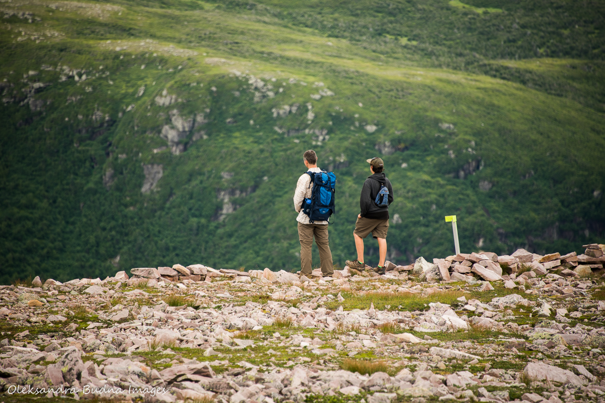
So here we are at the foot of Gros Morne Mountain. In retrospect, we should have waited a couple of days to build up our hiking stamina before tackling this challenging 16-kilometre trail but the weather is perfect – not raining, not too hot and, most importantly, not foggy. It’s the Goldilocks of hiking weather.

Do not underestimate the mountain
We start our slow ascent to the top of the “great sombre” (that’s the literal translation of Gros Morne from French). The lakes down below get smaller until they shrink to the size of puddles.
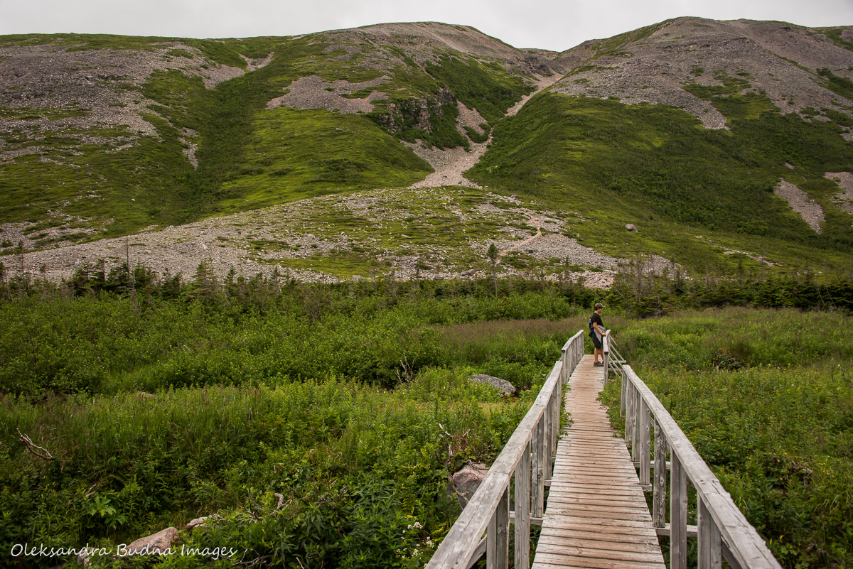
The climb to the top starts on the other side of the bridge


The hike up the mountain is trying

But the view is worth it!
It is quite chilly at the top so we start putting back on layers that we shed during our climb up. A sign signals we’ve arrived at the highest point of the mountain and the park itself.

We made it! Well, almost
We occupy the nearby rock shelter to get some cover from the wind. We have lunch and even catch a bit of a shut-eye. But we can’t stay for too long. There is still two-thirds of the trail up ahead.

Taking a break before taking on the rest of the trail
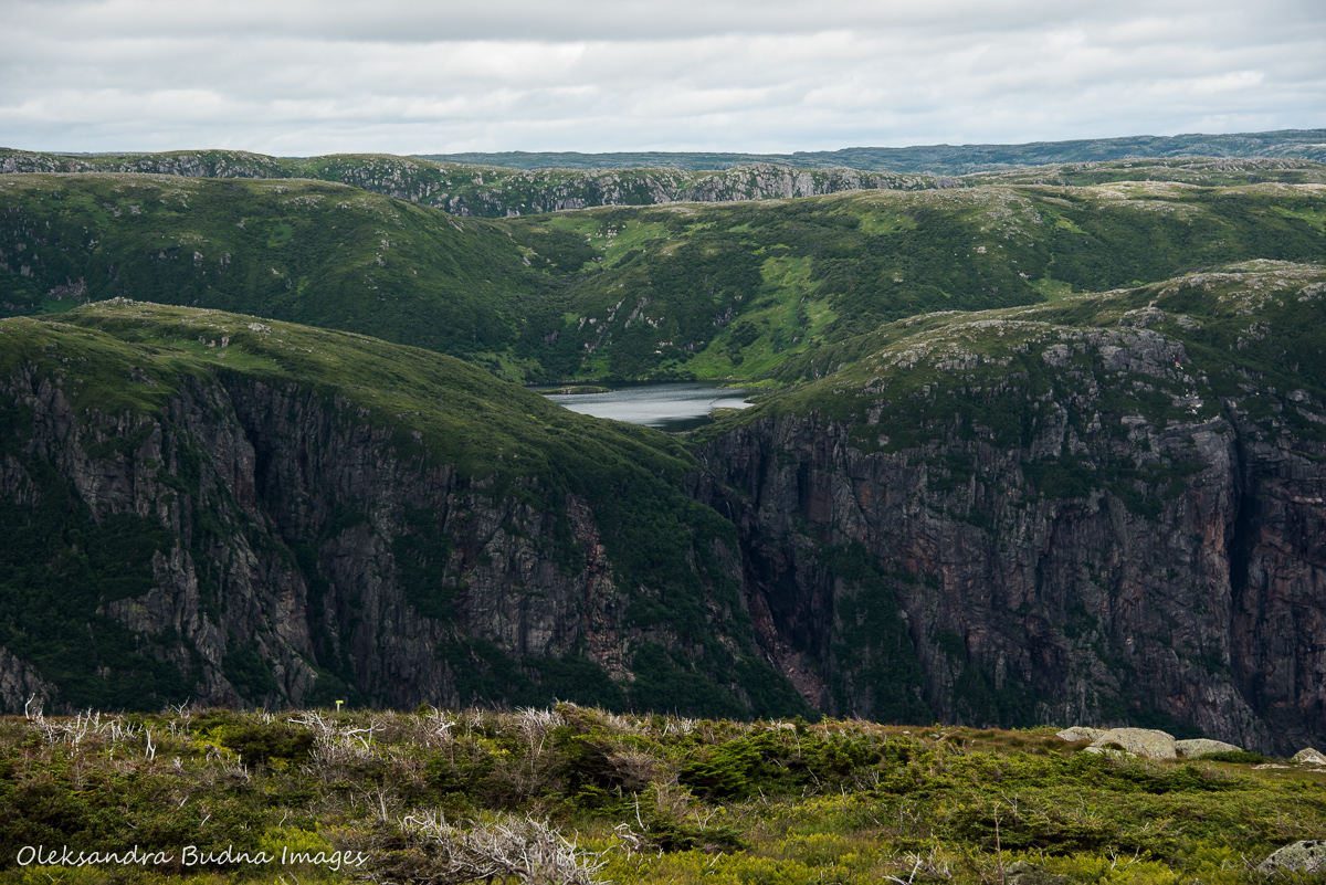
The trek across the top is my favourite part of the hike. Green mountain folds stretch in every direction, with almost perfectly round lakes balancing at their edges. We can see long narrow fjords nestled down below and a strip of the ocean in the distance.

A path of rocks

Views from the Gros Morne Mountain
Mountains can bring you up and ground you at the time


A boardwalk along the Gros Morne Mountain trail – a great place for a geocache
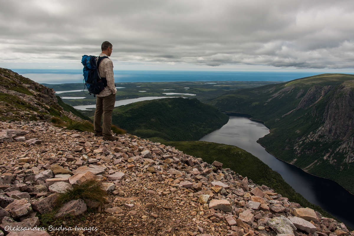
Ten Mile Pond down below, the blue of the ocean in the distance
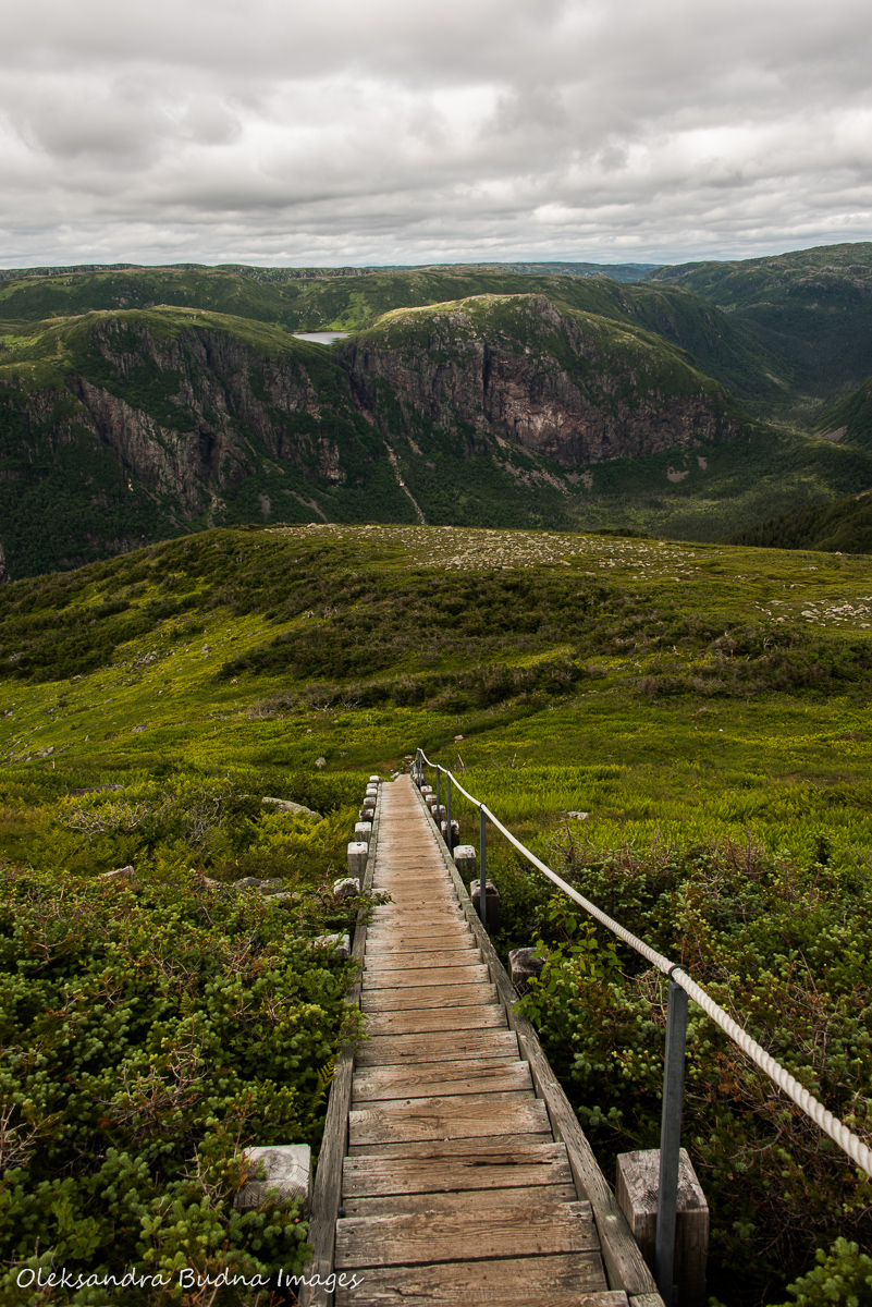

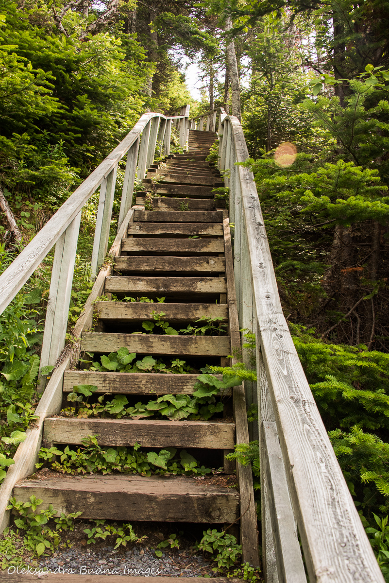
The hike along the top was mostly flat, except for one endless staircase. Good thing we had to go down, not the other way around

More breathtaking views from the mountain
I keep looking for caribou but they usually retrieve further away from people in the summer (although we will run into them later during our stop at Port aux Choix). We do find ourselves face to face with a young bull moose grazing right beside the trail. And then seconds later we turn around to see a cow moose with a calf jog along the other side of the lake and disappear in the bushes. They say there are three moose per each square kilometre so I guess those were the three that lived in that one.
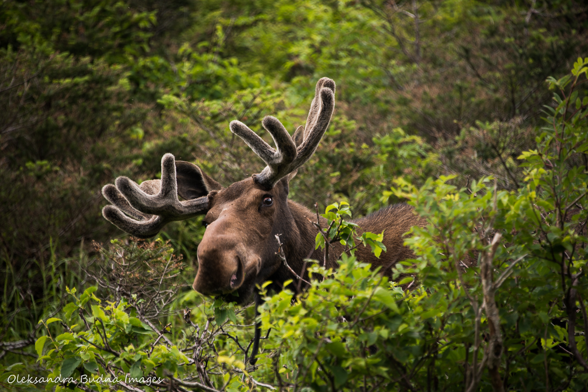
This moose seemed genuinely surprised to see us
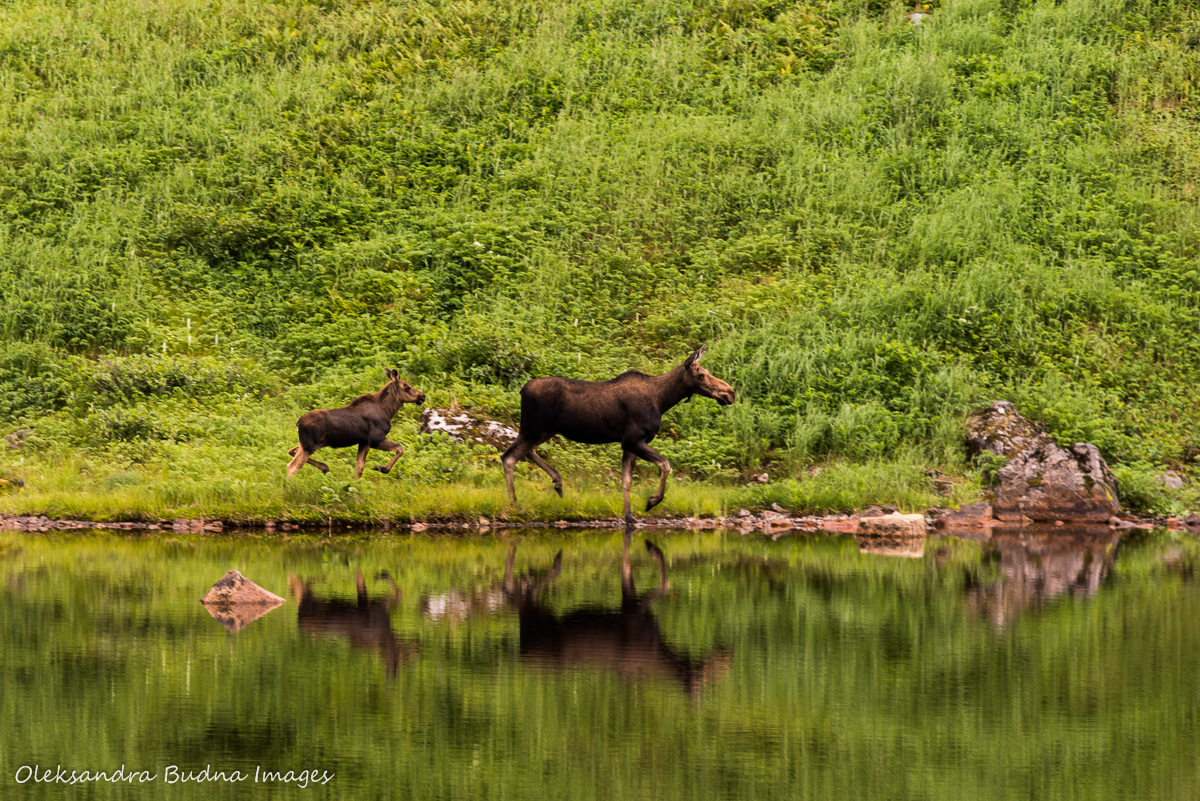
According to some estimates, Newfoundland has three moose per square kilometre
The descent gets more and more crowded as we catch up with groups of earlier hikers. Eventually, we find ourselves back at the foot of the mountain.

Starting our descent
The last four kilometres to the parking lot feel like the longest and most challenging part of the trail. There will be no sunset watching that night. Just a quick dinner and shower before we retreat into our snugly sleeping bags.

After the hike: you could say we are a bit tired
Hopping Across the pond
I open my eyes and do a quick scan of my body. All the muscles except for calves seem fully functional. After a bit of stretching, I can move again.
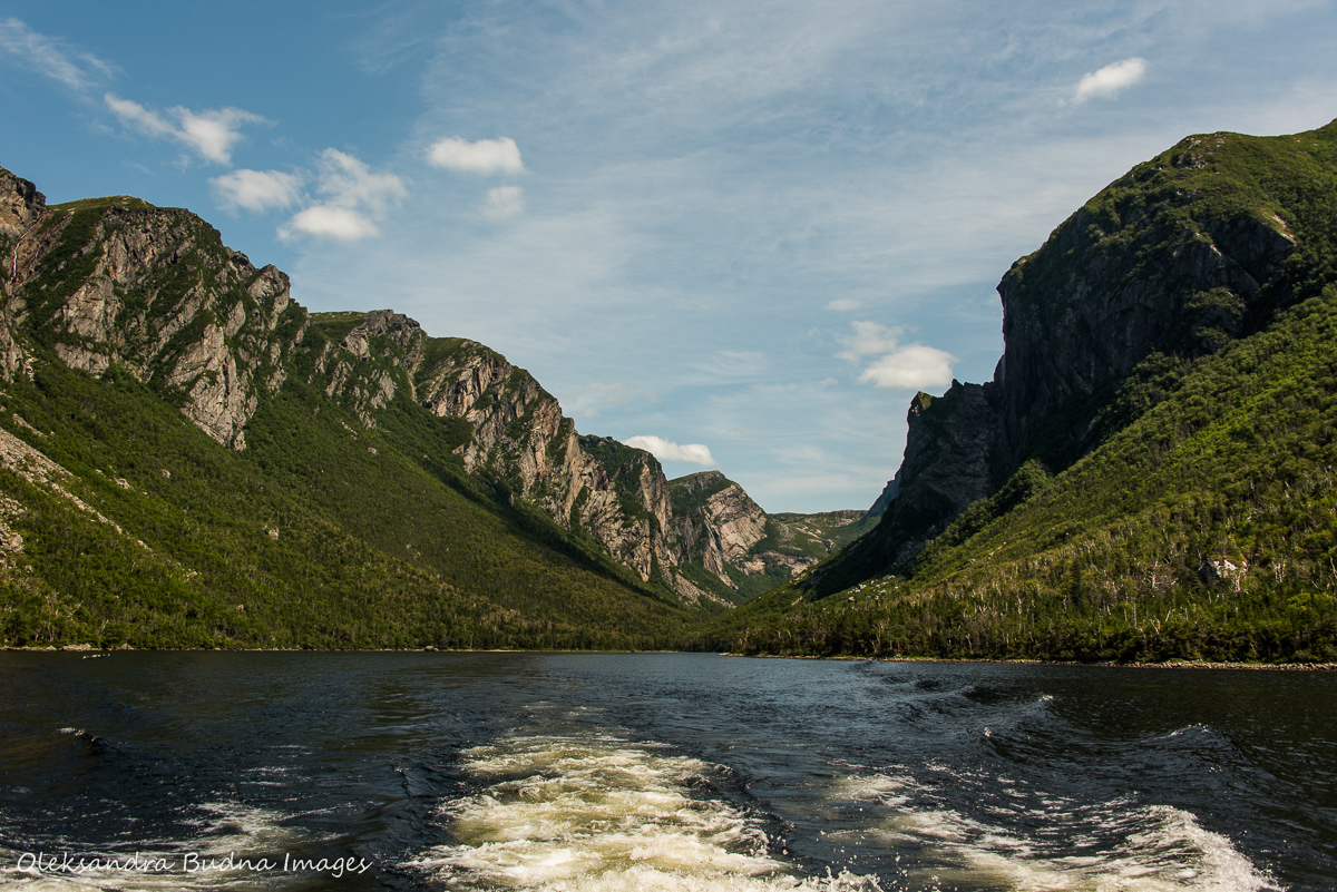
Today’s itinerary includes a boat tour of the Western Brook Pond. ‘Pond’ somehow doesn’t seem like a suitable name for a 16-kilometre long and 165-metre deep body of water but, I guess, that’s how things are in Newfoundland.
The tour doesn’t start until one so we do a short Steve’s Trail near the Broom Point to pick up one of the caches that will count towards the geocoin.

A geocache and a great view at the end of Steve’s Trail
By the time we get back to the Western Brook Pond parking lot, it’s full so we end up parking by the side of the road and start on a 3-kilometre trail that leads to the boat launch. Then about one-third of the way I remember that I forgot my credit card so I have to go back. We end up jogging most of the way. My calves scream for relief.

Western Brook Pond trail
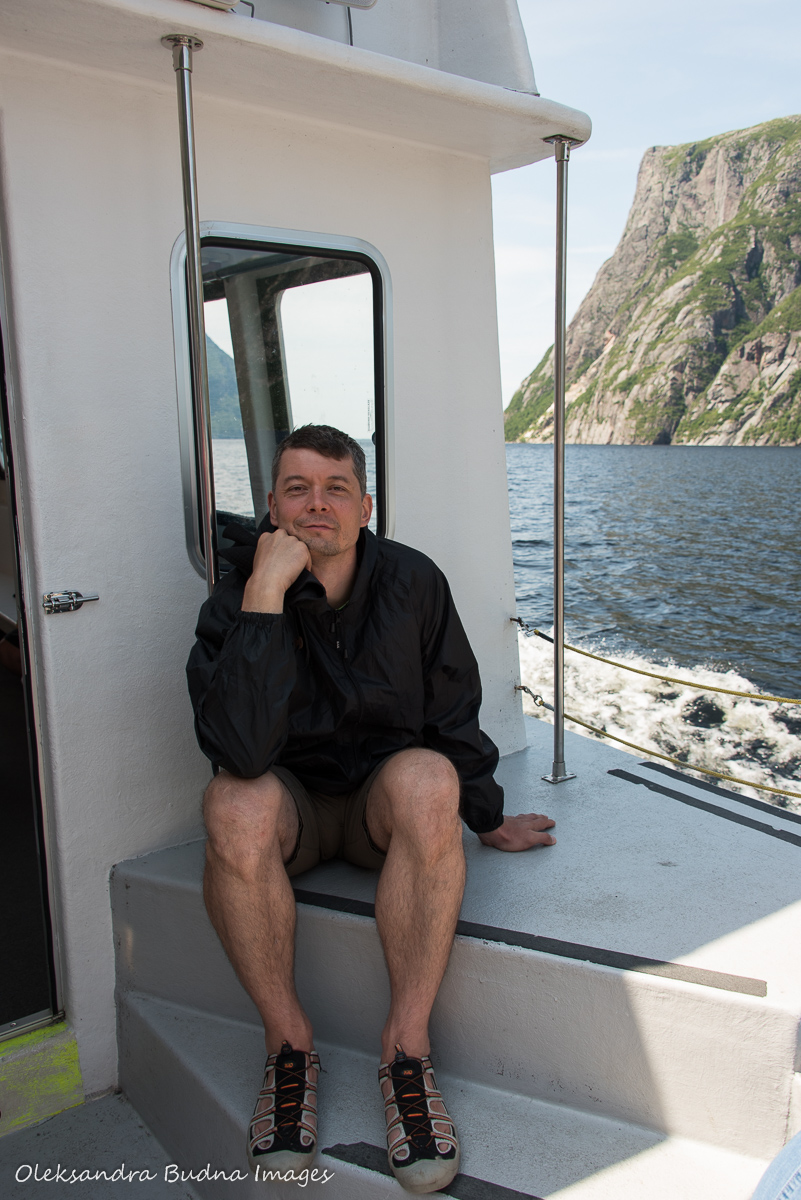
The tour is okay as far as boat tours go. I’d rather go on my own in a kayak or a canoe. Unfortunately, no other vessels except for the tour boats are allowed so I am stuck behind phone cameras and selfie sticks.

Western Brook Pond boat tour – great views of mountains and cameras
The surroundings make up for the disappointment. The pond used to be a fjord that eventually got separated from the ocean. Now this fresh and crystal clean strip of water sits between walls of rock higher than the CN tower.
Views worthy of the Lord of the Rings movies
The guide points out various prominent features along the way: narrow strips of waterfalls up at the top, rock formations that look like faces, a spot where a rock slide happened several years ago. Every time the boat does a 360 to make sure everyone can see.


Narrow strips of waterfalls

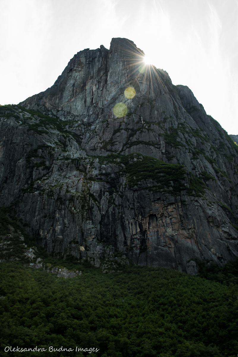
Imposing mountains, some higher that the CN Tower
Now that the guided part of the tour is done, time to enjoy the ride back
On our way back to the car, we take our time to observe the surroundings, which we missed during our jog to the boat launch.
Views along the Western Brook Pond Trail
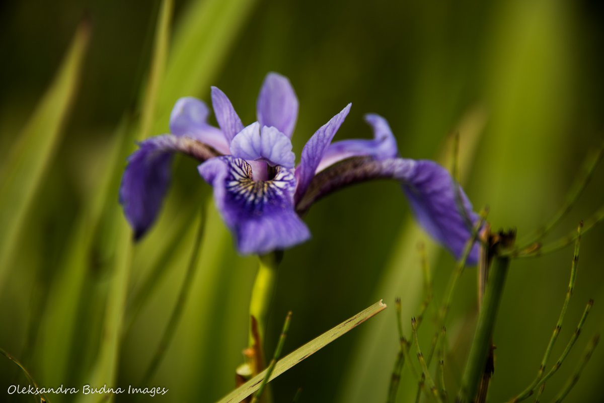

Irises are everywhere. So are bakeapple or cloudberries. If you think “bakeapple” is a weird name for a berry, you are not alone. The name supposedly came from French
“baie, qu’appelle” which roughly translates as “what’s the name of that berry.”
Our next stop is the day use area near the Shallow Bay campground where we make late lunch/early dinner. The main goal, however, is a geocache along the Old Mail Road. We find more than a cache there. The trail seems to be the central gathering point for all of Gros Morne mosquitoes. There is more jogging. My calves are now in full protest mode. We push through a mosquito cloud and find ourselves on a beautiful sandy beach. Seems like a much better way to get back to the car.
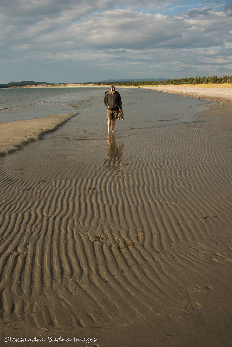
Shallow Bay is, well, shallow
After a halfhearted, and therefore unsuccessful, attempt at finding more geocaches in the nearby Cow Head community, we finish the day right where we started — at the Broom Point watching the sun go for its nightly swim in the Gulf of Saint Lawrence.

Sunset from the Broom Point
Travelling back in time
We start the day with a hike up the Berry Hill trail. It’s only 1.5 kilometres long but consists of endless sets of stairs. At the sight of them my calves emit a silent scream. We do manage to get to the top where our son finds the third cache towards his Gros Morne geocoin. The last two will have to wait till part II of the trip.
Berry Hill Trail – short but strenuous
We return to the Lobster Cove Head lighthouse to learn more about the life of lightkeepers who helped bring ships home. We discover that each multicolored flag equals a letter and staff use them to spell a different Newfoundland word every day. Today’s word is “nish” which means tender or delicate. We play several rounds of “geese and a wolf.” My husband gets to strum the guitar.

Lobster Cove Head Lighthouse
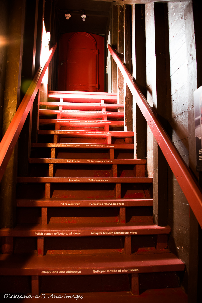

Lightkeeper’s duties written on the stairs. Every day, the flags spell a different word in Newfoundlandese, or is it Newfoundlandish?

Fun game of “Wolf and Geese”

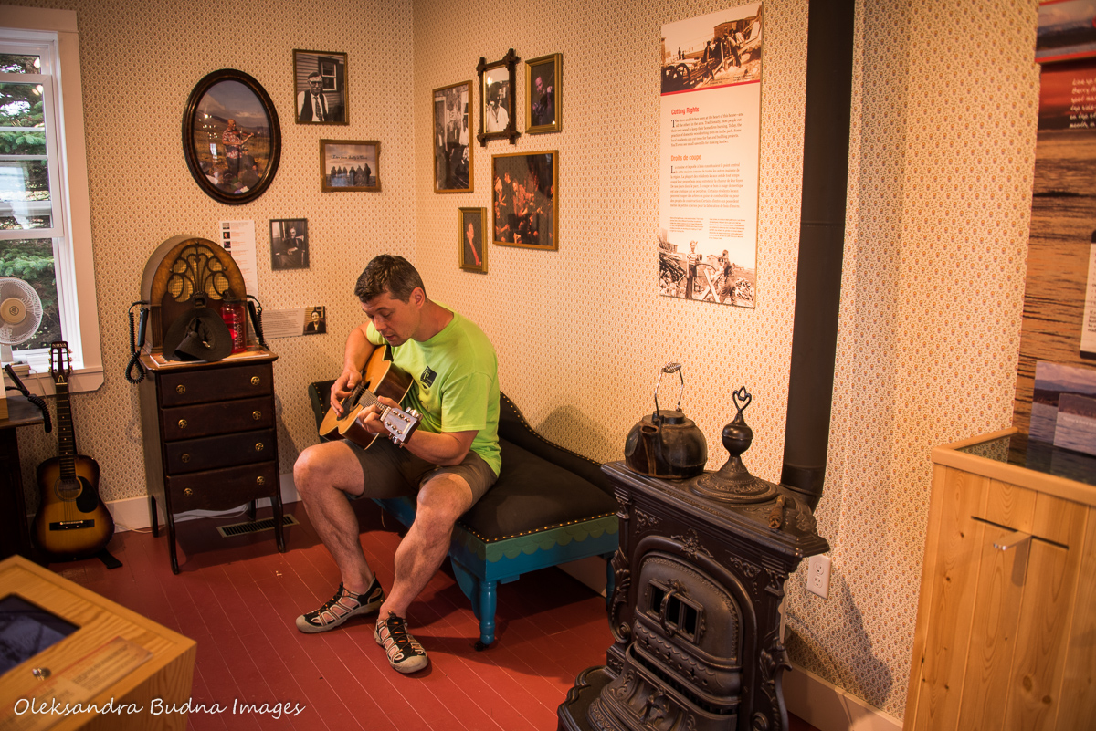
Music is an important part of the Newfoundland culture. The contraption on the left is an instrument known as ugly stick.
We take a hike down to the Yellow Point where we take a mandatory photo in Parks Canada red chairs.

A must-have red chair picture
The sea is at low tide revealing boulders with barnacle poked faces and seaweed hair. There is more rock skipping and balancing. I feel like we are finally getting into a vacation rhythm and my emotional and mental muscles start to relax even if my actual muscles are still sore.

There is always time for some rock skipping


Low tide reveals wonders of the ocean floor

Yellow Point near the Lobster Cove Head
I unfurl the map to find a picnic spot for lunch. During long road trips we often adopt a nomadic lifestyle: instead of going back to the campsite for every meal, we carry all our food and cooking equipment with us. That way we are always ready to whip something up.
We sip on a surprisingly delicious concoction of canned tomato soup, beans, a few remaining broccoli flowerettes and mushrooms we found at the bottom of the cooler and roasted potatoes from last night’s dinner. Our son calls it a leftover soup. There are several picnic shelters to our left but they are not occupied. So we have the beach all to ourselves. The sound of the waves crashing, the cackle of seagulls. I wish all our meals had a setting like that.
Beautiful views are everywhere
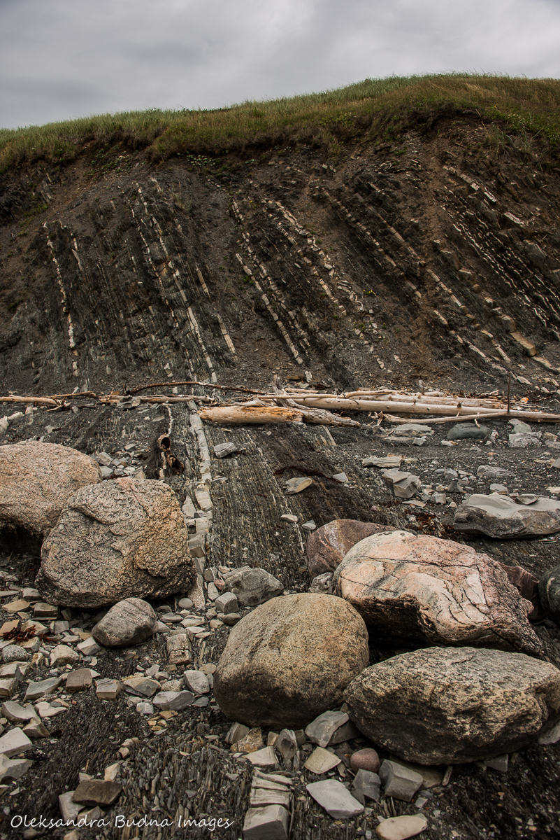
The ocean starts its slow return so we hurry to the Green Point to explore it at low tide. Green Point is described as an important geological benchmark because of the fossils found here, which define the boundary between the Cambrian and Ordovician periods. But it’s not until we get there that we truly appreciate what it means. Layers upon slanted layers of rock, each one is different shade and composition. Razor-thin dark plates, chunks of clay with deep impressions left by boulders that used to be trapped inside, blocks of pebbles sandwiched in between. Seeing 500 million years of Earth history on display really puts your life in perspective.

At Green Point, rocks tell time
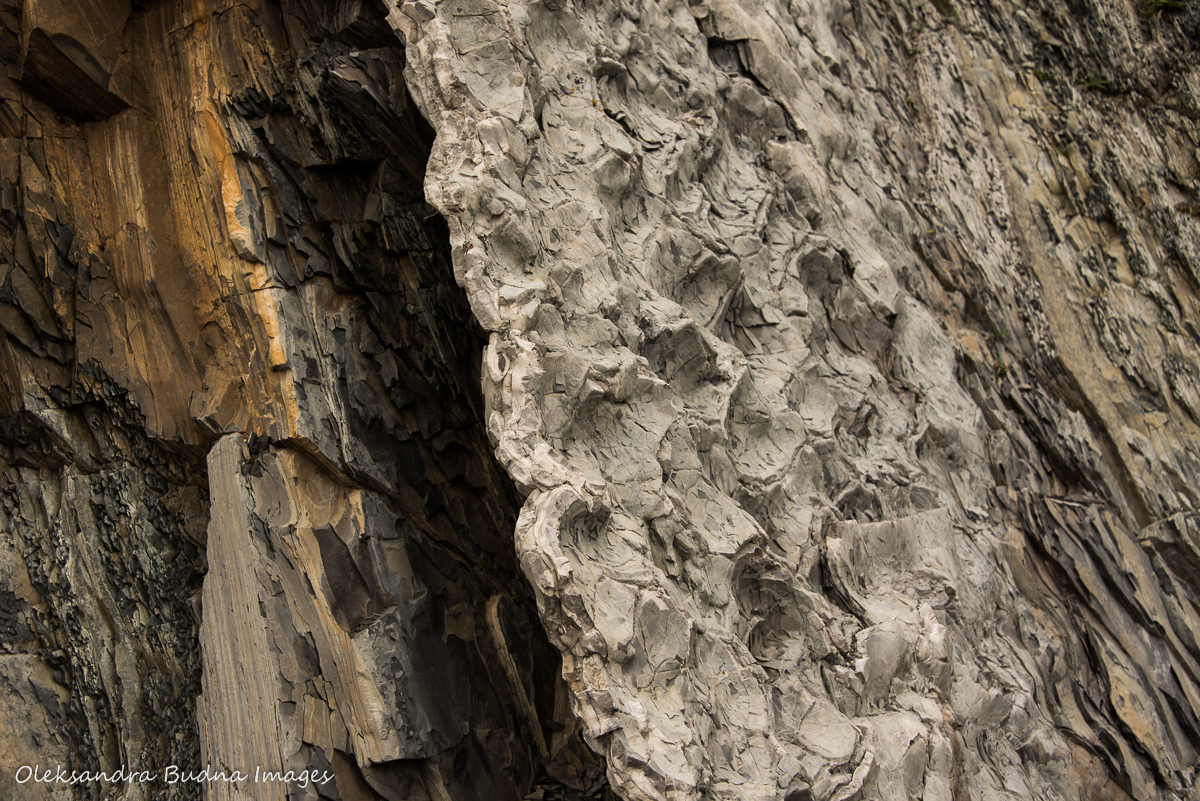
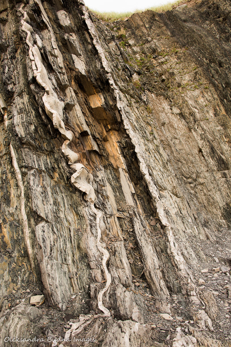

500 million years of Earth history etched into these layers

Sitting on top of the Green Point is a giant horn. One of Canada’s four Wave Sound art installations by Anishinaabekwe artist Rebecca Belmore, it encourages visitors to listen to the mighty ocean. Another reminder that humans are but a small part of a giant interwoven ecosystem.

Listening to the Earth – and each other
And if we needed another proof of the Earth’s majesty, sunset at Salmon Point provides just that. Tomorrow, there will be packing and moving on to other exciting places. Right now, however, nothing else matters but the sun’s magnificence splashed across the sky and the sea.

Magnificent end of day

I’ve never been to Newfoundland. I’d like to visit now. It looks like an amazing destination and I’d like to see moose again. It’s been nearly 20 years since I’ve seen moose. They used to be fairly common in Northwestern Minnesota when I was a child. We’d see a family of them traveling across the plains far from the the road. Once my mother was driving home with Geoff our 150 pound Alaskan Malamute and discover the road had been blocked by a moose. I think it’s the closest any of us ever got to a moose before.
I really enjoyed your post and the pictures. Now I’ve got to add this to my bucket list.
LikeLiked by 1 person
Newfoundland is really worth a visit. So much to see and do. And yes, there is no shortage of moose. We saw eight during our three weeks in Newfoundland, which is more than we’ve seen in all our years camping in Ontario. The most interesting thing is that moose aren’t even native to Newfoundland. A couple was introduced a little over a hundred years ago and now they are everywhere. Hope you get to visit Newfoundland sometime soon and look forward to hearing about your impressions of the island.
LikeLike
That was a hefty climb, well done. I loved your sunset pictures on the first day.
LikeLiked by 1 person
It was a great hike even if it took me a few days afterwards to recover. Thank you for reading and commenting. Always great to hear from you.
LikeLike
As I have remarked before, you seem to be able to find great places for walks and hikes.
LikeLiked by 1 person
Pingback: The magic of Gros Morne in two parts – Part II: Journey to the centre of the Earth | Gone Camping
Pingback: The Best of 2017 | Gone Camping